![]() Before
you create an account, please see the geodata.gov Privacy
and Policies
statements.
Before
you create an account, please see the geodata.gov Privacy
and Policies
statements.
Welcome to the geodata.gov Quick-Start Guide. geodata.gov provides access to maps, search options, articles, and other useful tools. Click the quick links below to learn about the geodata.gov Web site.
Before you create an account, please see the geodata.gov Privacy and Policies statements.
To create an account:
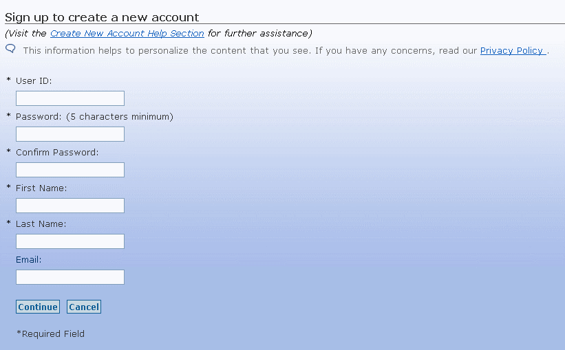
![]() Fields
with asterisks * are required fields, you must complete them to create a geodata.gov
account.
Fields
with asterisks * are required fields, you must complete them to create a geodata.gov
account.
Choose a User ID that you can easily remember. For security reasons, it is a good idea to use both letters and numbers when creating your User ID and Password. Be sure to store your User ID and Password in a secure location.
Figure 1: Sign up button
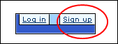
Figure 2: Sign up page
![]() If
your information is not correct, click Cancel to return to the
form and make the appropriate changes.
If
your information is not correct, click Cancel to return to the
form and make the appropriate changes.
Figure 3: Enrollment Successful screen
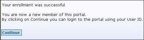
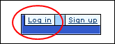
Figure 4: Log In button
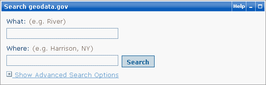
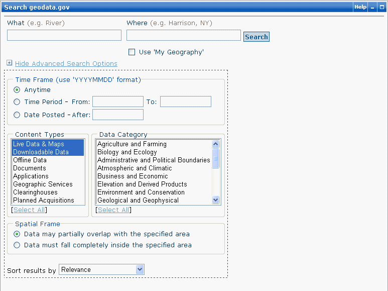
Search enables you to find and access a wide variety of geographic information within geodata.gov.You can perform a Search from the geodata.gov Home page or by clicking the Search tab.
To Search geodata.gov:
![]() The
‘What’ and 'Where' parameters are optional, but at least one
is needed for your search. Completing both fields helps to narrow your search.
The
‘What’ and 'Where' parameters are optional, but at least one
is needed for your search. Completing both fields helps to narrow your search.
Figure 5: Search geodata.gov
To perform an Advanced Search:
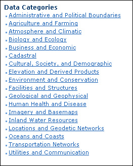
Figure 6: Advanced Search Options
Communities on geodata.gov provide a way for users of the portal to share information with each other about specific topics, such as fire, cadastral, local government, etc.
The list of communities on the Home page of the portal gives you quick access (2-clicks to content) to a specific community (see Figure 7).. The geodata.gov Communities are grouped according to:
Click the name of the community of your choice to browse key resources for that particular community rather than search for them.
Each Community is developed by a team of users with a common interest. The community pages may be as simple as a list of selected resources or they may be developed into living communities for collaboration, sharing, exchange, and networking. The Community pages can be expanded and customized by the community group to include one or more of the following activities:
Figure 7: Communities
To join a community and see the customized community features described above, you must be registered with geodata.gov.
The Maps section of geodata.gov contains popular maps that may be of interest to you. Click on the featured map on the Home page or click the Maps tab and select a popular map to launch in the Map Viewer to conduct searches and overlay other map services to meet your needs.
The Map Viewer is a Web-based geographic information system (GIS) application that allows you to view and interact with geographic data. The geodata.gov Map Viewer allows you to:
The Marketplace provides interactive tools for sharing planned data collection activities and for finding partners for cost sharing.
The marketplace tools provide:
The Help Center contains helpful information about the geodata.gov portal, including information regarding data standards, tools, and resources of interest to the U.S. geo-community. Click the Help Center tab to access this information.
To publish your metadata on geodata.gov, you must first register as a Publisher.
There are three ways to publish your metadata records on geodata.gov.
If you have an existing metadata repository, you can register your repository and we will harvest a copy of your metadata records for you. Click the "GOS/NSDI Metadata Publishing Guidance" link if you are interested in learning how to publish data collection activities.
![]() This document
is in Portable Document Format (PDF) and requires Adobe Acrobat Reader. Adobe
Acrobat Reader is a free download.
This document
is in Portable Document Format (PDF) and requires Adobe Acrobat Reader. Adobe
Acrobat Reader is a free download.
If you don't have a repository, you can publish directly to geodata.gov by using our online metadata creation form or XML upload.
Use the 'Login' link on the home page to access your Publisher account to conduct the following activities: