
Volcano Information
-
Yellowstone
- Current Update, last updated Jan 9, 2009 07:44 MST:
Small Earthquake Swarm on 9 January 2009 near northeast corner of Yellowstone Caldera
A currently modest swarm of earthquakes began in the northeast corner of the Yellowstone Caldera, about 10 miles (16 km) NNE of the north end of the Yellowstone Lake swarm that was active in late December and early January. As of 1930 MST, 10 earthquakes had been located by the University of Utah Seismograph Stations, the largest with M= 3.3 and two other events with M >2.0. Located depths are between 2 and 4 km.
Yellowstone Volcano Observatory staff and collaborators are analyzing the data from this and from the earlier Yellowstone Lake swarm and are checking for any changes to the thermal areas located near the epicenters. We will provide further information as it becomes available.
 Volcanic History Overview: The Yellowstone Plateau volcanic field developed through three volcanic cycles spanning two million years that included some of the world's largest known eruptions. Eruption of the >2450 cu km Huckleberry Ridge Tuff about 2.1 million years ago created the more than 75-km-long Island Park caldera. The second cycle concluded with the eruption of the Mesa Falls Tuff around 1.3 million years ago, forming the 16-km-wide Henrys Fork caldera at the western end of the first caldera. Activity subsequently shifted to the present Yellowstone Plateau and culminated 640,000 years ago with the eruption of the >1000 cu km Lava Creek Tuff and the formation of the present 45 x 85 km caldera. Resurgent doming subsequently occurred at both the NE and SW sides of the caldera and voluminous (1000 cu km) intracaldera rhyolitic lava flows were erupted between 150,000 and 70,000 years ago. No magmatic eruptions have occurred since the late Pleistocene, but large phreatic eruptions took place near Yellowstone Lake during the Holocene. Yellowstone is presently the site of one of the world's largest hydrothermal systems including Earth's largest concentration of geysers.
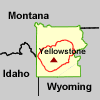 Location: Western US, WY
Latitude: 44.43
Longitude: -110.67
Elevation: 2805 m
Recent Eruption:- Hazard Assessments: Christiansen, R. L., Lowenstern, J. B., Smith, R. B., Heasler, H, Morgan, L. A., Nathenson, M., Mastin, L. G., Muffler, L. J. P., and Robinson, J. E., 2007, Preliminary Assessment of Volcanic and Hydrothermal Hazards in Yellowstone National Park and Vicinity, U.S. Geological Survey Open-File Report 2007-1071.
- Link to monitoring data:
Recent earthquake activity in Yellowstone National Park (map and catalog with links)
GPS Measured Horizontal Ground Motions
Provisional real-time stream-flow data
See the Yellowstone Volcano Observatory Monitoring Page for more.
Volcanic Alert Level: NORMAL Aviation Color Code: GREEN
