U.S. Geological Survey - science for a changing world

Energy Resources Program

Oil and Gas - Arctic Energy Assessment
Energy Home | About Energy | Contact Energy | How Are We Doing?navbar
Energy Sources Regional Studies Health and Environment Geochemistry and Geophysics Most Requested General Information Search Energy Publications and Data


Arctic Assessment
Quick links below
Related Publications and Data

for our newsletterENERGY PROGRAM NEWSLETTER


CONTACT

Don Gautier
Geologist
650-329-4909


Valid XHTML 1.0 Transitional

Arctic Energy Assessment

East Greenland Rift Basins Province

About Location Map Images
Photo: East Greenland
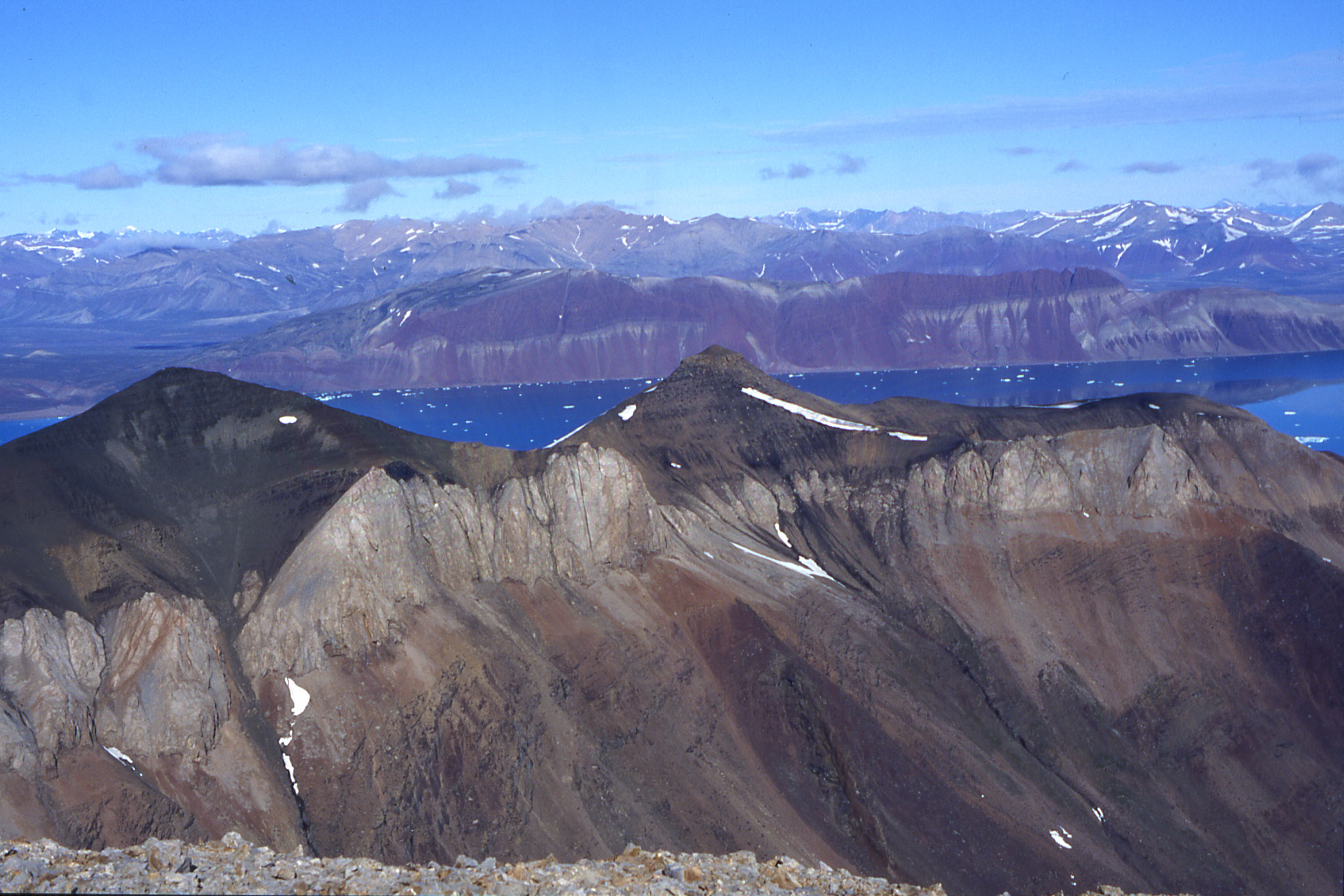
Wegener Halvø (seen from southeast to the northwest):
Devonian below unconformity, Permian carbonate
build-ups overlain by Ravnefjeld formation source
rock and Wordie Creek formation mudstones. Photo by
Stefan Piasecki (GEUS). (Larger Image)

Assessment of Undiscovered Oil and Gas Resources of the East Greenland Rift Basins Province

Overview---

Northeast Greenland is the prototype for the U.S. Geological Survey’s Circum-Arctic Oil and Gas Resource Appraisal. Using a geology-based methodology, the USGS estimates the mean undiscovered, conventional petroleum resources in the province to be approximately 31,400 MMBOE (million barrels of oil equivalent) of oil, gas, and natural gas liquids.


Open fact sheet (pdf)


Play Slide Show

Slide Show (Flash document 3.62 MB) -- Oil and Gas Resource Potential of the East Greenland Shelf: Prototype for the USGS Circum-Arctic Resource Appraisal

NOTE: You will need Flash Player 6 or higher to view Flash documents created by FlashPaper. NOTE: Flash documents are 508 compliant.

Accessibility FOIA Privacy Policies and Notices

Take Pride in America home page. FirstGov button U.S. Department of the Interior | U.S. Geological Survey
URL:
Page Contact Information: ERP Webmaster
Page Last Modified: