 Regional Weather Summary
 National Flood Outlook from HPC
 Terms and abbreviations are used by NWS Offices
| NWS Omaha Hazardous Weather Outlook | ||
|---|---|---|
Click here for printing. 000 FLUS43 KOAX 090829 HWOOAX HAZARDOUS WEATHER OUTLOOK NATIONAL WEATHER SERVICE OMAHA/VALLEY NE 329 AM CDT SAT MAY 9 2009 IAZ043-055-056-069-079-080-090-091-NEZ011-012-015>018-030>034- 042>045-050>053-065>068-078-088>093-092230- MONONA-HARRISON-SHELBY-POTTAWATTAMIE-MILLS-MONTGOMERY-FREMONT- PAGE-KNOX-CEDAR-THURSTON-ANTELOPE-PIERCE-WAYNE-BOONE-MADISON- STANTON-CUMING-BURT-PLATTE-COLFAX-DODGE-WASHINGTON-BUTLER- SAUNDERS-DOUGLAS-SARPY-SEWARD-LANCASTER-CASS-OTOE-SALINE- JEFFERSON-GAGE-JOHNSON-NEMAHA-PAWNEE-RICHARDSON- 329 AM CDT SAT MAY 9 2009 THIS HAZARDOUS WEATHER OUTLOOK IS FOR PORTIONS OF SOUTHWEST IOWA...WEST CENTRAL IOWA...EAST CENTRAL NEBRASKA...NORTHEAST NEBRASKA AND SOUTHEAST NEBRASKA. .DAY ONE...TODAY AND TONIGHT THERE IS A SLIGHT CHANCE OF AN ISOLATED THUNDERSTORM LATE THIS AFTERNOON AND EARLY THIS EVENING NORTH OF A LINE FROM ALBION TO ONAWA. SEVERE WEATHER IS NOT EXPECTED. .DAYS TWO THROUGH SEVEN...SUNDAY THROUGH FRIDAY ISOLATED THUNDERSTORMS ARE POSSIBLE ACROSS EAST CENTRAL AND SOUTHEAST NEBRASKA...AS WELL AS SOUTHWEST IOWA SUNDAY. SEVERE WEATHER IS NOT EXPECTED WITH THIS ACTIVITY. ANOTHER STORM SYSTEM WILL MOVE INTO THE AREA FOR TUESDAY THROUGH WEDNESDAY BRINGING A CHANCE OF THUNDERSTORMS TO THE AREA. .SPOTTER INFORMATION STATEMENT... SPOTTER ACTIVATION WILL NOT BE NEEDED TODAY OR TONIGHT. $$ |
||
| Click on the images below for additional details. | ||
|
Thunderstorms |
Flooding |
Fire Wx |
|
|
|
|
|
Wind and Fog |
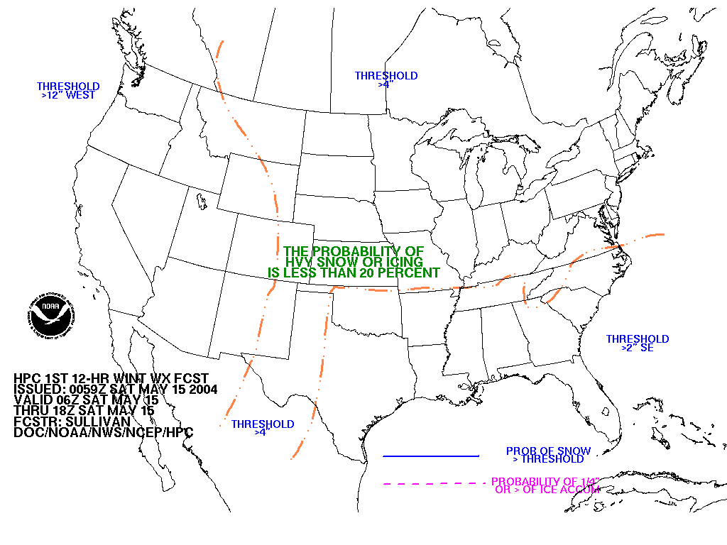
Winter Weather |
Hazards Outlook |
|
|
|
|


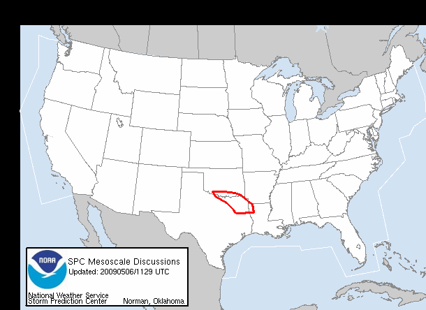
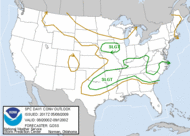
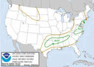
| Storm Prediction Center Products | ||||||
|---|---|---|---|---|---|---|
|
||||||
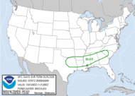
| Hydrometeorological Prediction Center Products | ||||
|---|---|---|---|---|
|
|
|||

