Digital Line Graphs (DLGs)
Product Sample
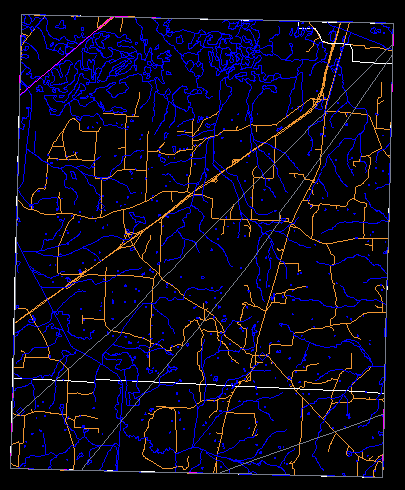
Large-scale (7.5-minute) DLG Boundary, Hydrography and Transportation layers (Dancyville, TN)
Product Description
Digital Line Graphs (DLGs) are digital vector representations of cartographic information derived from USGS maps and related sources.
Depending on scale, the following layers (or categories of feature type) are available:
| Layer |
Feature Type |
| Public Land Survey System (PLSS) |
Township, range, and section lines |
| Boundaries (BD) |
State, county, city, and other national and State lands such as forests and parks |
| Transportation (TR) |
Roads and trails, railroads, pipelines, and transmission lines |
| Hydrography (HY) |
Flowing water, standing water, and wetlands |
| Hypsography (HP) |
Contours and supplementary spot elevations |
| Non-vegetative features (NV) |
Glacial moraine, lava, sand, and gravel |
| Survey control and markers (SM) |
Horizontal and vertical monuments (third order or better) |
| Man-made features (MS) |
Cultural features, such as buildings, not collected in other data categories |
| Vegetative surface cover (SC) |
Woods, scrub, orchards, and vineyards |
The USGS produces three primary types of DLG data:
- Large-Scale (7.5-minute) DLGs correspond to the USGS 1:20,000-, 1:24,000-, and 1:25,000-scale topographic quadrangle maps. They are primarily cast to the Universal Transverse Mercator (UTM) projection system, but some are cast to the State Plane coordinate system. They are referenced to either the North American Datum (NAD) of 1927 (NAD27) or the NAD of 1983 (NAD83).
- Intermediate-Scale (1:100,000-scale) DLGs are derived from USGS 30- by 60-minute quadrangle maps and are sold in 30- by 30-minute units that correspond to the east or west half of the topographic quadrangle maps. Each 30-minute unit is produced and distributed as four 15- by 15-minute cells. They are cast to the UTM projection system and are referenced to either NAD27 or NAD83.
Additional Information
Back to Top
Search & Download
Back to Top
Sample Data
A sample large-scale DLG can be downloaded from USGS Geographic Data Samples.
Back to Top