USGS CoreCast
USGS Podcasts Home > CoreCast Home Page
Can't see Flash? Install Flash Player.
|
22
|
After the smoke from wildfires clears, debris flows can become a big problem. USGS Research Geologist Sue Cannon talks about how.
Type: audio/mpeg
File Size: 5006918 bytes Duration: 5:08 Released: Tue, 4 Dec 2007 22:02:28 UTC |
Transcript:
[music comes in and then fades out]
Dave Hebert
Hello there, and welcome to another episode of the USGS CoreCast. I'm Dave Hebert.
Here at the USGS, we've been focusing a lot on wildfires science and with obvious reason, after what happened in Southern California in October. Now that the fires are pretty much out, however, it would be easy to assume that the danger is over.
I'm sorry to say that this is not the case.
Wildfires often lead to other hazards, including landslides, which Southern California has certainly seen its fair share of. And with the rainy, winter season approaching, this issue is only going to get more serious.
With that in mind, we're talking with USGS Research Geologist Sue Cannon, who is going to school us on some of the other problems that wildfires lead to. Sue, thank you very much for taking some time with us.
Sue Cannon
Sure.
Dave
So after the fire is over, what are some of the other dangers that are presented?
Sue
Well, sadly the hazards aren't over. What we've seen is there's a big increase for debris flow and landslide activity and then also from water contamination from the movement of ash from hill slopes.
Dave
Could you tell us the difference between a debris flow and a landslide?
Sue Cannon
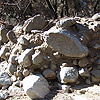
Well, "landslide" is actually the big umbrella term that refers to any movement of the land, usually in response to rainfall or water. And a debris flow is a special type of landslide that moves rapidly down channels, often looking a lot like wet concrete, but moving faster.
It can incorporate boulders, trees and vegetation, and sadly any structures that it encounters along its way.
Dave
Why does a wildfire increase the risk for landslides and debris flow?
Sue
Because we've removed all the vegetation and altered the soil. Removing all the vegetation that acts as a rainfalls sponge makes any rainfall on the area run off much more rapidly.
Also, the passage of the fire itself can dry out the soil so that it makes it more difficult to absorb water. And then also, it can develop a hydrophobic soil within the soil profile that can repel water as it tries to infiltrate.
So, essentially, what we're doing is decreasing infiltration and storage, and then this results in huge increases in runoff.
Dave
Now, the USGS is developing a product that will identify the most vulnerable areas to landslides and debris flows following these wildfires in Southern California. What will it tell people in these areas?
Sue
We're just getting going on generating a series of maps for all of the new wildfires in Southern California. That's going to be about 25 different fires. So, what these maps will do is show the relative risk of debris flow hazards from individual drainage basins in response to a series of different storms.
So what we're looking at is the probability of a debris flow coming out of a basin and then how big the event will be. And then we combine that into a relative hazard. So we can identify the basins that have the highest probability of producing the big events or that are down on the response spectrum and would just produce . . . have a low probability of producing a small event.
Dave
The USGS has also worked on a Debris Flow Early Warning System with NOAA, the National Oceanic and Atmospheric Administration. Tell us a little bit about that.
Sue
This is a very exciting new project we've just gotten going in the last couple of years, where we recognize the need to be able to issue watches and warnings from these recently burned areas.
So it's a collaboration between the USGS and NOAA, where the USGS provides our expertise and, sort of, understanding of the physical processes in the burned areas. And NOAA provides their expertise in forecasting weather and also issuing watches and warnings.
So we've provided them rainfall thresholds that tell them when in a storm we could expect a response from a given burned area. And they use these thresholds as part of their warning system.
They compare how much rain is falling on the ground—and also what their radar estimates are showing—they compare those to the rainfall thresholds. And when they're getting close to the threshold, they issue either a watch or warning.
Dave
So where can people go to get more information on landslides and debris flows, particularly those people in the areas affected by these wildfires?
Sue
We have two great sites: usgs.gov/hazards/landslides and also usgs.gov/hazards/wildfires. So both of those sites contain information about landslides, about wildfires, and about the relationship between wildfires and debris flows.
Dave
Sue, thanks again for your time. We really appreciate it.
Sue
Uh-huh. No problem.
Dave
Well, that is a wrap for this episode of CoreCast. Remember to check out those sites Sue mentioned—usgs.gov/hazards/wildfires and usgs.gov/hazards/landslides—for more on these topics. And as always, visit usgs.gov/corecast for this and other episodes.
CoreCast is a product of the U.S. Geological Survey, Department of the Interior. Until next time, I'm Dave Hebert. Thanks for listening, and take it easy.
[music fades in and then out]
Music credit:
"Elec_guit_cleanfunk_riff6" by Soundgram Post
Mentioned in this segment:
- USGS Wildfire Hazards Gateway site
- USGS Landslide Hazards Gateway site
- Debris Flow Early Warning System