| Site Descriptions |
 |
Agua Tibia East, CA
The Red Mountain real-time pan/tilt digital camera system was installed southeast
of Hemet, California, in September 2003. In August 2007 a third view to the southwest, was established
to view Agua Tibia Wilderness from the east. The Agua Tibia East view includes Agua Tibia Mountain
and the Agua Tibia Wilderness, ~28 kilometers in the distance. Non-reference (2B Technologies)
nitric oxide and ozone analyzers, and meteorology equipment are located at this site to provide
current air quality and climate measurements. |
| |
|
 |
Bitterroot Valley, MT
The Selway-Bitterroot real-time digital camera
system was installed outside of the Stevensville Ranger Station,
Montana, in May 2002. The camera views Crown Point, 11.0 kilometers
to the northwest. A TEOM-PM10 particulate
sampler is also operational; however, no data are transmitted for
public viewing at this time. Associated meteorological data are
collected from the Stevensville, Montana, RAWS station. |
| |
|
 |
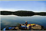
Boundary Waters, MN
The Boundary Waters real-time digital camera system was installed in December 2005. Supporters include the
USDA-Forest Service in cooperation with the Central States Air Resource Agencies (CenSARA).
The monitoring site is located on the Superior National Forest approximately 3 kilometers east
of Triangle Lake, and views to the northwest. An ozone monitor, aerosol sampler, and associated
meteorological equipment are also located at the site. |
| |
|
 |
Bridger Wilderness, WY
The Bridger real-time digital camera system was installed at the top of the White Pine Ski Area
in October 2006. The site is located approximately 15 kilometers northeast of Pinedale, Wyoming and views Mount Bonneville,
36 kilometers to the east-southeast. Supporters include the USDA-Forest Service in cooperation with the Shell Exploration
and Production Company and Wyoming Department of Environmental Quality. |
| |
|
 |
Columbia River Gorge – Wishram,
WA
The Columbia River Gorge real-time digital camera
system was installed on the northern bank of the Columbia River
(Washington), slightly east of the Dalles Dam, in March 2001. The
camera views Mount Hood, 63.0 kilometers to the southwest. An aerosol
sampler, ozone monitor, ambient nephelometer, and associated meteorological
equipment are also located at the site. |
| |
|
 |
Cucamonga, CA
The Cucamonga digital camera system was installed near the Mt. Wilson Observatory
in September 2001. Web-based real-time monitoring began in 2008. The camera views San Gorgonio Mountain ~115 kilometers
to the east. Associated ozone data are collected from the South Coast Air Quality Management District - Crestline
air quality station. Meteorological data are obtained from the NOAA weather station located at the Mount Wilson Observatory. |
| |
|
 |
Cucamonga South, CA
The Red Mountain real-time pan/tilt digital camera system was installed
southeast of Hemet, California, in September 2003. The camera pans to the north-northwest to view
Diamond Valley Lake and the Cucamonga Wilderness, ~105 kilometers in the distance.
Non-reference (2B Technologies) nitric oxide and ozone analyzers, and meteorology
equipment are located at this site to provide current air quality and climate measurements. |
| |
|
 |
Dolly Sods, WV
The Dolly Sods Web camera system was installed
in the Bearden Knob air quality monitoring compound in November
2003. The camera views the Canaan Valley and Mt. Port Crayon, 21
kilometers to the south. An aerosol sampler, ozone monitor, and associated
meteorological equipment are also located
at the site. |
| |
|
 |
Joyce Kilmer-Slickrock, NC
The Joyce Kilmer-Slickrock real-time digital camera system was installed
in December 2005. Supporters include the USDA-Forest Service in cooperation with the Southern Research
Station and North Carolina Department of Environment and Natural Resources (NCDENR). Images and
air quality data are provided courtesy of the national forests in North Carolina and the NCDENR.
The monitoring site is located northeast of Andrews, NC and views
Hangover Ridge 22 kilometers to the northwest. An ozone monitor and associated meteorological
equipment are also located at the site. |
| |
|
 |
Mount Hood, OR
The Mount Hood digital camera system was
installed at the Timberline Ski Area in November 2000. Web-based
real-time monitoring began in 2003. The camera views Mt. Jefferson,
~70 kilometers to the south. No air quality or meteorological data
are currently associated with these images. |
| |
|
 |
Mount Zirkel, CO
The Mount Zirkel digital camera system was
installed at the Steamboat Ski Resort, in the Storm Peak Laboratory, in November 2000. Web-based
real-time monitoring began in August 2005. The camera views Hahns Peak, ~45.5 kilometers to the north.
Associated weather and ozone data are collected from meteorological and air monitoring equipment
located at the site. Visibility data are obtained from the ambient nephelometer monitoring station on Buffalo Pass, 8km to the north.
|
| |
|
 |
Pasayten, WA
The Pasayten digital camera system was
installed at the Loup Loup Ski Area in November 2000. Web-based
real-time monitoring began in 2003. The camera views the Methow
River Valley and Sawtooth Ridgeline to the southwest. No air quality
or meteorological data are currently associated with these images. |
| |
|
 |
San Gabriel, CA
The Josephine Peak real-time pan/tilt digital camera system was installed northeast
of Pasadena, California, in May 2008. The San Gabriel Wilderness view includes Twin Peaks
and Vetter Mountain ~6 kilometers to the east-northeast. Associated ozone data are collected
from the South Coast Air Quality Management District - Crestline air quality station.
Meteorological data are obtained from the NOAA weather station located at the Mount Wilson Observatory. |
| |
|
 |
San Jacinto, CA
The Red Mountain real-time pan/tilt digital camera system was installed
southeast of Hemet, California, in September 2003. The camera pans to the northeast to view San Jacinto
Peak and the San Gorgonio Wilderness, ~50 kilometers in the distance.
Non-reference (2B Technologies) nitric oxide and ozone analyzers, and meteorology equipment are located
at this site to provide current air quality and climate measurements. |
| |
|
 |
Shamrock, CO
The Shamrock NOxand
ozone air quality monitoring station was installed east of Bayfield,
Colorado in February 2004. The station monitors air quality conditions
for the Weminuche Wilderness and Four-Corners Region. Monitoring
instrumentation at the site includes a NOxanalyzer
(Nitric Oxide–NO, Nitrogen Dioxide–NO2,
Oxides of Nitrogen-NOx), Ozone (O3)
analyzer, and wind speed, wind direction, air temperature, relative
humidity, solar radiation, and precipitation meteorological sensors. Hourly data are collected,
summarized, and posted daily in the Real Time Images section of this web site.
A digital camera system was installed southwest of the monitoring station in November 2005.
The camera views Mesa Mountains 40 kilometers to the southwest. Received flash card images are
immediately archived and posted to the Image Library database. |
| |
|
 |
Shining Rock, NC
The Shining Rock real-time digital camera
system was installed in March 2000. Supporters include the USDA-Forest
Service, in cooperation with the Southern Research Station and North
Carolina Department of Environment and Natural Resources (NCDENR).
Images and air quality data are provided courtesy of the national
forests in North Carolina and the NCDENR. The monitoring site is
located along the Blue Ridge Parkway and views Cold Mountain, 7.7
kilometers to the west. An aerosol sampler, ozone monitor, and associated
meteorological equipment are also located at the site. |
| |
|
 |
Upper Buffalo, AR
The Upper Buffalo real-time digital camera system was installed
in November 2005. Supporters include the USDA-Forest Service, in cooperation with the
Central States Air Resource Agencies (CenSARA). The monitoring site is located along
Highway 16 south of Red Star, Arkansas and views Moonhull Mountain to the southeast.
An aerosol sampler, nephelometer, and associated meteorological equipment are also located
at the site. |
| |
|
| |
|
Back To Top |