USGS CoreCast
USGS Podcasts Home > CoreCast Home Page
Can't see Flash? Install Flash Player.
|
37
|
In this video podcast, USGS experts give preliminary observations on what took place during the high flow experiment. Time lapse videos and photos available. Play Video: (downloading may take some time due to file sizes)
Type: video/quicktime
File Size: 19171912 bytes Duration: 8:23 Released: Mon, 7 Apr 2008 11:35:45 UTC |
Transcript:
| Time Lapse Videos: These time lapse videos of sandbars from the Glen Canyon Dam High Flow Experiment show the impact of the high flow experiment at two locations over the course of the last 30 days. |
|
|
|
River Mile 45 (Windows Media) River Mile 3 (Windows Media) |

Interior Secretary Dirk Kempthorne: Today we're here to set the river free
[Sound of Glen Canyon Dam jet tubes opening]
Jennifer LaVista: At 10:00 this morning, March 5, Interior Secretary Dirk Kempthorne pushed a button that opened a series of jet tubes below the Glen Canyon Dam and started a 60-hour high flow experiment.
The Secretary's action marked the start of an inter-agency research effort lead by the U.S. Geological Survey to study and improve Colorado River resources in the Grand Canyon National Park.
I met with USGS experts to get the inside scoop on this high flow experiment.
Andrea Alpine: I'm Andrea Alpine. I'm the center director for the Southwest Biological Science Center of the US Geological Survey. I oversee the science that's conducted in the Grand Canyon.
Jennifer: Describe for me what the opening of those jet tubes was like for you.
Andrea: This was amazing. I was down on the edge of the dam when the Secretary opened the valves. We started with two of the bypass tubes opening. And the power that you feel coming from that is just tremendous. If you see some of these photographs you can see how powerful that is. It made us all there think about how this was trying to replicate what occurred in nature in the past - very large flows of water that would rush down this river. And I think, we're not anywhere near as high as they did in the past but it's still, you can sort of feel the power of this water and the way that it both pushes the sand and sediment up and the way it's created this canyon.
For scientists this is probably, I'd describe it as the gold standard of science experiments. Where you actually get to manipulate the environment and then measure those changes that occur as you manipulate the environment. That's very rare in the world to be able to do that.
Jennifer: This is a few hours after the jet tubes have been opened. Can you tell me, are you seeing any differences in the river and the sediment so far?
Andrea: Yeah, it was really interesting to watch. Right away you could start to watch the river rise. You see the river come up to much farther on the sides of it, and you started to see places where you could now see that the water changed colors, you'd see that there is sediment in the water, you start seeing places that before were just rocky shores, start to fill up. I think the dramatic pictures, they're taking some right now while they're out there, dramatic pictures will be when the water starts going down.
Jennifer LaVista: Tell me, why are we doing this right now? Why March?
Andrea Alpine: So, "why march?" is a question that lots of folks ask. And "why now, versus any other time?" So the first part of that is that all the sediment that we get now delivered to this canyon comes from tributaries. So what used to come down the Colorado River gets stopped by the dam. So the only we get sediment into the system now is through tributaries. What's happened in the last 16 months is we've had a lot of monsoonal storms that's brought a lot of sediment into the system that we haven't seen before. So now we're looking at two and a half to three times as much as we've seen in 2004 when we did this experiment before. So, you want to time these high flow releases to time when you have a lot of sediment in the system so you can try to, what they call it mobilize it, put it into the water with this high flow and then when you let the water go down, when you turn the valves back off, that sediment will sink out and will be on the sides of the river and make these beaches. And that's what we're trying to do now. That's why we do at this time in the yearly long sequence, and in March was a critical part. We want to do it between January and March somewhere - for many other reasons why you don't want to go past March. So for things like Tamarisk, it's an invasive plant that grows along the sides of the river. It's not so great for the beaches to have that Tamarisk on it - so we have to remove it often. It flowers right in the spring time. So you don't want to do this high flow release when it's flowering and now you push those seeds and flowers even further than they already go. So you have a small window of time when you want to try and do this. It does pose some difficulties in March for our fly fishing friends. And we don't really know the effects of this on trout fisheries. So this year, on this experiment we've spent a great deal of time working on tagging these trout and being able to clearly figure out if they are being affected by this or not.
To learn more about trout tagging I went just downstream of Glen Canyon to Lee's ferry. There I met with Kara Hilwig.
Kara Hilwig: My name is Kara Hilwig. I work for USGS Grand Canyon Monitoring and Research Center as a fisheries biologist. I was hired to develop a non-native fish management plan for Grand Canyon.
We're down here at Lee's Ferry a few hours after the jet tubes have been opened. I'm down here monitoring the movements of fish that I've surgically implanted with sonic tags, rainbow trout specifically, to see what the effect of the flow is on the rainbow trout movement.
Nobody's ever done this study before, so all the hypothesis include: they could all be washed down stream, they could all hunker down and stay right in position, or they may displace downstream and then gradually move back upstream. We really don't know.
Jennifer: What are the main goals of this study, and how do they relate to the endangered humpback chub?
Kara: So there's two questions that are going to be addressed in this study. One of which is related to the angling public. Do these fish, do these rainbow trout, wash downstream to areas where they are less available to the angling public. And secondly, do these fish wash downstream into areas that are important to humpback chub. If they do wash into areas that are important for humpback chub, there may be adverse affects such as competition or predation, however the verdict is still out on that - we really don't know what the affect of rainbow trout on humpback chub is.
Jennifer: To put the high flow experiment in perspective, I asked Andrea Alpine how long this experiment will last after the water is ramped down.
Andrea: This has really just begun. So we have all those hundred scientists that are down on the river right now and their making measurements at frequencies much more rapidly than we normally do.
Jennifer: When we know the results?
Andrea: So, we have about, I think there's eight different studies going on right now. So we have things like measuring the sediment and the creation of sandbars, to looking at backwater habitats, what are the food resources for fish doing?, how is this effecting humpback chub?, so we have lots of separate studies that are going on all during this time period.
Some things we will know immediately. As soon as you drop that water we'll see sandbars created. So they'll be taking photographs, as they're doing right now, so that kind of information, the part where we get to see immediate results, we'll see as soon as we let the water back down.
Other things will take much longer. So, I think that from today through another year we'll be learning and collecting information and we'll be getting that out to all the people who need to know these things, the people who make management decisions, as quickly as we can. So some things you'll know right away and other things like what's the importance of backwater habitat to humpback chub, that will take us longer to decide, or to find. So, over time we'll be getting those results out.
Jennifer: And we'll be sure to keep you posted over time as more findings are released on the high flow experiment.
That does it for this episode of Corecast. Thanks to all of you for listening.
You can learn more information on the high flow experiment by visiting gcmrc.gov and clicking on the high flow experiment tab.
Corecast is a product of the US Geological Survey Department of the Interior. Until next time, I'm Jennifer LaVista.
Credits:
The Glen Canyon Dam High Flow Experiment is an interagency research effort.
Partners Include:
- U.S. Department of the Interior
- Bureau of Reclamation
- National Park Service
- U.S. Geological Survey
- U.S. Fish and Wildlife Service
- Bureau of Indian Affairs
- And many other state and local cooperators.
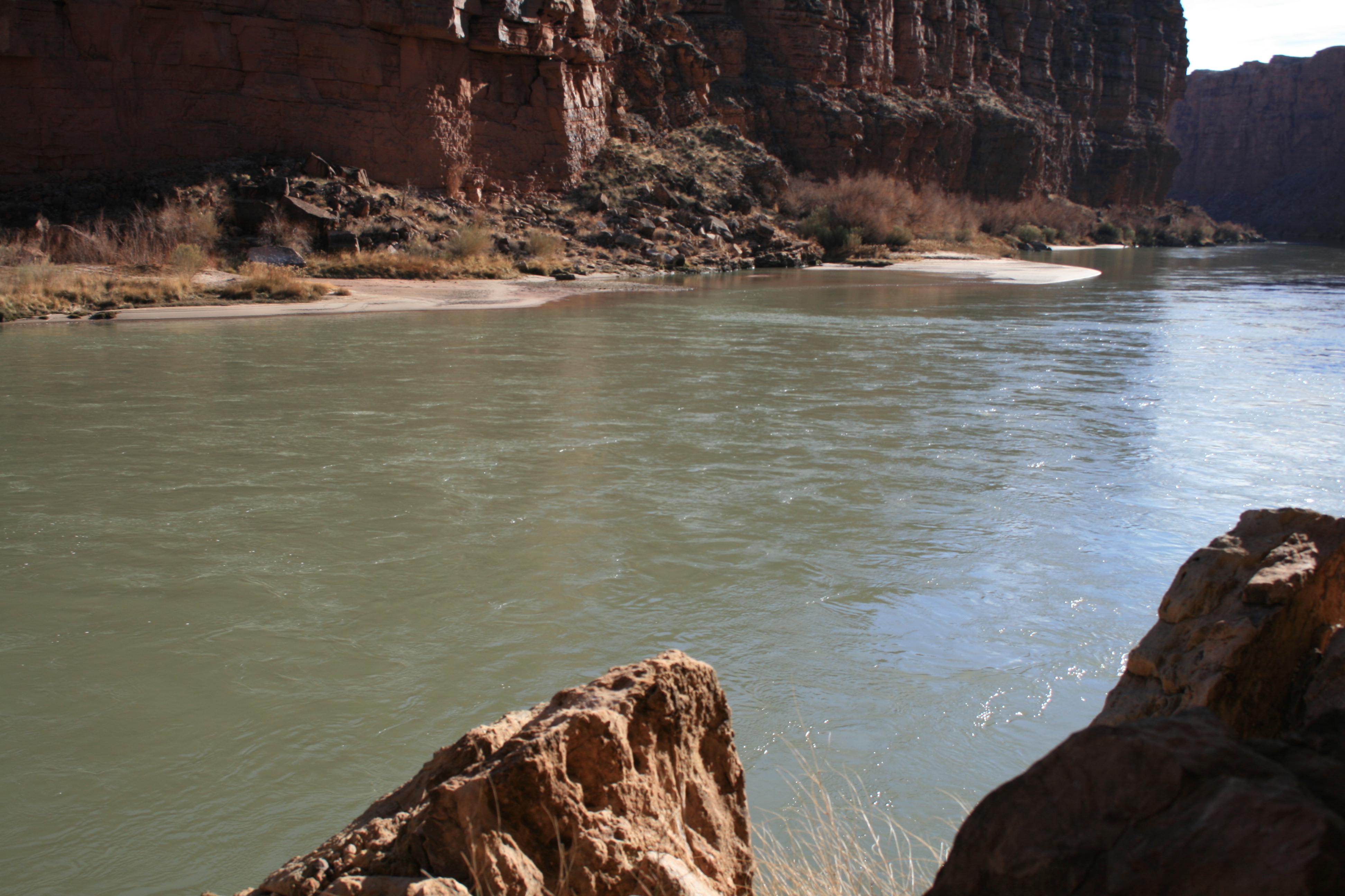 Photo of River Mile 3 taken on February 10, 2008 |
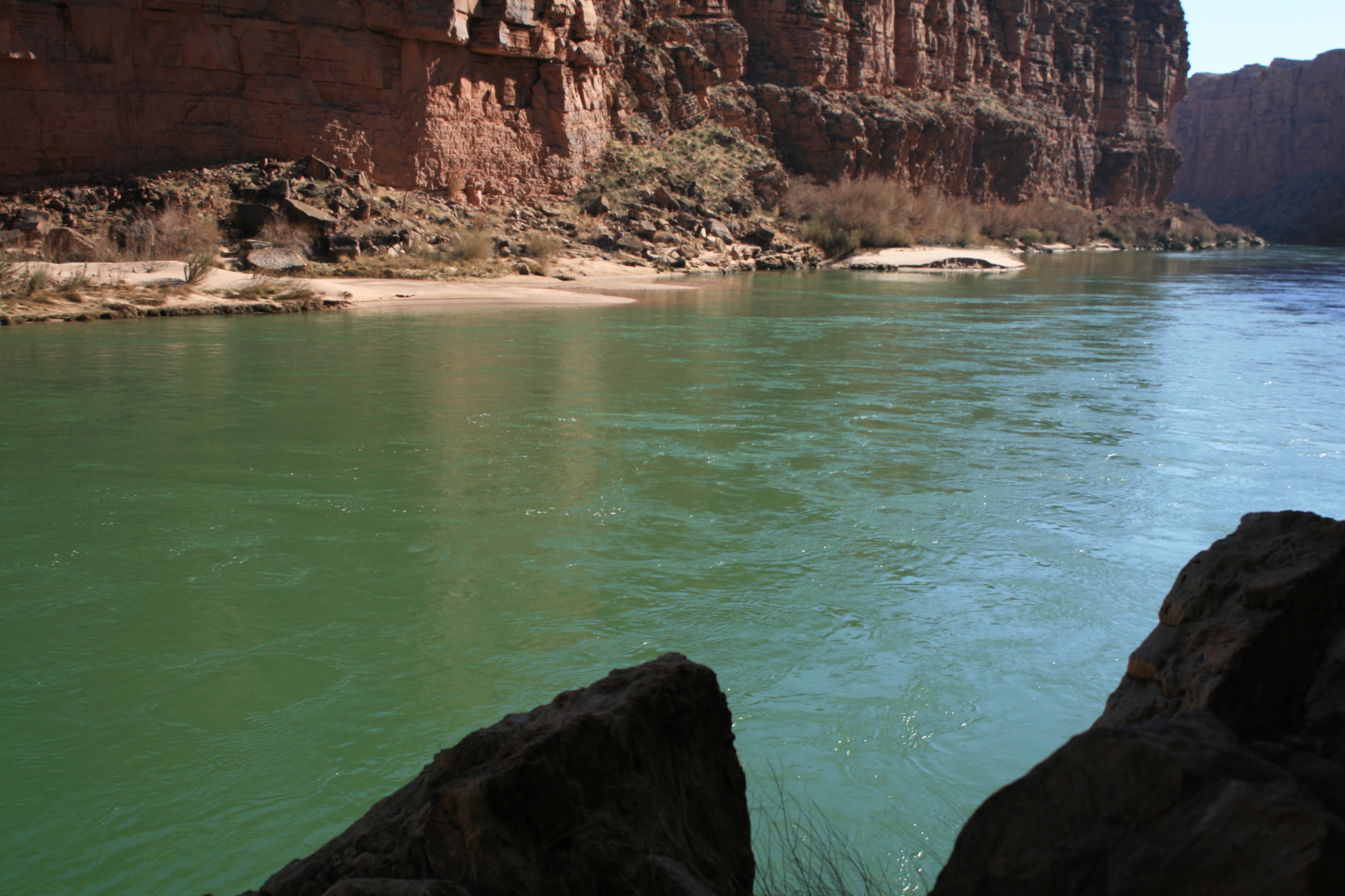 Photo of River Mile 3 taken after the high flow experiment on March 18, 2008 |
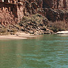
 Photo of River Mile 45 taken on March 4, 2008 |
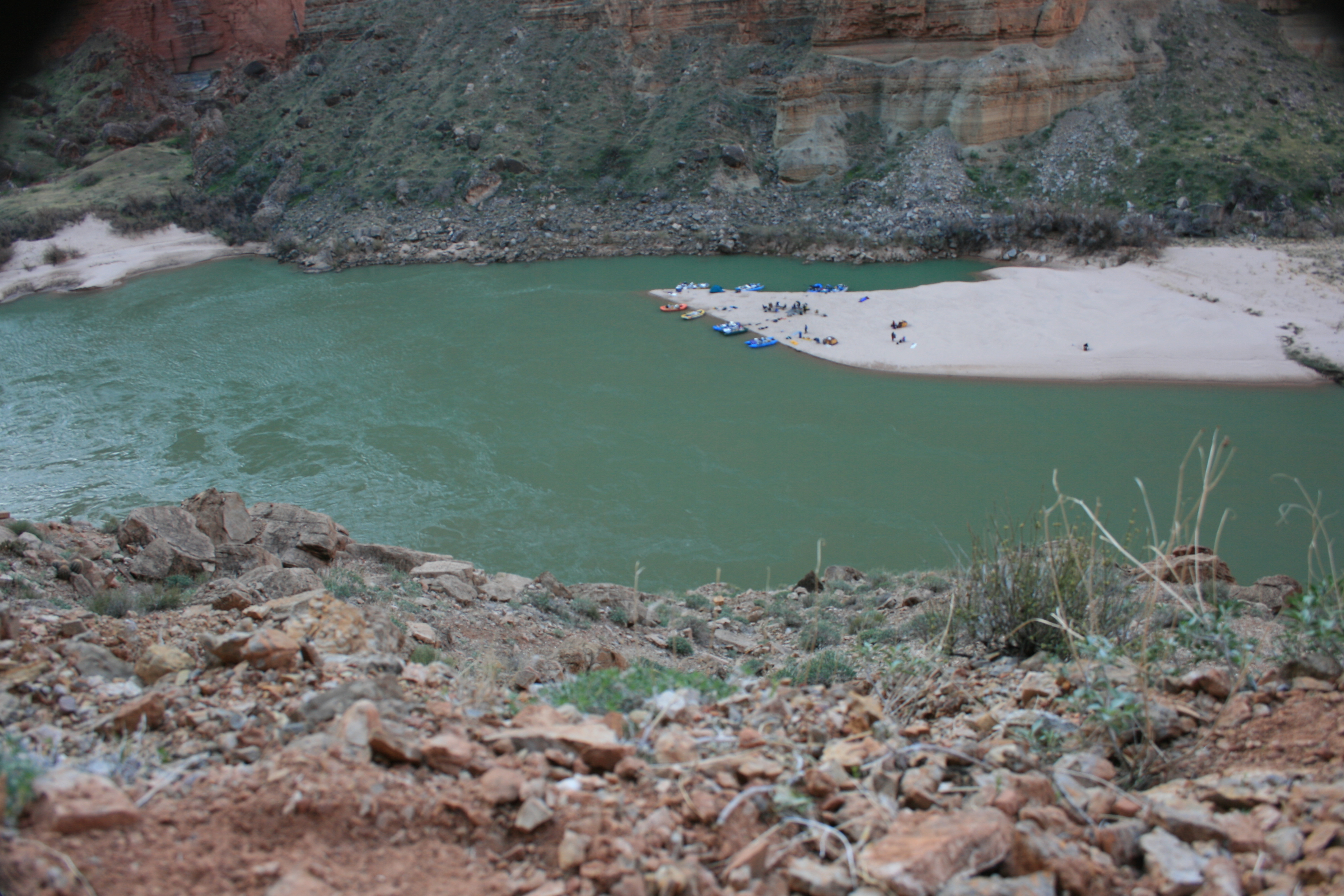 Photo of River Mile 45 taken after the high flow experiment on March 14, 2008. |
|
Media conference call recording (Apr 7, 2008) (MP3 - Transcription available in 7 - 10 business days.) |
|