 |
||||
|
|
|
|||


| |
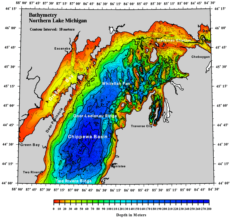
Great Lakes Bathymetry and Shoreline Data
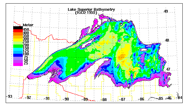
Great Lakes bathymetric data maps (sample above):
Gridded bathymetric data and digitized shorelines for the Great Lakes:
- Lake Superior (233Kb)
- Lake Michigan (209Kb)
- Lake Huron (253Kb)
- Lake St. Clair (16Kb)
- Lake Erie (72Kb)
- Lake Erie [rotated] (89Kb)
- Lake Ontario (76Kb)
- Great Lakes shorelines (260Kb)
The bathymetric grids consist of an array containing the average lake depths in 2-km squares (1.2-km squares for Lake St. Clair). The digitized shorelines are lists of latitudes and longitudes for closed loops describing lake and island shorelines. Conversion equations for map-to-geographical and geographical-to-map coordinate transformations for all bathymetric grids, as well as the format of the above data is described in the following NOAA technical memo:Computerized Bathymetry and Shorelines of the Great Lakes
D.J. Schwab and D.L. Sellers
NOAA Data Report ERL GLERL-16
Great Lakes Topographic Relief Map:
More information on Great Lakes bathymetry data:
David J. Schwab
Oceanographer
NOAA Great Lakes Environmental Research Laboratory
2205 Commonwealth Blvd.
Ann Arbor, MI 48105-2945 USA
313-741-2120, 313-741-2055 (FAX)
David.Schwab@noaa.gov
http://www.glerl.noaa.gov/data/bathy/