

Down the dusty, dirt roads of south-central Colorado lie two of our nation’s greatest natural
treasures: the Black Canyon of the Gunnison National Park
and the Gunnison Gorge National Conservation Area. Management of these extraordinary landscapes
falls under the U.S. Department of the Interior’s National Park Service and its
Bureau of Land Management, respectively. DOI oversees almost 140,000 acres of
land surrounding the Gunnison River as it flows west along U.S. Route 50 from
Gunnison to Delta, Colo. In June of this year, my three adult brothers, our two
parents, two friends and I took a guided-float fishing trip through the
Gunnison Gorge. We spent our first day exploring Black Canyon.
Our group, a long-time ranching crew chose the rugged grandeur of the canyon’s
north rim rather than its south, whose paved roads draw more visitors. To get to the north rim, you take a dirt road that follows
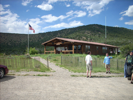
Grizzly Gulch to the North Rim Ranger Station. NPS rangers Brent Mims and Mark
Franklin manned the station. The two seemed to recognize each group of climbers
that came through, and I noticed they required them all to log in and out to
ensure safety. Mims recommended that we drive over to the North Rim Campground
and hike the Chasm View Nature Trail. At
the trailhead was a box containing a very insightful guide for the trail with a
title that fit our entire trip: “Beyond the Brink of Time.” A
product of geology and the power of water, Black
Canyon is one of the most spectacular
gorges in the United States.. In the 1930s, to preserve its scenic values, locals began to lobby NPS to take
control of the canyon. On March 2, 1933, the Black Canyon
became a national monument; and on Oct. 21, 1999, a national park. Standing at the edge of the great chasm
that is the Black
Canyon, all of these
dates seem insignificant. Your eyes scan down the 2,250 vertical feet of the
canyon’s “Painted Wall,” which reveals 1.7 billion years of Earth’s history. The view from the overlook is staggering once
you summon the courage to actually get out there. The distance from the north rim to the south
rim at the overlook is 1,100 feet across, and the river is 1,723 feet
below! Once I had gotten over the worst
of the vertigo, I could see visitors on the south rim and, below them, rock
climbers charting new paths on the vast face of time. As we left the overlook, a gentle mule-deer
cow greeted us. It had been grazing on the spring grasses, which had come up
from the last rain. The following morning Gunnison River Expeditions arrived
with assorted fishing gear and dry-bags to stow our clothes on the rafts. The company is one of the 10 commercial rafting and float-fishing outfitters that BLM allows to access the
area. We loaded all of our gear on top
of a giant van with huge off-road tires and climbed in for the drive to the
Chukar Trail in Gunnison
Gorge NCA. We had a 40-minute
drive on paved roads through a tough desert country, the “adobe badlands.” As we
got to the boundary of the Wilderness Area, the road all but disappeared, and
we continued on over a rugged track though the beautiful, wild desert. The Chukar Trail, which provides the main access for boaters, winds one mile down the red-earth mountains
to the Gunnison River.
This is the most eastern edge of the Wilderness Area that visitors can
access, and it is here that all the float-fishing trips start. Early that morning a mule team had delivered
our boats, food, tents and other gear to the river. BLM requires one guide for each two guests
and limits total group size to 12. Before we climbed on our boats, our guides gave us a brief talk on the rules of
visiting the National Conservation Area:
We were to watch for pygmy rattlesnakes, although visitor encounters
with them are rare. Each morning we
should shake our boots out before putting them on to remove any sleeping
scorpions. And most important, we were
to leave no trace that we had been here.
We could leave no trash, including “micro-trash,” such as food crumbs,
which would attract ants and other insects to the campsites. Our guides also informed
us that we were to do all urinating in the river and that at each campsite they
would set up a “groover” to handle our morning routines. Yes, they had to pack
that up and carry it out, too. Chukar Rapid was there waiting for us. Not that it was that big or that scary, but
as a white-water enthusiast I wanted to get onto the water. The winter and spring of 2007-2008 were very
wet in Colorado, and earlier in the season the
Gunnison was flowing at more than 7,000 cubic
feet per second. By June it was down to
a more reasonable level of just more than 3,000 cubic feet per second, which according
to the USGS Web site is about average for June. While the rafts are less wild
than the kayaks I am used to, the rapids are great fun, and the cold water is refreshing
in the 97-degree air. One of
the campgrounds at which we stayed, the Ute Bluff campground is on a large
meadow where about 100 head of elk spend each winter. This meadow offers flat places to sleep and
foot access to about a mile of river. It
is where the majority of hikers come down following the 4.5-mile Ute
Trail. Another point of interest here is
the BLM Ranger Station called the “Tee Pee.”
I had to go see it, and, indeed, there it was in a lovely, small green
meadow: a large white tepee. And
there were two BLM rangers cooking dinner: Ryan Mathis and Jeremy Matlock. I had seen two kayakers go down the river
earlier in the day, and here they were. Mathis
and Matlock are stationed in Montrose.
They come down the river a couple times a week to check all the
campgrounds and make sure visitors are respecting the wilderness. We spent our last morning on the river in the “Hall of the
River Gods.” This is the most narrow, vertical-walled section of the Wilderness
Area gorge. The river in the gorge is one
rapid right after another — half a dozen or a whole dozen, depending on your
comfort with white water. On either side of you, the walls of stone rise
vertically from the cold water and lumber up into the blue desert sky. I was wonderfully lucky and blessed to have experienced the
wild river and land for those days. I
also found there new reasons to appreciate my work here at DOI. My work revolves around the stewardship of
cultural resources, and it is gratifying to see others being good stewards of
our natural resources. I offer a
heart-felt thanks to the DOI employees I met on my trip. I also thank all who work hard to save the
wild places and make sure that the American people use and appreciate them. Thank you. .
Contents
Bureau News
More About Interior
 Print Version
 E-mail This Article

![[+] Enlarge](javascript:OpenNewWindow('/scienceandstewardship/images/full-1.jpg'))