PNSN Logo
The Pacific Northwest Seismic Network

All about earthquakes and geologic hazards of the Pacific Northwest        


HOME | Latest Quakes | Volcanoes | Catalogs & Data | Hazards & Preparation | Research | Outreach & Education | Operations & Projects
  
UW | Dept. of E&SS | REPORT AN EARTHQUAKE | USGS EQhazards | USGS PNW | Seismosurfing | Site Map | CONTACT US   

Catalogs and
Data


Hazards

Outreach and Education


Real-Time Info Products


Info Products You are here

Pacific Northwest (Washington and Oregon) Earthquake-Related Information Products

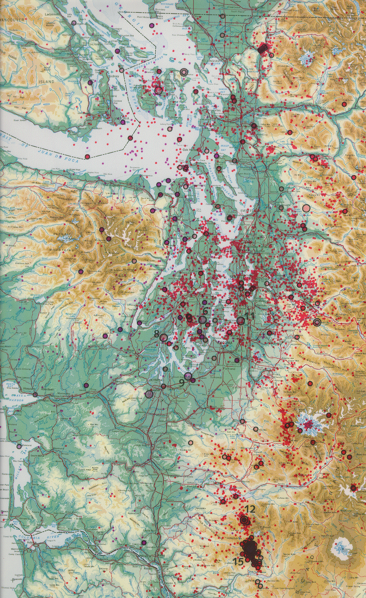
HAZARDS MAPS AND FACT SHEETS

FROM THE PNSN SEISMICITY WALL MAPS AND USGS PRODUCTS EARTHQUAKE SCENARIOS AND TSUNAMI INUNDATION MODELING LIDAR MAPS GEOLOGIC MAPS
This is file /SEIS/PNSN/INFO_GENERAL/infoproducts.html, last modified 11/13/02
UW Logo ESS Logo