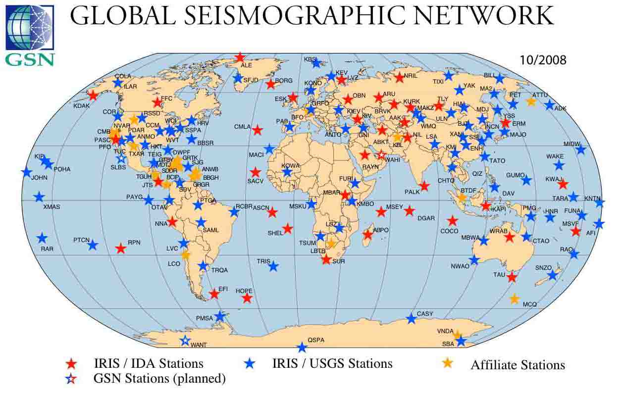
The Global Seismographic Network (GSN) is a 150+ station, globally distributed, state-of-the-art digital seismic network providing free, realtime, open access data through the IRIS DMS. The map above shows the distribution of the current 150 station network with respect to network operations. This includes 4 planned stations to be installed in the near future.
The Global Seismographic Network is a cooperative partnership between IRIS and the U.S. Geological Survey (USGS), coordinated with the international community, to install and operate a global, multi-use scientific facility as a societal resource for Earth observations, monitoring, research, and education. GSN instrumentation is capable of measuring and recording with high fidelity all seismic vibrations from high-frequency, strong ground motions near an earthquake to the slowest global Earth oscillations excited by great earthquakes. The primary focus in creating the GSN has been seismology, but the infrastructure is inherently multi-use and can be extended to other disciplines. Several GSN stations currently incorporate microbarographs, GPS, Geomag, and Meteorological packages.
Community oversight of the GSN is provided by a standing committee made up of seismologists from IRIS member institutions and international community, with participation by our network operators and major agencies as observers.
The GSN is the U.S. contribution towards global, uniform, unbiased Earth coverage by a permanent network of broadband, three-component digital stations. GSN is coordinated internationally within the International Federation of Digital Seismograph Networks (FDSN), of which IRIS is a founding member.
GSN equipment is based on the GSN Design Goals document developed and coordinated with the GSN Standing Committee and the IRIS Instrumentation Committee. GSN makes every effort to take advantage of a broad mix of available telecommunication technologies, using public and private Internet links, and dedicated satellite circuits.
The GSN, together with the USGS National Earthquake Information Center (NEIC), are principal global sources of data and information for earthquake locations, earthquake hazard mitigation, and earthquake emergency response. In collaboration with National Oceanic and Atmospheric Administration (NOAA) Tsunami Warning Centers, Japanese Meteorological Agency (JMA), and the Australian Tsunami Warning System, the GSN provides essential data for tsunami warning response globally. The GSN works closely with the International Monitoring System (IMS) for the Comprehensive Nuclear-Test-Ban Treaty Organization (CTBTO), where nearly 30 GSN stations are now linked directly to the CTBTO International Data Centre. The GSN is an official observing system within the Global Earth Observing System of Systems (GEOSS).


