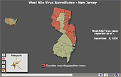
| Directions -
Click the small map to the left to view the West Nile Virus 2000 dynamic
maps.  To
explore these maps, move your cursor over the map key to select a map
type. Then move your cursor onto the colored areas of the map. A
bar scale will appear showing the cumulative number of occurances for
a particular week and the prevoius week. The text area on the control
bar lists the name of the State or county that the cursor is over. To
explore these maps, move your cursor over the map key to select a map
type. Then move your cursor onto the colored areas of the map. A
bar scale will appear showing the cumulative number of occurances for
a particular week and the prevoius week. The text area on the control
bar lists the name of the State or county that the cursor is over.
The cumulative number of occurances since the beginning of 2000 will
appear as small text above the bar scale.
To change weeks use the forward and back buttons on
the control bar. on
the control bar.
Click one of the buttons under the conrtol bar to select a different
map.
Information
Cases of West Nile virus (WNV) in the United States were first documented
in the fall of 1999. WNV has been commonly found in humans and birds
and other vertebrates in Africa, Eastern Europe, West Asia, and the
Middle East, but had not previously been documented in the Western Hemisphere.
The virus is transmitted to humans through the bite of a mosquito and
can cause encephalitis - an inflammation of the brain. WNV interferes
with normal central nervous system functioning. It is closely related
to St. Louis encephalitis virus found in the United States. In 2000,
the disease occurred in eighteen people in the New York City area and
Northern New Jersey. There was only one fatality. The dynamic maps presented
here document how the disease spread in 2000.
|