Volcano Hazards Program Features Archive
-
Alaska Volcano Observatory (AVO) Celebrates Twenty Years of Volcano Research and Hazard Mitigation …
-
On the evening of March 23, 2008 small incandescent particles were observed erupting from the vent below the Halema`uma`u Overlook. See the HVO Timeline for more information …
-
Growth of the new lava dome inside the crater of Mount St. Helens, which began in October 2004, appears to have paused …
-
Parts of the Yellowstone Caldera rose as much as 7 cm (~3") per year from 2004 to 2006. …
-
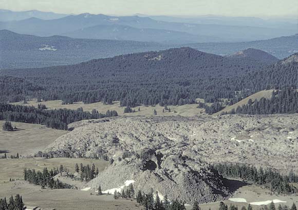
Medicine Lake volcano covers more than 2000 square km in California. New report covers potential volcano hazards. …
-
Lava flow hazard assessment, as of August 2007, for Kilauea East Rift Zone eruptions, Hawai'i Island …
-
Track volcanic and earthquake activity on your personal Google Map …
Previous Archive
08 January 2008
The U.S. Geological Survey,
through its Cascades Volcano Observatory in Vancouver,
Washington, invites applications for the 2008 Jack
Kleinman Volcano Research Grants Program.
Stipends of $500 to $2,000 are available to senior
undergraduates and graduate students who are conducting
research in volcanology, preferably in the Cascade
Range, Aleutian volcanic arc, Hawaii, Yellowstone, or
Long Valley caldera. The application deadline is March
1, 2008. [Added May 2008] To see this year's winners, please see the Jack
Kleinman Internship page.
17 December 2007
The Cascade magmatic arc is a belt of Quaternary volcanoes that extends 1,250 km from Lassen Peak in northern California to Meager Mountain in Canada, above the subduction zone where the Juan de Fuca Plate plunges beneath the North American Plate. Newly published Professional Paper 1744, Quaternary Magmatism in the Cascades—Geologic Perspectives by Wes Hildreth, presents a synthesis of the entire volcanic arc, addressing all 2,300 known Quaternary volcanoes. Wes Hildreth’s insightful understanding of volcanic processes and his uncompromising scientific integrity make him uniquely qualified to present this synthesis. During more than three decades of volcanological studies, he has carried out comprehensive investigations of Mount Adams, Mount Baker, the Three Sisters, and the Simcoe Mountains Volcanic Field. He also brings a broad experience in other volcanic arcs, having conducted integrated field and laboratory investigations at several major volcanic centers in the Andes and the Aleutian arcs. His expertise and perspective have been further enhanced by in-depth petrologic studies of caldera environments, primarily in Long Valley, California, and Yellowstone. This scientific volume will influence and guide the course of Cascade investigations for decades to come. [excerpted from Foreword]
2 July 2007
USGS scientists along with our colleagues at the U.S. Forest Service
have published a new Fact Sheet,
Boiling Water at Hot Creek - The
Dangerous and Dynamic Thermal Springs in California's Long Valley
Caldera. The Fact Sheet was written in response to safety concerns
regarding recent hot spring activity and geysering in Hot Creek
Gorge. Due to the unpredictability of the hazardous spring activity,
the U.S. Forest Service has closed parts of the Hot Creek Geologic
Site. Fact Sheet 2007-3045 explains why the previously popular
swimming area is thermally unstable.
21 June 2007
For more information please see the
summary of the June 12th earthquake sequence south of Long Valley caldera.
19 June 2007
For more information please see the Kīlauea update page (http://volcano.wr.usgs.gov/hvostatus.php). For the most recent images, please see the current images page (http://hvo.wr.usgs.gov/kilauea/update/images.html).
14 June 2007
The ability to forecast near future activity
during periods of volcanic unrest
has been a primary concern for human populations living near volcanoes. Our
ability to forecast future activity and mitigate hazards is based on knowledge
of previous activity at the volcano exhibiting unrest and knowledge of previous
activity at similar volcanoes. A small set of experts with past experience are
often involved in forecasting. To both preserve the knowledge the experts
use and continue to investigate volcanic data to make better forecasts, the
World
Organization of Volcano Observatories (WOVO) has designed a database
called WOVOdat. The Design Document, written by USGS scientists Dina Venezky
and Chris Newhall, covers the first phase
of the project and explains the schema for version 1.0. For more information,
please seeWOVOdat Design Document: The Schema, Table Descriptions, and Create Table Statements for the Database of Worldwide Volcanic Unrest (WOVOdat Version 1.0).
04 April 2007
Yellowstone Volcano Observatory (YVO) just released a
Preliminary
Assessment of Volcanic and Hydrothermal Hazards in Yellowstone
National Park and Vicinity.
The assessment, four years in the making, is authored by Robert Christiansen, a leading expert on the Yellowstone volcanic
system, along with eight colleagues. The preliminary assessment has been published as an Open-File Report. Over
the next 2 years, the assessment will be enlarged to include a seismic
hazards analysis and other additional enhancements. At that point, the
hazards assessment will be released as a more formal USGS Scientific
Investigations Report that will replace this preliminary report.
26 January 2007
The U.S. Geological Survey,
through its Cascades Volcano Observatory in Vancouver,
Washington, invites applications for the 2007 Jack
Kleinman Volcano Research Grants Program.
Stipends of $500 to $2,000 are available to senior
undergraduates and graduate students who are conducting
research in volcanology, preferably in the Cascade
Range, Aleutian volcanic arc, Hawaii, Yellowstone, or
Long Valley caldera. The application deadline is March
1, 2007. For more information please see the Jack
Kleinman Internship page.
3 January 2007
It is with deep sadness we inform you that our colleague, Jim Luhr, Curator in the Department
of Mineral Sciences at the Smithsonian Institution, passed away unexpectedly on January
1, 2007, at the age of 53. He died peacefully in his
sleep. He directed the Smithsonian's Global
Volcanism Program since 1995, and is
well-known for elegantly written descriptions of
insightful, multi-pronged studies of his beloved Mexican
volcanoes. For more information please see the
Smithsonian's page on James Luhr.
21 December 2006
The long awaited third edition of the popular This Dynamic Planet map has been released. The map is designed to show Earth's most prominent features when viewed from a distance, and more detailed features upon closer inspection. The back of the map zooms in further, highlighting examples of fundamental processes, while providing text, timelines, references, and other resources to enhance understanding of this dynamic planet. The map was published by the Smithsonian Institution, the U.S. Geological Survey, and the U.S. Naval Research Laboratory.
More information about the map can be found on the USGS publications site.
For an interactive online version, please see
The Smithsonian's This Dynamic Map page.
3 October 2006
The U.S. Geological Survey (USGS)
has adopted a common system nationwide for characterizing the level of unrest and eruptive activity at volcanoes. See USGS
Volcano-Warning Scheme for the United States for
a description of the new alert-level system.
Satellite Technologies Detect Uplift in the Yellowstone Caldera
22 March 2006
This March 2006, the journal Nature published a paper by YVO scientist Charles Wicks and colleagues about a period of uplift in the northern part of the Yellowstone caldera. For more information about the recent findings, please see Satellite Technologies Detect Uplift in the Yellowstone Caldera. See also the InSAR
research Group Section.
Volcano Information Statements now Released using the Common Alerting Protocol (CAP)
29 March 2006
The Volcano Hazards Program is now using a standard format called CAP for all volcano information statements. CAP was created to meet the recommendation of the National Science and Technology Council's report on "Effective Disaster Warnings" (2000) that:
"A standard method should be developed to collect and relay instantaneously and automatically all types of hazard warnings and reports locally, regionally and nationally for input into a wide variety of dissemination systems."
The volcano information statements on our websites will look similar to how they have looked in the past. The underlying format, however, is now in eXtensible Markup Language (XML) and includes additional information describing the type of alert for emergency managers.
The full CAP messages are available as an RSS feed from the following url http://www.usgs.gov/homepage/rss_feeds.asp#volcanoes.
For more information about CAP please see the OASIS website.
U.S. Geological Survey launches new website styles
29 March 2006
The U.S. Geological Survey (USGS) has provided new header and
footer templates to give our web pages a unified look and to
increase accessibility. The Volcano Hazards Program will slowly
roll out the templates starting with new pages. You will notice
that changes have been made to this page including easier access
to information about erupting volcanoes in the 'Worldwide and
U.S. Volcano Updates' and news stories with dates of
publication. We will also be adding new features, such as RSS
feeds, and revising the navigation. Stay tuned for more information about our exciting web changes.
Five-Year Volcano Hazards Plan Released
The Five-Year Volcano Hazards Plan, Understanding Volcano Hazards and Preventing Volcanic Disasters,
A Science Strategy for the Volcano Hazards Program,
U.S. Geological Survey, 2004-2008 is now available in pdf format.


