
- HOME
- EXPLORE
- Oceans
- Coasts
- Coastal Decision-making Tools
- Coastal Ecosystem Science
- Coastal Zone Management
- Coastal Monitoring and Observations
- Contaminants in the Environment
- Ecological Forecasting
- Harmful Algal Blooms
- National Estuarine Research Reserves
- Natural Hazards Assessment
- Natural Resource Restoration
- Training and Capacity- Building
- Charting and Navigation
- EDUCATION
- DATA EXPLORER
- NEWS
- OFFICES
- Center for Operational Oceanographic Products and Services
- International Program Office
- Management and Budget Office
- National Centers for Coastal Ocean Science
- National Geodetic Survey
- Office of National Marine Sanctuaries
- NOAA Coastal Services Center
- Office of Coast Survey
- Office of Ocean and Coastal Resources Management
- Office of Response and Restoration
- OUTREACH
- PUBLICATIONS
- WEB SITES
- ABOUT

|
|
Some of the biggest challenges facing coastal communities involve coastal hazards. Such natural hazards include hurricanes, tsunamis, erosion, and harmful algal blooms. It is the job of local and state governments to reduce the negative environmental, social, and economic impact that these natural hazards can have on their communities. NOAA’s National Ocean Service (NOS) is a part of this effort. NOS provides helpful hazard-related information and tools to state and local coastal programs. Much of this work is developed at the NOAA Coastal Services Center and involves training, information dissemination, and tools and methodologies created to assist in hazards assessment, response, and mitigation. Training is an important component of this effort. Topics include managing natural hazards in coastal areas and determining which portions of a community are most at risk. Courses are designed for state and local officials and can be taught at the Center or brought to the customer.
The Vulnerability Assessment Techniques and Applications Web site provides researchers and practitioners with access to more than 40 hazard vulnerability assessment case studies that have been successfully applied in the Western Hemisphere. Harmful algal bloom (HAB) alert bulletins predict HAB landfall for the eastern Gulf of Mexico. NOS scientists can locate blooms by assessing surface chlorophyll concentrations detected by satellite imagery and verified by data from ships. They then apply their understanding of the biological and physical aspects of bloom dynamics and transport and the conditions that are conducive for HAB development to predict when and where HABs will impact coastal communities. Helping citizens assess their personal hazard risk is another service NOAA provides. The hazard information service lets users input an address or general location area and easily access pertinent coastal hazard information. The first example of this tool was developed for the state of Hawaii. State tsunami evacuation zone maps and tsunami awareness information can be found on the Hawaii Tsunami Hazard Information Service. Education about tsunami risk is especially important for Hawaii, which is located within the Pacific Ring of Fire – one of the most geologically active regions on Earth, making the Hawaiian coast under a constant threat of tsunami inundation.
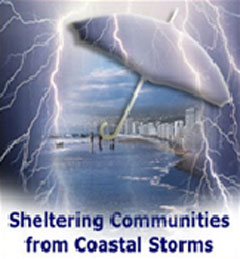
The Center's Coastal Storms Program (CSP) determined the best way to accomplish its goal of reducing the adverse impacts of storms on life, property, the economy, and environmental health in coastal areas is to localize the effort by implementing regional pilot projects. Through this approach, the CSP focuses its energies and tailors its products to each pilot region’s specific coastal issues and hazards. A team of local officials and NOAA representatives conduct a thorough assessment of the region to determine its most pressing needs. The group then works together to address these needs through new technology, data, information, and partnerships. Examples of the types of issues already addressed include navigational safety, improved prediction capabilities, risk and vulnerability assessments, and hidden impacts. The first pilot effort occurred in Florida; similar efforts are underway in Oregon and Southern California. To learn more about the program, visit the Coastal Storms Programs Web site. |
...the CSP focuses its energies and tailors its products to each pilot region’s specific coastal issues and hazards. |
||||||||||||||||||
- NOS Program Offices
- Center for Operational Oceanographic Products and Services
- National Centers for Coastal Ocean Science
- NOAA Coastal Services Center
- National Geodetic Survey
- Office of Coast Survey
- Office of National Marine Sanctuaries
- Office of Ocean and Coastal Resource Management
- Office of Response and Restoration

Revised September 05, 2007
| Questions, Comments? Contact Us | Report
Error | Disclaimer | About
the Site | User Survey
National Oceanic and Atmospheric
Administration | U.S.
Department of Commerce | USA.gov
http://oceanservice.noaa.gov/topics/coasts/assessment/welcome.html