(content link) weather.gov    
NOAA link National Weather Service   NWS link
National Operational Hydrologic Remote Sensing Center

Forecasts

Watches, Warnings, and Advisories

The latest nationwide information from the National Weather Service:
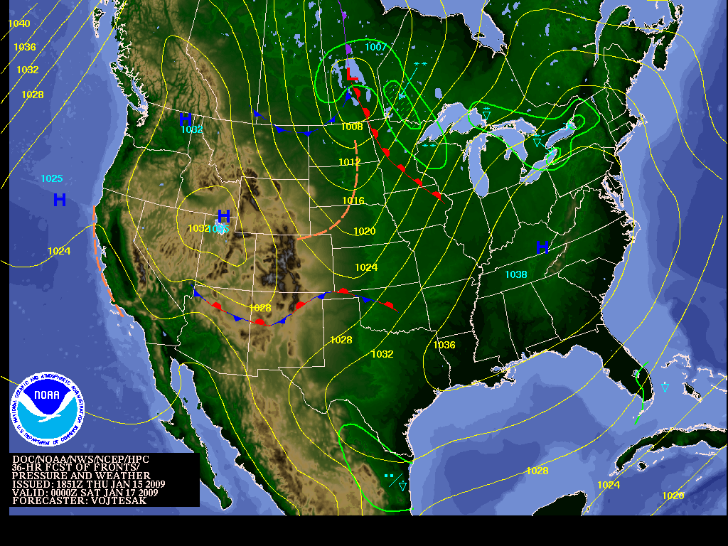
Active Watch/Warnings River Flood Conditions
Active Watch/Warnings Rivers

Weather Forecasts

Current and forecasted weather fronts and precipitation:
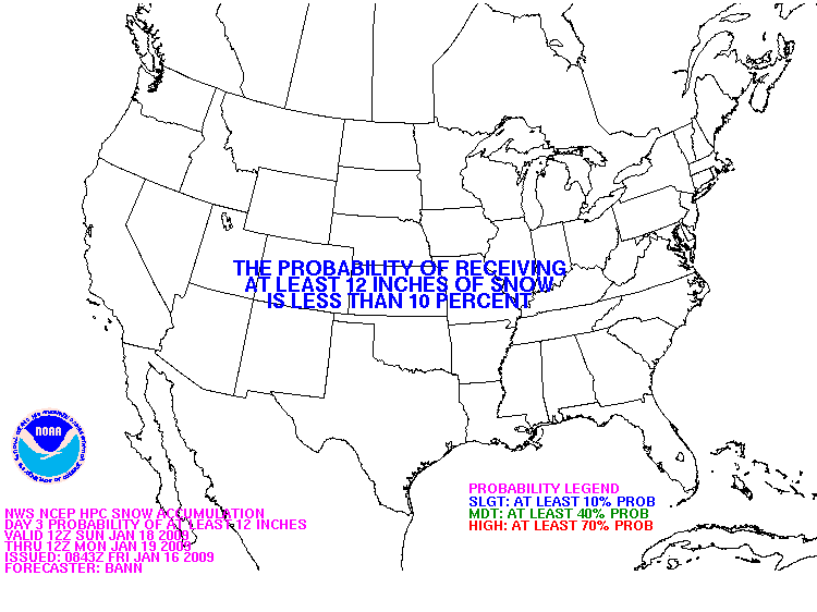
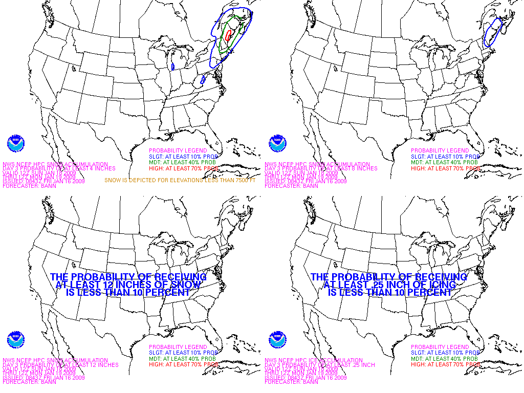
Fronts and Precipitation Radar and QPF
National Forecast - Current National Precipitation Forecast 24 Hours Out
12 Hours Out
24 Hours Out 24 Hours Out
36 Hours Out
Day 2 Day 2
(Fronts only) Day 3 Day 3
(Fronts only) Day 4
(Fronts only) Day 5
(Fronts only) Day 6

Snow Probability Forecasts

The following charts depict the probability of snowfall reaching or exceeding 4, 8, or 12 inches in the next 24 to 72 hours.

>= 4" Snow >= 8" Snow
Probability of snowfall greater than or equal to 4 inches Probability of snowfall greater than or equal to 8 inches
Day 1 Day 1
Day 2 Day 2
Day 3 Day 3

>= 12" Snow Composite
Probability of snowfall greater than or equal to 12 inches Composite of probability of snowfall maps
Day 1 Day 1
Day 2 Day 2
Day 3 Day 3

More Winter Weather Forecasts from the Hydrometeorological Prediction Center


NOHRSC
Mission Statement  |  Contact


National Weather Service
National Operational Hydrologic Remote Sensing Center
1735 Lake Drive W.
Chanhassen, MN 55317

NOHRSC homepage
Contact NOHRSC
Glossary
Credits
Page last modified: Apr 07, 2008
About Us
Disclaimer
Privacy Policy
Career Opportunities