USGS - science for a changing world

Science In Your Backyard

Maps, Imagery, and Publications Hazards Newsroom Education Jobs Partnerships Library About USGS Podcasts/RSS

Science In Your Backyard: Coastal and Offshore Activities

Go to Science In Your Backyard


Coastal and Offshore Activities
Image caption below

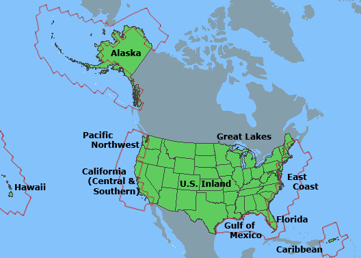
The map projection above shows the United States, Puerto Rico, and Virgin Islands in relation to the North American continent. The red boundary lines show the major coastal and ocean areas for USGS work. These ocean areas around the United States and its territories are part of the U.S. Exclusive Economic Zone (EEZ).


Accessibility FOIA Privacy Policies and Notices

Take Pride in America logo USA.gov logo U.S. Department of the Interior | U.S. Geological Survey
URL: http://www.usgs.gov/state/coastal_offshore.asp
Page Contact Information: Ask USGS
Page Last Modified: Tuesday, July 08, 2008

Alaska California (Central & Southern) Caribbean East Coast Florida Great Lakes Gulf of Mexico Hawaii Pacific Northwest U.S. Inland