USGS - science for a changing world

Upper Midwest Environmental Sciences Center

Home/ Overview/ Science Programs/ Data Library/ Products and Publications/States/ Rivers/Teachers and Students/ Links/ Contact/ Search

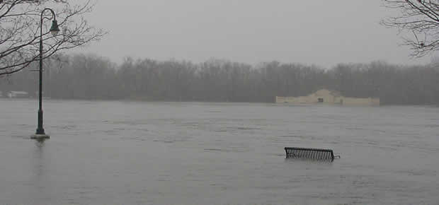
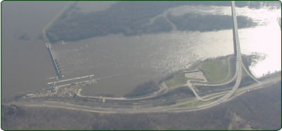
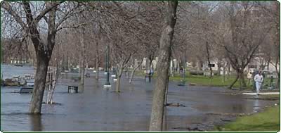
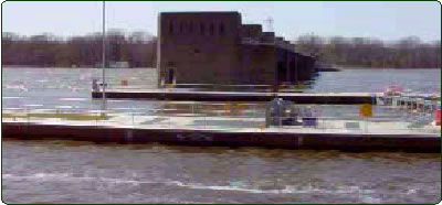
Mississippi River Flood: April 2001

Mississippi River flooding at La Crosse Wisconsin

The Mississippi River overflowed onto the waterfront promenade in Riverside Park
in La Crosse, Wisconsin.  Photo taken: April 16, 2001.


In April, 2001 the Upper Mississippi River experienced severe flooding of historic significance - the river rose to its highest level since 1965.  The Upper Midwest Environmental Sciences Center documented the flooding in the region of La Crosse, Wisconsin with a collection of surface and aerial obliques (photographs) and video.


Aerial Obliques

Aerial photos of
Mississippi River
Pools 6 through 9,
April 18, 2001.
Additional photos of
Pools 8, 9, 12-15,
April 24, 2001.

Interstate 90 crosses the Mississippi River south of Navigation Dam 7

Surface Obliques

Ground-level photos
throughout the
La Crosse region.
April 16 - 25, 2001

Also, photos of USGS staff volunteering.

Flooded Riverside Park

Video

Footage throughout
the La Crosse region.
April 16, 2001

Navigation Dam 8

All photos and video taken by UMESC staff members: Larry Robinson, Jennifer Dieck, J. C. Nelson, Mark Wenger, Mike Caucutt, and Robert Kratt

Accessibility FOIA Privacy Policies and Notices

Take Pride in America logo USA.gov logo U.S. Department of the Interior | U.S. Geological Survey
URL: http://www.umesc.usgs.gov/flood_2001/flood.html
Page Contact Information: Contacting the Upper Midwest Environmental Sciences Center
Page Last Modified: October 2, 2007