![[design image slice] U.S. Department of Agriculture Forest Service on faded trees in medium light green background](https://webarchive.library.unt.edu/eot2008/20090114063805im_/http://www.fs.fed.us/r2/mbr/local-resources/images/rmt-trees-left-usfs.gif)
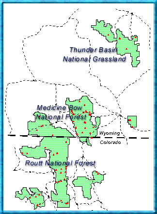
Medicine Bow - Routt National Forests
Thunder Basin National Grassland
| Home | |
| About Us | |
| Contact Us | |
| Current Conditions | |
| Education | |
| FAQ | |
| Fire | |
| Jobs | |
| Maps & Brochures | |
| Natural Resources | |
| Newsroom | |
| Passes & Permits | |
| Projects & Plans | |
| Publications | |
| Recreation | |
| Volunteering | |
Find a Forest (NF)
or Grassland (NG)
USDA Forest Service Telephone for the |
|
Maps & Brochures
Get ready for your visit to the Medicine Bow-Routt National Forests, Thunder Basin National Grassland by checking out our detailed maps, brochures, and information guides. You can even "see" what we are like before your visit—find photos of our forest on the visitor map and in some brochures. Brochures, Guides & MapsCall us for a FREE
BROCHURE or to purchase one of our visitor maps 307-745-2300
and list for local recreation, wildlife, fire safety, and other
information. "A Guide To Your National Forests" is a free brochure showing locations of national forests and grasslands along with contact information. Available from forest service offices.
VISITOR MAPS There are four visitor maps that cover the Medicine Bow-Routt National Forests, Thunder Basin National Grassland. "Visitor Maps" for each national forest and grassland provide forest-wide information on attractions, facilities, services, and opportunities. The most comprehensive source for maps is the US Geological Survey.
"Topographic Maps" provide the greatest level of detail and only cover small portions of a forest. These maps are available to purchase from the US Geological Survey, many individual forests, and many retail outlets.
Many specialty maps and brochures are available from individual Ranger District offices covering specific trails, Wilderness Areas and other special areas. The US Geological Survey also sells many other map products covering the national forests and grasslands.
|
|
||||
USDA Forest Service, Medicine Bow - Routt National Forests,
Thunder Basin National Grassland
Website comments? Please
let us know.
Last modified
January 18, 2008