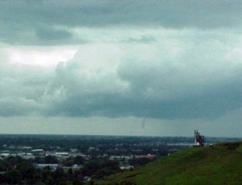
June 14, 1999 Funnel Cloud East of Rapid City, SD
At approximately 1:40 PM on June 14, 1999, a funnel cloud was observed about 8 miles east of the NWS office in Rapid City, SD (thanks to Kevin Parks of Litton/PRC who first noticed this funnel during our AWIPS training!). This was a good example of a "non-supercell" type funnel (in this case, perhaps a "cold-air" funnel), which can be produced from non-severe thunderstorms. These types of funnel clouds, if they do touch down, rarely cause any damage or injury. The first image below illustrates that the funnel was extending down from a growing towering cumulus cloud with a dark, "hard" base, indicating the presence of a significant updraft. The image at the bottom was taken about 3 minutes after the first. This funnel cloud lasted 5-10 minutes, and eventually became thin and rope-like before finally dissipating. Photos were taken from the NWS office in Rapid City, SD.