|
|
|
Metadata
|
|
ID
|
L-2-84-AN
|
|
Abstract
|
United States Geological Survey, Menlo Park, California.
Chief Scientists: Alan Cooper, Fred Davey. Geological and
Geophysical data (3dot5khz, 12khz, gradiometer, uniboom,
airgunmonitor, airgun, sonobuoy, gravitycore, chaindredge,
dartcore, magnetics, Digitrack, heatflow,
integratednavigation, transitsatellite, 24channel) of field
activity L-2-84-AN in Antarctica from 02/03/1984 to
03/03/1984
|
|
Organization
|
United States Geological Survey, Menlo Park, California
|
|
Chief Scientist
|
Alan Cooper
Fred Davey
|
|
Activity Type
|
Geological and Geophysical
|
|
Platform
|
Samuel Phillips Lee
|
|
Area of Operation
|
Antarctica
|
|
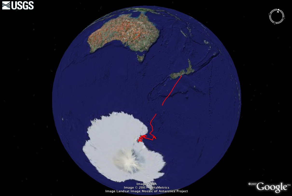
Location map
|
|
|
Bounding Coordinates
|
-43.59192
163.00166 -173.37114
-77.64513
|
|
Dates
|
02/03/1984 (JD 034) to 03/03/1984 (JD 063)
|
|
Analog Materials
|
list
|
|
Index maps


|
|
|
Information Specialist
|
|
|
Crew
|
|
Aaron Dunwald
|
Chief Engineer
|
|
Al McClenaghan
|
Ship Captain
|
|
Alan Cooper
|
Chief Scientist
|
|
Andy Stevenson
|
Geologist
|
|
Brian Edwards
|
Geologist
|
|
Dave Howell
|
Geologist
|
|
Dennis Mann
|
Chief Watchstander
|
|
Donna Blackman
|
Watchstander
|
|
Erk Reimnitz
|
Geologist
|
|
Fred Davey
|
Chief Scientist
|
|
Herman Karl
|
Geologist
|
|
Holly Ryan
|
Watchstander
|
|
Jim Vaughan
|
Chief Engineer
|
|
Joe Edwards
|
Mechanical Technician
|
|
John Behrendt
|
Geophysicist
|
|
John Rapp
|
Geochemist
|
|
Kaye Kinoshita
|
Navigator
|
|
Kevin O'Toole
|
Mechanical Technician
|
|
Pat Moore
|
Chief Mate
|
|
Roy Fields
|
Electronics Technician
|
|
Shawn Dadisman
|
Dafe Curator
|
|
Skip Pelletier
|
Watchstander
|
|
|
Equipment Used
|
|
3dot5khz
|
|
12khz
|
|
gradiometer
|
|
uniboom
|
|
airgunmonitor
|
|
airgun
|
|
sonobuoy
|
|
gravitycore
|
|
chaindredge
|
|
dartcore
|
|
magnetics
|
|
Digitrack
|
|
heatflow
|
|
integratednavigation
|
|
transitsatellite
|
|
24channel
|
|
|
Information to be Derived
|
|
Seismic reflection profiles, gravity, magnetics, lithology,
|
|
and bathymetry.
|
|
|
Summary
|
|
Approximately 2,350-line km of multichannel
|
|
seismic-reflection data, as well as 4,500 km of other geophysical
|
|
profile data including gravity, magnetic gradiometer, and
|
|
echo-sounding profiles for the western Ross Sea, Antarctica
|
|
were collected.
|
The seismic source consisted of a tuned five-airgun array
|
|
totaling 1,311 cu.in. pressurized to 1,900 psi, towed at a
|
|
depth of 10.5 m.
|
The receiver consisted of a 24-channel
|
|
hydrophone streamer, with 100-m group lengths containing 60
|
|
hydrophones in each group.
|
The streamer was towed at a
|
|
depth of 12.5 m.
|
The data were recorded with a GUS Model
|
|
HDDR-4200 recording system.
|
All lines were recorded to 12
|
|
sec, with exception of Line 407 (15 sec) and Line 419 (8
|
|
sec).
|
|
Magnetic data were recorded continuously with a
|
|
Geometrics proton-procession gradiometer to remove the large
|
|
temporal magnetic variations commonly recorded at polar
|
|
latitudes.
|
The gradiometer system consisted of two proton-precession
|
|
magnetometers separated horizontally by 500 ft
|
|
(152 m) with the forward sensor lying 225 m aft of the ship.
|
Both sensors were towed at a depth of approximately 20-40m.
|
|
Data were sampled at 4-sec intervals.
|
|
Gravity data were
|
|
recorded continuously with a LaCoste and Romberg sea
|
|
gravimeter (S53) on a two-axis stabilized platform.
|
The data were collected at 20-sec intervals and subsequently
|
|
desampled to 2 min or greater for plotting and modeling.
|
|
|
NGDC Overview
|
|
! Converted to time format with year at start.
|
|
!
|
|
DATA COLLECTION OVERVIEW (use NGDC GEODAS CD to retrieve data)
|
|
|
|
MCG Data Collection ID --- L284AN
|
|
Institution Data Collection ID --- L284AN
|
|
NGDC ID --- 06050069
|
|
Funding --- (unspecified)
|
|
Project, Cruise & Leg --- ANTARCTICA - ROSS SEA
|
|
Study region --- -43.00000,-78.00000,+163.00000,-173.00000
|
|
Chief Scientist(s) --- ALAN COOPER,FRED DAVEY
|
|
Date field data collection started --- 02/03/84 LV MCMURDO
|
|
Date field data collection ended --- 03/03/84 ARRIVE LYTTLETON, N.Z.
|
|
Parameters surveyed ---
|
|
Bathymetry: surveyed, contained in data file
|
|
Magnetics: surveyed, contained in data file
|
|
Gravity: surveyed, contained in data file
|
|
High-resolution seismics: (unspecified)
|
|
Deep penetration seismics: (unspecified)
|
|
Format --- (I1,A8,F5.2,4I2,F5.3,F8.5,F9.5,I1,F6.4,F6.1,I2,i1,3F6.1,I1,F5.1,F6.0,F7.1,F6.1,F5.1,A8,4I1)
|
|
Date of data input to NGDC --- 08/05/87
|
|
Contributing institution --- USGS Branch of Pacific Marine Geology
|
|
Country --- United States
|
|
|
|
Navigation instrumentation --- NAV SATELLITE / INTEGRATED NAV
|
|
Position determination method --- (unspecified)
|
|
|
|
Bathymetry instrumentation --- 12KHZ
|
|
Additional forms of bathymetric data --- ANALOG
|
|
General rate of bathymetry in file --- 0.9 minutes
|
|
General collection rate of bathymetry --- (unspecified)
|
|
Assumed sound velocity --- (unspecified)
|
|
Bathymetric datum code --- No correction applied (sea level)
|
|
Bathmetry interpolation scheme --- (unspecified)
|
|
|
|
Magnetics instrumentation --- (unspecified)
|
|
Additional forms of magnetics data --- (unspecified)
|
|
General rate of magnetics in file --- 0.9 minutes
|
|
General collection rate of magnetics --- (unspecified)
|
|
Magnetic sensor tow distance --- (unspecified)
|
|
Magnetic sensor depth --- (unspecified)
|
|
Two sensor horizontal separation --- (unspecified)
|
|
Residual magnetics reference field --- (unspecified)
|
|
Method of applying residual field --- (unspecified)
|
|
|
|
Gravity instrumentation --- SHIPBOARD GRAVITY METER
|
|
Additional forms of gravity data --- ANALOG RECORDS
|
|
General rate of gravity in file --- 0.7 minutes
|
|
General collection rate of gravity --- (unspecified)
|
|
Theoretical gravity formula --- (unspecified)
|
|
Reference system --- (unspecified)
|
|
Corrections applied --- (unspecified)
|
|
Starting land tie --- (unspecified)
|
|
Ending land tie --- (unspecified)
|
|
|
|
Seismic instrumentation --- 3.5KHZ,24 CHAN,SNGL CHAN AIRGUN,UNIBOOM
|
|
Formats of seismic data --- ANALOG
|
|
|
|
Notes ---
|
|
SONOBOUY
|
|
|
Publications
|
|
Davey, F.J., and Cooper, A.K., 1984, U.S.G.S. geoscience survey; Ross Sea, Antarctica:
|
New Zealand Antarctic Record, v. 5, no. 3, p. 41-43.
|
|
|
Cooper, Allen K., 1984, Geophysical and geologic studies of Ross Sea continental margin,
|
|
Antarctica, in 1984 American Association of Petroleum Geologists annual convention with
|
|
divisions, Society For Sedimentary Geology/EMD/DPA: American Association of Petroleum
|
Geologists Bulletin, v. 68, no. 4, p. 465.
|
|
|
Cooper, A.K., and Davey, F.J., 1985, Marine geological and geophysical investigations in
|
the Ross Sea, Antarctica: Antarctic Journal of the United States, v. 19, no. 5, p. 80-82.
|
|
|
Cooper, Alan K., and Davey, F.J., 1985, Episodic rifting of Phanerozoic rocks in the
|
Victoria Land Basin, western Ross Sea, Antarctica: Science, v. 229, no. 4718, p. 1085-1087.
|
|
|
Cooper, Alan K., Mann, D.M., Childs, Jonathan R., and Davey, F.J., 1986, Marine geophysical
|
data from the western Ross Sea, Antarctica: U.S. Geological Survey Open-File Report 86-0634, 14 p.
|
|
|
Dadisman, S.V., Ryan, H.F., and Mann, D.M., 1987, Recording and processing procedures for
|
|
multichannel seismic-reflection data collected in the western Ross Sea, Antarctica, in Cooper, Alan
|
|
K., and Davey, Frederick J., eds., The Antarctic continental margin; geology and geophysics of the
|
|
western Ross Sea: Circum-Pacific Council for Energy and Mineral Resources, Earth Science Series,
|
v. 5B, p. 17-26.
|
|
|
Hansen, R.O., and Childs, J.R., 1987, The Antarctic continental margin magnetic gradiometer data;
|
|
suppression of time variations, in Cooper, Alan
|
|
K., and Davey, Frederick J., eds., The Antarctic continental margin; geology and geophysics of the
|
|
western Ross Sea: Circum-Pacific Council for Energy and Mineral Resources, Earth Science Series,
|
v. 5B, p. 139-153.
|
|
|
Behrendt, J.C., Cooper, Alan K., and Yuan, A., 1987, Interpretation of marine magnetic gradiometer
|
|
and multichannel seismic-reflection observations over the western Ross Sea shelf, Antarctica, in
|
|
Cooper, Alan K., and Davey, Frederick J., eds., The Antarctic continental margin; geology and
|
|
geophysics of the western Ross Sea: Circum-Pacific Council for Energy and Mineral Resources,
|
Earth Science Series, v. 5B, p. 155-177.
|
|
|
Barron, J.A., and Burckle, L.H., 1987, Diatoms from the 1984 USGS Antarctic cruise in the Ross
|
|
Sea, in Cooper, Alan K., and Davey, Frederick J., eds., The Antarctic continental margin; geology
|
|
and geophysics of the western Ross Sea: Circum-Pacific Council for Energy and Mineral Resources,
|
Earth Science Series, v. 5B, p. 225-230.
|
|
|
Wong, F.L., Barrett, P.J., Gamble, J., and Howell, D.G., 1987, Petrography of rock samples
|
|
dredged from Iselin Bank, Ross Sea, Antarctica, in Cooper, Alan
|
|
K., and Davey, Frederick J., eds., The Antarctic continental margin; geology and geophysics of the
|
|
western Ross Sea: Circum-Pacific Council for Energy and Mineral Resources, Earth Science Series,
|
v. 5B, p. 231-253.
|
|
|
Wold, Richard J., and Cooper, Alan K., 1989, Marine magnetic gradiometer; a tool for the
|
seismic interpreter: Geophysics: The Leading Edge of Exploration, v. 8, no. 8, p. 22-27.
|
|
|
Bartek, Louis R., and Anderson, John B., 1990, Neogene stratigraphy of the Ross Sea continental
|
|
shelf; revelations from Leg 2 of the 1990 Ross Sea expedition of the R/V Polar Duke, in
|
|
Cooper, Alan K., and Webb, Peter N., eds., International workshop on Antarctic offshore acoustic
|
|
stratigraphy (Antostrat); overview and extended abstracts: U.S. Geological Survey Open-File Report
|
90-0309, p. 53-62.
|
|
|
Childs, Jonathan R., and Cochrane, Guy R., 1990, Sonobuoy seismic data over the Ross Sea and Wilkes
|
|
Land continental margins, in Cooper, Alan K., and Webb, Peter N., eds., International workshop on
|
|
Antarctic offshore acoustic stratigraphy (Antostrat); overview and extended abstracts: U.S.
|
Geological Survey Open-File Report 90-0309, p. 97-101.
|
|
|
Cochrane, Guy R., Cooper, Alan K., Childs, Jonathan R., and Hart, Patrick E., 1992,
|
|
USGS seismic refraction surveys in the Ross Sea, 1984-1990: U.S. Geological Survey
|
Open-File Report 92-0556, 17 p.
|
|
http://www.ngdc.noaa.gov/mgg/fliers/87-MGG-09
|
|
|
Got Help?
|
For L-2-84-AN, we would appreciate any information on -- contract, days at sea, dive count, funding, kms of navigation, national plan, notes, owner, ports, project, project number, purpose, scanned materials, seismic description, station count, station description, submersible, tabulated info.
|
|