Status of Map Change Requests
Automated Status Information
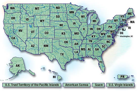
To obtain an automated report regarding Federal Emergency Management Agency (FEMA) map change activities within a state, select that state on the map below. To obtain status information by telephone or e-mail and to learn more about Priority Map Changes, Letter of Final Determination lists, and Proposed Base Flood Elevation notices, click on the appropriate links below.
To gain a better understanding of the information provided by clicking on the state map above, please click on one of the links below.
- Letter of Map Change Status and Description Explanations
- Letter of Map Revision (LOMR)
Changes, Notable Circumstances, and Effective Dates - Study Status and Description Explanations
Other Map Change Information
Priority Map Changes
Information regarding flood map changes FEMA-contracted studies or restudies, community-initiated Physical Map Revisions (PMRs), or community-initiated Letters of Map Revision (LOMRs) for specific communities that have resulted or will result in the Special Flood Hazard Area (SFHA) shown on the effective National Flood Insurance Program (NFIP) map(s) being changed for a significant area of one or more community is available through a separate page on this Website. Learn more about Recent Priority Map Changes.
Requests for Information on Other Map Change Requests
Status information regarding less extensive map changes may be obtained by calling the Map Specialists in the FEMA Map Assistance Center (FMAC) or by sending an e-mail to the FEMA Map Specialists via e-mail.
To assure you received the information you require in a timely manner, you should first collect the following information:
- Name(s) of the community(ies) affected by the map change
- Name of the county(ies) in which the communities are located
- Six-digit community identification number(s) of the community(ies) of interest (see below)
- Type of map change request
- FEMA-contracted study or restudy
- PMR
- LOMR
- Conditional Letter of Map Revision (CLOMR)
- Letter of Map Amendment (LOMA)
- Conditional Letter of Map Amendment (LOMA)
- Letter of Map Revision Based on Fill (LOMR-F)
- Conditional Letter of Map Revision Based on Fill (CLOMR-F)
The six-digit Community Identification Number, or CID, may be obtained from the FEMA Community Status Book (CSB). The CSB includes the participation status of identified communities, the effective dates of the current NFIP map index, and the CIDs.
To Call the FMAC for Status Information
You may reach the FMAC, toll free, at 1-877 FEMA MAP (1-877-336-2627). For additional information on the FMAC, including hours of operation, please visit the FMAC Web Page.
To E-Mail a Map Specialist for Status Information
To send your status request to a FEMA Map Specialist via e-mail, write to the following address: FEMAMapSpecialist@mapmodteam.com. In submitting your request, please provide as much of the following information as possible in addition to the information listed below:
- Your full name
- Your property address, including zip code
- Name of the community your interested in
- Your daytime telephone number
Letter of Final Determination Lists
A Letter of Final Determination (LFD) is a letter sent to a community stating that a new FIRM will become effective in 6 months and each participating floodprone community must adopt a new or updated compliant floodplain management ordinance by that effective date. The LFD list is a consolidated list of all LFDs distributed to communities for a specific FIRM effective date. It is prepared biweekly on predetermined LFD dates. View and obtain additional information about Letter of Final Determination Lists.
Proposed Base Flood Elevation Notices
NFIP regulations require the publication of public notices each time FEMA proposes new or modified Base Flood Elevations (BFEs) or base flood depths. These notices are published to start the statutorily required appeal periods for the affected communities. View Proposed BFE Notices.
Last Modified: Tuesday, 19-Jun-2007 12:47:56 EDT