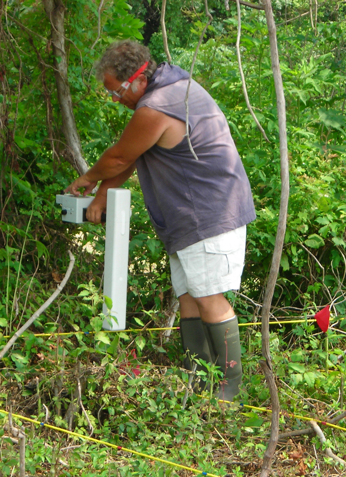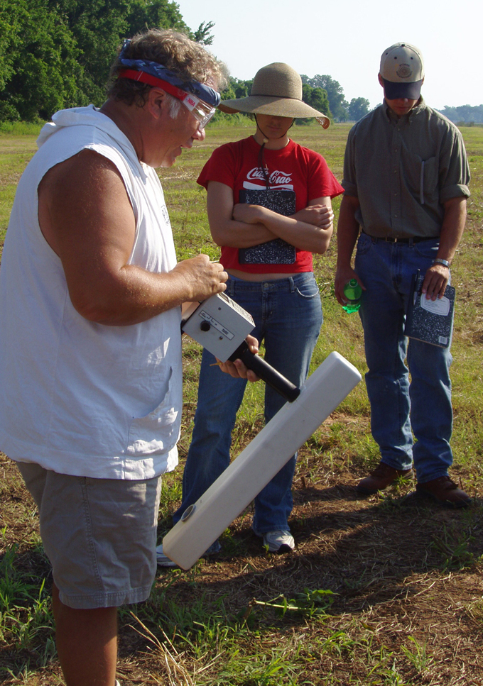
Geoscan FM36 fluxgate gradiometer. [Figure Gear 1, Figure Gear 11] Used for the magnetic survey, this instrument has a 0.05nT resolution with 0.1 nT absolute accuracy. The magnetic survey was designed to collect eight samples per meter along one-meter traverses or eight data values per square meter. The data were collected in a zig zag fashion with the surveyor alternating direction of travel for each traverse across the grid. A total of 3,200 data measurements were collected for each complete 20x20m grid square.
Geonics EM38 ground conductivity meter with an Omnidata DL-720 polycorder. This instrument is designed for electromagnetic induction surveys. Its specifications include apparent conductivity of the ground in millisiemens per meter (mS/m); measurement precision ±0.1% of full scale deflection; and 100 and 1000 mS/m conductivity ranges (4 digit digital meter). The conductivity survey was designed to collect in the continuous or automatic mode with readings collected every quarter of a second resulting in four samples per second. The data were collected in a parallel fashion or unidirectional mode with the surveyor conducting the data acquisition in the same the direction of travel for each traverse across the grid. The conductivity data were collected along one-meter traverse at a sampling density of four samples per meter or four samples per square meter. A total of 1,600 data measurements were collected in each complete 20 m by 20 meter grid unit.
Geoscan RM15 resistance meter system with a PA5 twin probe array. [Figure Gear 2, Figure Gear 3, Figure Gear 7, Figure Gear 10] This electrical resistance survey instrument has an 0.05 ohms resolution with 0.1 ohms absolute accuracy. Resistance surveys were designed to collect two samples per meter along one meter traverses or two data values per square meter. The data were collected in a zigzag fashion with the surveyor alternating the direction of travel for each traverse across the grid. Thus, a total of 800 data measurements were collected in a full 20-m by 20-m grid unit.
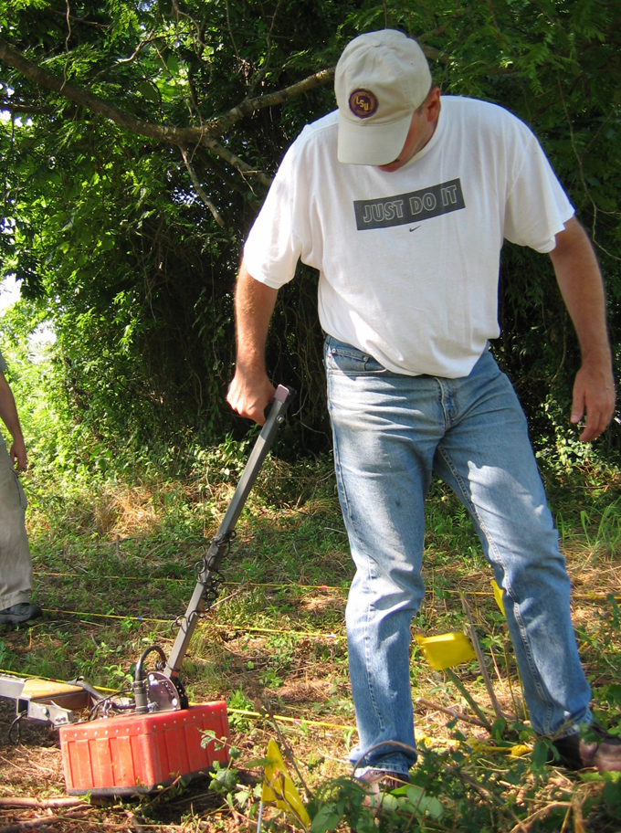
GSSI SIR 2000 ground penetrating radar with a 400 MHz antenna [Figure Gear 4, Figure Gear 5, Figure Gear 8, Figure Gear 9]. The Geophysical Survey Systems Incorporated (GSSI) SIR2000 system includes a control unit built from a laptop computer with 2.1 GB of storage and a battery. The components can be worn on a harness, mounted on a cart, or separated using a long cord. Vertical profiles are displayed in real time on the screen. An integrated survey wheel, which is used to determine the distance along the transect line, attaches to the antenna sled. Data were collected using north-south oriented transects spaced either .5 m or 1 m apart. Samples were collected at a 512 per scan and 32 scans were collected per meter. A standard time window of 60 ns was used. A radiometric resolution of 8 bits was used. The GPR data were downloaded to a laptop computer and processed using GPR Slice software, produced by the Geophysical Archaeometry Laboratory. For each data set, twelve amplitude slice maps were created to a depth of approximately 110 cm. Because of the highly conductive soil, data below this depth were degraded and excluded from analysis. A hyperbola fit was performed on the data to allow the depth to be estimated. An overlay was constructed of all twelve slices to locate strong anomalies throughout the data. The raster data set was exported from GPR Slice to be included in a GIS, where anomalies were identified for multiple depth ranges.
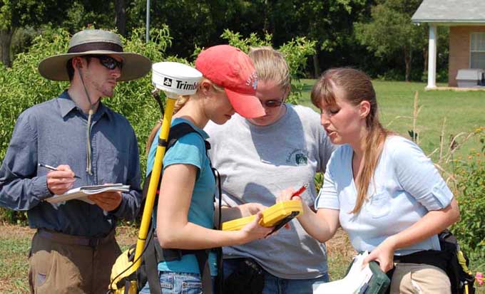
Trimble ProXR global positioning system [Figure Gear 6] This is a 12 channel global positioning system (GPS) receiver produced by Trimble, Inc. The receiver includes a differential GPS receiver module and an automatic, dual-channel MSK beacon receiver module for obtaining differential GPS broadcasts. This allows for real-time sub-meter accuracy. No data were collected unless they were derived from four or more satellites. Data were considered unacceptable if the positional dilution of precision (PDOP) was above six, the signal to noise ratio (SNR) was lower than six, and if the angle of elevation of satellites above the horizon was less than 15 degrees. Data were post-processed and differentially corrected using Trimble Pathfinder software.
Supplementary Material
For additional information on equipment and methods, please see Bryan Haley's Investigating the Whittington and Ailhaud St. Anne Sites with Ground Penetrating Radar, A Summary of Results from the 2006 and 2007 Field Seasons (PDF, 6.2MB).


Funding for the research project from 2002-2007 was generously provided by the U.K. Arts and Humanities Research Council, the British Academy, the U.S. National Endowment for the Humanities, the Cane River National Heritage Area, the National Park Service’s Delta Initiative, and the Institute of Archaeology at University College London.