Pennsylvania Model GIS/Atlas Project
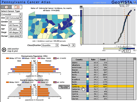
The goal of the Pennsylvania Model GIS/Atlas Project is to develop, test and disseminate methods that provide an accurate, timely, and compelling display of state-based, geospatial cancer data. Primary users of this research are national, state, and local health professionals as they plan, implement and evaluate initiatives to reduce cancer morbidity and mortality. The product displays cancer incidence and demographic data, is constructed with open source software, and includes innovative features such as animation, brushing and dynamic linkage of map attributes (i.e., if you click on a county on the map, then the corresponding portion of the graph and table are highlighted).
The Pennsylvania State University. (This project is made possible through a Cooperative Agreement between the Centers for Disease Control and Prevention (CDC) and the Association of American Medical Colleges (AAMC), award number MM-0718. The contents of this Web site are the responsibility of the authors and do not necessarily reflect the official views of the CDC or AAMC.)
* Links to non-Federal organizations found at this site are provided solely as a service to our users. These links do not constitute an endorsement of these organizations or their programs by CDC or the Federal Government, and none should be inferred. CDC is not responsible for the content of the individual organization Web pages found at these links.