|
|
|
Metadata
|
|
ID
|
78010
|
|
Also Known As
|
78010
OCNS045
O-45-78-NA
|
|
Abstract
|
United States Geological Survey, Woods Hole, Massachusetts.
Chief Scientist: Brad Butman. Data (navigation) of field
activity 78010 (O-45-78-NA) in Georgia Shelf, Atlantic
Continental shelf, United States, North America, North
Atlantic from 05/10/1978 to 05/18/1978
|
|
Organization
|
United States Geological Survey, Woods Hole, Massachusetts
|
|
Project/Theme
|
North Atlantic Environmental Assessment
|
|
Chief Scientist
|
Brad Butman
|
|
Platform
|
Oceanus
|
|
Area of Operation
|
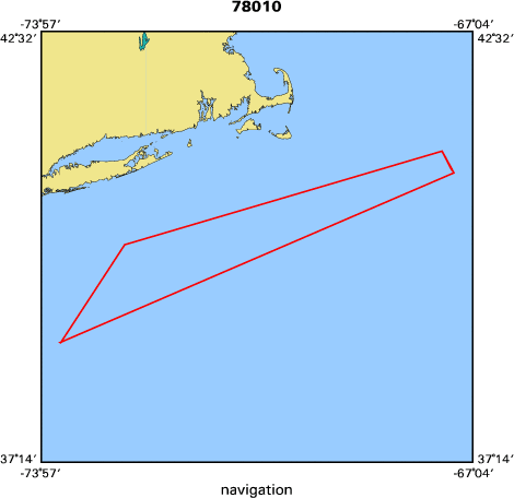
Georgia Shelf, Atlantic Continental shelf, United States, North America, North Atlantic
|
|
Location map
|

|
|
Bounding Coordinates
|
41.50000
-74.00000 -67.25000
38.50000
|
|
Dates
|
05/10/1978 (JD 130) to 05/18/1978 (JD 138)
|
|
Analog Materials
|
No analog holdings.
|
|
Index map
|
|
|
Crew
|
|
Brad Butman
|
Chief Scientist, USGS Woods Hole
|
|
Mike Bothner
|
Unspecified, USGS Woods Hole
|
|
Carol Parmenter
|
Unspecified, USGS Woods Hole
|
|
Stephanie Pfirman
|
Unspecified, USGS Woods Hole
|
|
Gary Prisby
|
Unspecified, USGS Woods Hole
|
|
Rick Rendigs
|
Unspecified, USGS Woods Hole
|
|
Nora Thom
|
Unspecified, USGS Woods Hole
|
|
John West
|
Unspecified, USGS Woods Hole
|
|
Sally Wood
|
Unspecified, USGS Woods Hole
|
|
Andy Eliason
|
Unspecified, Eliason Data Services
|
|
Dave Stremaitis
|
Unspecified, Energy Resources CO
|
|
Jim Broda
|
Unspecified, WHOI
|
|
Paul C. Howland
|
Ship Captain, WHOI
|
|
|
Equipment Used
|
|
|
Purpose
|
|
|
Got Help?
|
For 78010, we would appreciate any information on -- activity type, analog materials, contract, days at sea, dive count, funding, information specialist, information to be derived, kms of navigation, national plan, NGDC Info, notes, owner, ports, project number, publications, scanned materials, seismic description, station count, station description, submersible, summary, tabulated info.
|
|


