|
|
|
Metadata
|
|
ID
|
I-10-90-AT
|
|
Also Known As
|
AMASSEDS_CRUISE_III
CI9004
|
|
Abstract
|
Woods Hole Oceanographic Institution,University of
Washington,United States Geological Survey, Menlo Park,
California. Chief Scientist: Richard Sternberg. Geological
data (Geoprobe, nets) of field activity I-10-90-AT in Amazon
Shelf, Atlantic Ocean from 06/16/1990 to 06/24/1990
|
|
Organization
|
Woods Hole Oceanographic Institution
University of Washington
United States Geological Survey, Menlo Park, California
|
|
Chief Scientist
|
Richard Sternberg
|
|
Activity Type
|
Geological
|
|
Platform
|
Columbus Iselin
|
|
Area of Operation
|
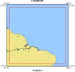
Amazon Shelf, Atlantic Ocean
|
|
Location map
|
|
|
Bounding Coordinates
|
19.75000
-59.75000 -29.75000
-9.75000
|
|
Dates
|
06/16/1990 (JD 167) to 06/24/1990 (JD 175)
|
|
Analog Materials
|
list
|
|
Index map

|
|
|
Crew
|
|
Richard Sternberg
|
Chief Scientist, UW
|
|
Robert Beardsley
|
Unspec. Inv., WHOA
|
|
Richard Limeburner
|
Unspec. Inv., WHOA
|
|
Peter Clay
|
Unspec. Inv., WHOA
|
|
Scott Worrilow
|
Unspec. Inv., WHOA
|
|
David Simoneau
|
Unspec. Inv., WHOA
|
|
Gail Kineke
|
Unspec. Inv., UW
|
|
George Tate
|
Unspec. Inv., USGS Western Region
|
|
Joanne Thede Ferreira
|
Unspec. Inv., USGS Western Region
|
|
Bill Strahle
|
Unspec. Inv., USGS Western Region
|
|
Nelson Hogg
|
Unspec. Inv., Navy
|
|
Belmiro Castro
|
Unspec. Inv.
|
|
Luiz De Miranda
|
Unspec. Inv.
|
|
Reinaldo Fernandes Boneto
|
Unspec. Inv.
|
|
Paul Oliveira Alcarpe
|
Unspec. Inv.
|
|
Marnio Nepolo Alves
|
Unspec. Inv.
|
|
Valdenira Ferreira Dos Santos
|
Unspec. Inv.
|
|
E. Walcott
|
Unspec. Inv.
|
|
A. Fernandes
|
Unspec. Inv.
|
|
|
Equipment Used
|
|
|
Purpose
|
|
To study the movement of sediment particles in the water column, the
|
|
accumulation of sediment particles on the seabed, and the effects that sediment
|
|
particles have on geochemical processes in the water column and seabed.
|
|
|
Summary
|
|
The instrumented moorings and instrumented tripod, GEOPROBE, were
|
|
recovered during this leg. These instruments had all been deployed during
|
|
AmasSeds Cruise 2 in February 1990. The mooring at site M-1 was recovered first
|
|
with all instruments except for one Datawell Waverider which apparently broke
|
|
free and drifted out of the study. All instruments were recovered from site M-3
|
|
with no complications. At site M-2 the instrumented mooring had to be dragged
|
|
for with grappling hooks because all surface buoys deployed at M-2 had broken
|
|
free. All instruments on the mooring wee recovered by dragging except for one
|
|
which was subsequently found and returned by Brazilian fishermen. The
|
|
instrumented-tripod, GEOPROBE, was recovered using a trawling net. The
|
|
instruments on the tripod were recovered undamaged and with data preserved.
|
|
|
Publications
|
|
Rine, James M. and Nittrouer, Charles A. 1990. Report on field measurements and
|
|
sampling during AmasSeds Cruise III - CI9004. Marine Sciences Research Center,
|
|
State University of New York, NY. November 1990. 135 p.
|
|
|
Got Help?
|
For I-10-90-AT, we would appreciate any information on -- contract, days at sea, dive count, funding, information specialist, information to be derived, kms of navigation, national plan, NGDC Info, notes, owner, ports, project, project number, scanned materials, seismic description, station count, station description, submersible, tabulated info.
|
|


