
 Feeds & Data
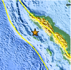
Magnitude 9.1 - OFF THE WEST COAST OF NORTHERN SUMATRA
2004 December 26 00:58:53 UTC
Earthquake Details
| Magnitude | |
|---|---|
| Date-Time |
= Coordinated Universal Time = local time at epicenter |
| Location | 3.316°N, 95.854°E |
| Depth | 30 km (18.6 miles) set by location program |
| Region | OFF THE WEST COAST OF NORTHERN SUMATRA |
| Distances | 250 km (155 miles) SSE of Banda Aceh, Sumatra, Indonesia 300 km (185 miles) W of Medan, Sumatra, Indonesia 1260 km (780 miles) SSW of BANGKOK, Thailand 1590 km (990 miles) NW of JAKARTA, Java, Indonesia |
| Location Uncertainty | horizontal +/- 5.6 km (3.5 miles); depth fixed by location program |
| Parameters | Nst=276, Nph=276, Dmin=654.9 km, Rmss=1.04 sec, Gp= 29°, M-type=teleseismic moment magnitude (Mw), Version=U |
| Source | USGS NEIC (WDCS-D) |
| Event ID | usslav |
- This event has been reviewed by a seismologist.
Did You Feel It?
Report shaking and damage at your location. You can also view a map displaying accumulated data from your report and others.
Earthquake Summary

Felt Reports
This is the fourth largest earthquake in the world since 1900 and is the largest since the 1964 Prince William Sound, Alaska earthquake. In total, 227,898 people were killed or were missing and presumed dead and about 1.7 million people were displaced by the earthquake and subsequent tsunami in 14 countries in South Asia and East Africa. The earthquake was felt (IX) at Banda Aceh, (VIII) at Meulaboh and (IV) at Medan, Sumatra and (III-V) in parts of Bangladesh, India, Malaysia, Maldives, Myanmar, Singapore, Sri Lanka and Thailand. The tsunami caused more casualties than any other in recorded history and was recorded nearly world-wide on tide gauges in the Indian, Pacific and Atlantic Oceans. Seiches were observed in India and the United States. Subsidence and landslides were observed in Sumatra. A mud volcano near Baratang, Andaman Islands became active on December 28 and gas emissions were reported in Arakan, Myanmar.
Tectonic Summary
The devastating megathrust earthquake of December 26th, 2004 occurred
on the interface of the India and Burma plates and was caused by the
release of stresses that develop as the India plate subducts beneath
the overriding Burma plate. The India plate begins its descent into the
mantle at the Sunda trench which lies to the west of the earthquake's
epicenter. The trench is the surface expression of the
plate interface between the Australia and India plates, situated to the
southwest of the trench, and the Burma and Sunda plates, situated to the northeast.
MORE...


FAQ - Everything Else You Want to Know about this Earthquake & Tsunami
Earthquake Maps
Earthquake Location
Location Maps
Did You Feel It?
Tell Us
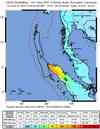
ShakeMap
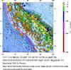
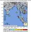
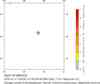
Historical Seismicity
EQ Density Map

Google Map

Additional Information, News Reports
- News Release
- Magnitude 7 and Greater Earthquakes in 2004
- Tsunami Animation - Natl. Inst. of Advanced Industrial Science & Technology
- Relief Web
- USAID - The United States Agency for International Development
- Foreign Embassies of Washington, D.C.
- U.S. Department of State: Current Travel Warnings
- News Links from Google
- Sounding the Alarm on a Tsunami is Complex and Expensive - NY Times (registration required)
- At Warning Center, Alert for the Quake, None for a Tsunami - NY Times (registration required)
- Finite Fault Model
- Largest Earthquakes in the World Since 1900
- Rupture Area of Fault
- FAQ - Everything Else You Want to Know about this Earthquake & Tsunami
- Preliminary Earthquake Report
- U.S. Geological Survey, National Earthquake Information Center
World Data Center for Seismology, Denver
