|
|
|
Metadata
|
|
ID
|
S-5-78-EG
|
|
Abstract
|
Chief Scientists: George Plafker, Paul Carlson. Geophysical
data (transitsatellite, LoranC, integratednavigation, 12khz,
3dot5khz, magnetics, airgunarcer, gravitycore, chaindredge,
radar, minisparker, uniboom) of field activity S-5-78-EG in
Eastern Gulf of Alaska from 06/23/1978 to 07/12/1978
|
|
Chief Scientist
|
George Plafker
Paul Carlson
|
|
Activity Type
|
Geophysical
|
|
Platform
|
Sea Sounder
|
|
Area of Operation
|
Eastern Gulf of Alaska
|
|
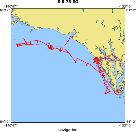
Location map
|

|
|
Bounding Coordinates
|
59.62197
-146.19354 -134.25795
56.04063
|
|
Ports
|
leave Juneau, AK
arrive Yakutat, AK
|
|
Dates
|
06/23/1978 (JD 174) to 07/12/1978 (JD 193)
|
|
Analog Materials
|
list
|
|
Index map
|
|
|
Crew
|
|
Art Conradi
|
Navigator
|
|
Bill Levy
|
Navigator
|
|
Bill Schwab
|
Watchstander
|
|
Bob Wilson
|
Mechanical Technician
|
|
Edith Stanley
|
Navigator
|
|
George Plafker
|
Chief Scientist, USGS Western Region
|
|
Glen Thrasher
|
Watchstander
|
|
John Laingor
|
Chief Mate
|
|
John Saladin
|
Electronics Technician
|
|
K. Simpson
|
Ship Captain
|
|
Mark Wheeler
|
Watchstander
|
|
Paul Carlson
|
Chief Scientist, USGS Western Region
|
|
Paula Quniterno
|
Watchstander, USGS Western Region
|
|
Ron Schmitz
|
Electronics Technician
|
|
Sue Hunt
|
Dafe Curator, USGS Western Region
|
|
Tom Atwood
|
Watchstander
|
|
Warren Coonrad
|
Watchstander
|
|
Bill Soule
|
Chief Engineer
|
|
|
Equipment Used
|
|
transitsatellite
|
|
LoranC
|
|
integratednavigation
|
|
12khz
|
|
3dot5khz
|
|
magnetics
|
|
airgunarcer
|
|
gravitycore
|
|
chaindredge
|
|
radar
|
|
minisparker
|
|
uniboom
|
|
|
NGDC Overview
|
|
! Converted to time format with year at start.
|
|
!
|
|
DATA COLLECTION OVERVIEW (use NGDC GEODAS CD to retrieve data)
|
|
|
|
MCG Data Collection ID --- S578EG
|
|
Institution Data Collection ID --- S578EG
|
|
NGDC ID --- 06110023
|
|
Funding --- (unspecified)
|
|
Project, Cruise & Leg --- George Plafker
|
|
Study region --- +60.00000,+56.00000,-147.00000,-134.00000
|
|
Chief Scientist(s) --- Paul Carlson
|
|
Name of vessel --- Sea Sounder (surface ship)
|
|
Date field data collection started --- 06/23/78 LV JUNEAU, AK
|
|
Date field data collection ended --- 07/10/78 AR YAKUTAT, AK
|
|
Parameters surveyed ---
|
|
Bathymetry: surveyed, contained in data file
|
|
Magnetics: (unspecified)
|
|
Gravity: (unspecified)
|
|
High-resolution seismics: (unspecified)
|
|
Deep penetration seismics: (unspecified)
|
|
Format --- (I1,A8,F5.2,4I2,F5.3,F8.5,F9.5,I1,F6.4,F6.1,I2,i1,3F6.1,I1,F5.1,F6.0,F7.1,F6.1,F5.1,A8,4I1)
|
|
Date of data input to NGDC --- 11/30/90
|
|
Contributing institution --- USGS Branch of Pacific Marine Geology
|
|
Country --- United States
|
|
|
|
Navigation instrumentation --- SAT-NAV-MAGNAVOX 702 LORAN C-MAGNAVOX TD
|
|
Position determination method --- L601 INTEGRATED NAV SYSTEM RADAR
|
|
|
|
Bathymetry instrumentation --- 12 KHZ BATHYMETRY 3.5 KHZ BATHYMETRY
|
|
Additional forms of bathymetric data --- (unspecified)
|
|
General rate of bathymetry in file --- 1.7 minutes
|
|
General collection rate of bathymetry --- (unspecified)
|
|
Assumed sound velocity --- 1463.0 m/sec
|
|
Bathymetric datum code --- No correction applied (sea level)
|
|
Bathmetry interpolation scheme --- (unspecified)
|
|
|
|
Magnetics instrumentation --- SHIPBOARD MAGNETOMETER
|
|
Additional forms of magnetics data --- (unspecified)
|
|
General rate of magnetics in file --- (unspecified)
|
|
General collection rate of magnetics --- (unspecified)
|
|
Magnetic sensor tow distance --- (unspecified)
|
|
Magnetic sensor depth --- (unspecified)
|
|
Two sensor horizontal separation --- (unspecified)
|
|
Residual magnetics reference field --- (unspecified)
|
|
Method of applying residual field --- (unspecified)
|
|
|
|
Gravity instrumentation --- (unspecified)
|
|
Additional forms of gravity data --- (unspecified)
|
|
General rate of gravity in file --- (unspecified)
|
|
General collection rate of gravity --- (unspecified)
|
|
Theoretical gravity formula --- (unspecified)
|
|
Reference system --- (unspecified)
|
|
Corrections applied --- (unspecified)
|
|
Starting land tie --- (unspecified)
|
|
Ending land tie --- (unspecified)
|
|
|
|
Seismic instrumentation --- 160 KJ SINGLE CHAN ARCER
|
|
Formats of seismic data --- (unspecified)
|
|
|
Publications
|
|
Hampton, M.A., Bouma, A.H., Carlson, P.R., Molnia, B.F., Clukey, E.C., and Sangrey, D.A.,
|
|
1978, Quantitative study of slope instability in the Gulf of Alaska: Offshore Technology
|
Conference Proceedings, no. 10, v. 4, p. 2307-2318.
|
|
|
Nelson, C.H., Kvenvolden, K.A., and Thor, D.R., 1979, Seafloor thermogenic gas seep, Norton Sound:
|
U.S. Geological Survey Professional Paper 1150, p. 154-155.
|
|
|
Molnia, B.F., and Carlson, P.R., 1980, Quaternary sedimentary facies of the northeast Gulf
|
of Alaska Continental Shelf: U.S. Geological Survey Professional Paper 1175, p. 158-159.
|
|
|
Carlson, Paul R., Plafker, George, and Bruns, Terry R., 1981, Seaward extension of the Fairweather
|
|
Fault on the southeastern Alaska shelf, in American Geophysical Union; 27th annual Pacific Northwest
|
regional meeting: American Geophysical Union Eos, Transactions, v. 62, no. 5, p. 60.
|
|
|
Carlson, Paul R., Plafker, George, and Bruns, T.R., 1985, Map and selected seismic profiles
|
|
of the seaward extension of the Fairweather Fault, eastern Gulf of Alaska: U.S. Geological
|
Survey Miscellaneous Field Studies Map MF-1722, 2 sheets.
|
|
|
Carlson, Paul R., Plafker, George, Bruns, Terry R., and Levy, William P., 1979, Seaward extension
|
of the Fairweather Fault: U.S. Geological Survey Circular 0804-B, p. B135-B139.
|
|
|
Plafker, George, Carlson, Paul R., Coonrad, Warren L., Hunt, Susan J., and Quinterno, Paula, 1979,
|
|
Geologic implications of 1978 outcrop sample data from the continental slope in the eastern Gulf
|
of Alaska: U.S. Geological Survey Circular 0804-B, p. B143-B146.
|
|
|
Bruns, Terry R., von Huene, Roland, Carlson, Paul R., and Keller, G. Randy, 1983, The eastern
|
|
Gulf of Alaska transcurrent plate boundary and the migration of terranes, in Tectonique cassante
|
|
en distension et coulissement; seance specialisee de la Societe Geologique du Nord: Societe
|
Geologique du Nord Annales, v. 103, no. 2-3, p. 325-331.
|
|
|
Carlson, Paul R., Bruns, Terry R., and Plafker, George, 1988, Late Cenozoic offsets on
|
|
the offshore connection between the Fairweather and Queen Charlotte faults off Southeast
|
Alaska: Marine Geology, v. 85, no. 1, p. 89-97.
|
|
|
Bruns, T.R., and Carlson, P.R., 1987, Geology and petroleum potential of the
|
|
southeast Alaska continental margin, in D. Scholl, A. Grantz, and J. Vedder,
|
|
editors, Geology and resource potential of the continental margin of W. No.
|
|
America and adjacent ocean basins: Houston, TX, Circum-Pacific Council for
|
Energy and Mineral Resources Earth Science Series, v. 6, p. 269-282.
|
|
|
Got Help?
|
For S-5-78-EG, we would appreciate any information on -- contract, days at sea, dive count, funding, information specialist, information to be derived, kms of navigation, national plan, notes, organization, owner, project, project number, purpose, scanned materials, seismic description, station count, station description, submersible, summary, tabulated info.
|
|


