| Home >> | Advanced Search >> |
 |
|
Astronaut Photography of Earth - Display Record
STS105-E-5416

Low-resolution Browse Image
(Most browse images are not color adjusted.)Images
Conditions for Use of Images >>Image Transformation Tutorial >> Saving, Color Adjusting, and Printing Images >>
Images to View on Your Computer Now
| File Name | File Size (bytes) | Width | Height | Annotated | Cropped | Purpose | Comments | |
|---|---|---|---|---|---|---|---|---|
| View | STS105-E-5416.JPG | 64571 | 540 | 351 | Yes | Yes | NASA's Earth Observatory web site | |
| View | STS105-E-5416.JPG | 76783 | 640 | 434 | No | No | ||
| View | STS105-E-5416_3.JPG | 110537 | 400 | 257 | Yes | Yes | Photographic Highlights | |
| View | STS105-E-5416.JPG | 1136645 | 3040 | 2064 | NASA's Earth Observatory web site |
Large Images to Request for Downloading
| File Name | File Size (bytes) | Width | Height | Annotated | Cropped | Purpose | Comments | |
|---|---|---|---|---|---|---|---|---|
| Request | STS105-E-5416.JPG | 1136645 | 3040 | 2064 | No | No |
Download a Keyhole Markup Language (KML) file for use in Google Earth.
Electronic Image Data
Camera Files >> No sound file available.Identification
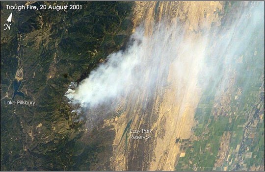
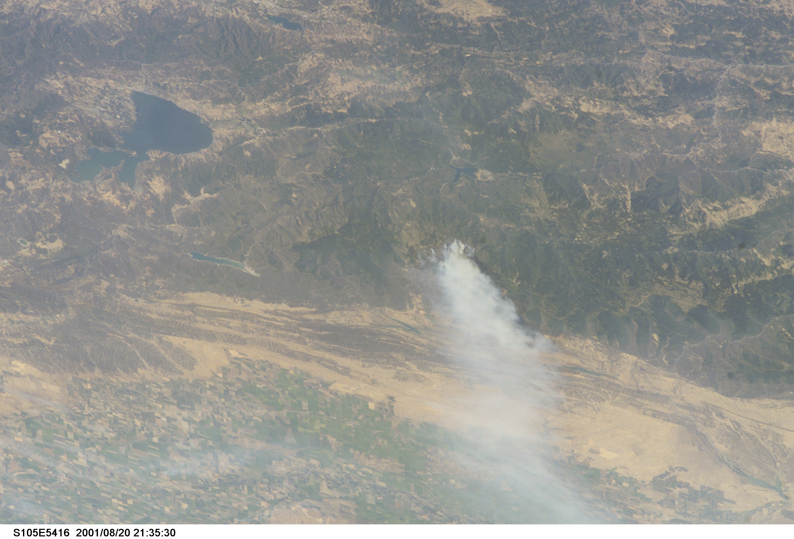
Mission: STS105 Roll: E Frame: 5416 Mission ID on the Film or image: STS105Country or Geographic Name: USA-CALIFORNIA
Features: COAST RANGE, FOREST FIRE
Center Point Latitude: 39.5 Center Point Longitude: -122.5 (Negative numbers indicate south for latitude and west for longitude)
Stereo: (Yes indicates there is an adjacent picture of the same area)
ONC Map ID: JNC Map ID:
Camera
Camera Tilt: 52Camera Focal Length: 180mm
Camera: E3: Kodak DCS660 Electronic Still Camera
Film: 3060E : 3060 x 2036 pixel CCD, RGBG array.
Quality
Film Exposure:Percentage of Cloud Cover: 10 (0-10)
Nadir
Date: 20010820 (YYYYMMDD)GMT Time: 213730 (HHMMSS)Nadir Point Latitude: 43.7, Longitude: -122.3 (Negative numbers indicate south for latitude and west for longitude)
Nadir to Photo Center Direction: South
Sun Azimuth: 217 (Clockwise angle in degrees from north to the sun measured at the nadir point)
Spacecraft Altitude: 200 nautical miles (370 km)
Sun Elevation Angle: 54 (Angle in degrees between the horizon and the sun, measured at the nadir point)
Orbit Number: 158
Captions
After undocking with Space Station Alpha, on August 20, 2001, astronauts on the Space Shuttle photographed wildfires burning in the western U.S. using a digital camera. Zooming in with a longer lens length, astronauts recorded details of individual fires. The digital images were then downlinked to the ground.The Trough Fire, burning in Mendocino National Forest was 76 percent contained and had burned 16,751 acres at the time the photo was taken. Information on fire status and locations was obtained from the National Fire Interagency Center and U.S. Forest Service Detailed Fire Intelligence (http://www.fire.r5.fs.fed.us/scsc/sitreport-archive/082001-sitreport.html).
Link to Earth Observatory Caption >>
Download Packaged File.
This option downloads the following items, packaged into a single file, if they are available:
- Browse image
- Cataloged information with captions
- Camera file
- Sound file
Server: 2 |
This service is provided by the International Space Station program. |
Recommended Citation: |
||

