Introduction
A workshop jointly sponsored by the NOAA Center for Tsunami Inundation Mapping Efforts, the U.S. Geological Survey, the Washington State Military Department Emergency Management Division, and the Washington State Department of Natural Resources was held in June 2002 at the NOAA Pacific Marine Environmental Laboratory in Seattle, Washington, to review potential tsunami sources in Puget Sound. Workshop participants included emergency manager, geoscientists, and oceanographers who made a series of recommendations for modeling the tsunami hazard for at-risk Puget Sound communities. GIS data were developed for the workshop to promote discussion and to graphically display final recommendations. These data are associated with the following publication:
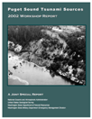
Gonzalez, F.I., B.L. Sherrod, B.F. Atwater, A.P. Frankel, S.P. Palmer, M.L. Holmes, R.E. Karlin, B.E. Jaffe, V.V. Titov, H.O. Mofjeld, and A.J. Venturato (2003): Puget Sound Tsunami Sources - 2002 Workshop Report. A contribution to the Inundation Mapping Project of the U.S. National Tsunami Hazard Mitigation Program, NOAA OAR Special Report, NOAA/OAR/PMEL, 34 pp.
Revisions
There is no plan to update these data.
Data Formats
Data are provided in ESRI ArcGIS shapefile format. A README text file provides more information about the data. Complete details are available in the above publication. Data include the following:
- Tsunami Evidence -- Points representing geologic tsunami deposits, and possible evidence from Native American stories
- Earthquake Faults -- Polylines representing possible tsunamigenic earthquake fault zones in Puget Sound
- River Deltas -- Polygons representing major river delta regions and historic delta failures in Puget Sound
- Landslides -- Polygons representing potential landslide zones and historic submarine/subaerial landslides, and polylines representing regions of steep topography and deep coastal water
Acknowledgments
This project was partially funded by the National Tsunami Hazard Mitigation Program to develop tsunami inundation maps for at-risk U.S. coastal communities. The development of these data were also partially supported by the Joint Institute for the Study of the Atmosphere and Ocean (JISAO) under NOAA Cooperative Agreement NA67RJO155.
|