NOAA Laboratory for Satellite Altimetry
Topex/Poseidon vs. Pacific Tide Gauges (Oct 1992 - July 2002)

Topex/Poseidon vs. Pacific Tide Gauges (Oct 1992 - July 2002)
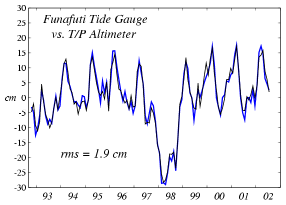
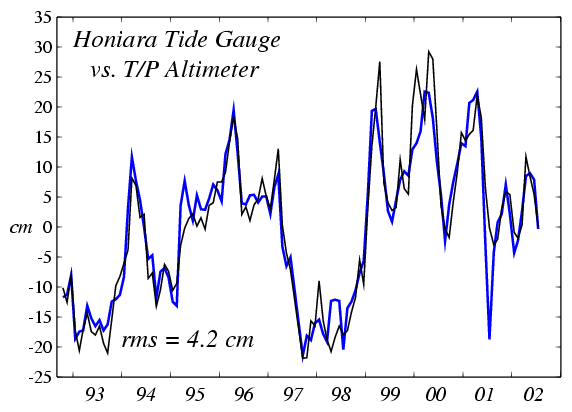
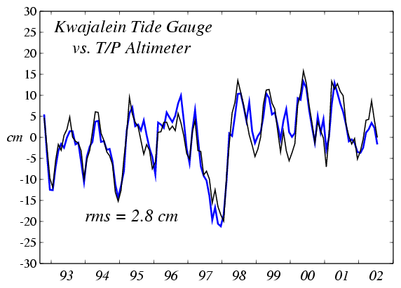
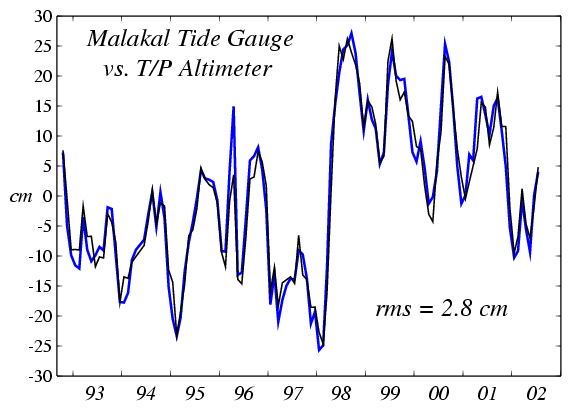
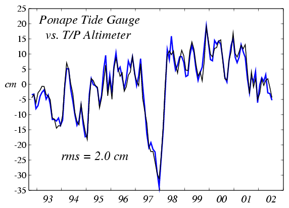
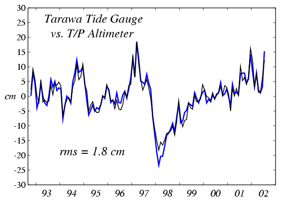
Results are shown in the table below, and a figure is provided for each island comparison. The method is described in Cheney et al., 1994. Locations given below correspond to the 4x1 cells which gave the smallest rms differences.
| N Lat, E Lon | Island | Months | rms (cm) | r |
|---|---|---|---|---|
| -1, 266 | Baltra | 99 | 2.5 | 0.96 |
| -2, 186 | Canton | 106 | 1.7 | 0.96 |
| 0, 202 | Christmas | 117 | 2.0 | 0.98 |
| -8, 178 | Funafuti | 118 | 1.9 | 0.98 |
| -10, 158 | Honiara | 116 | 4.2 | 0.94 |
| 1, 158 | Kapinga | 113 | 2.5 | 0.95 |
| 9, 170 | Kwajalein | 118 | 2.8 | 0.92 |
| 7, 170 | Majuro | 116 | 2.5 | 0.95 |
| 8, 134 | Malakal | 117 | 2.8 | 0.98 |
| 1, 170 | Nauru | 107 | 2.6 | 0.96 |
| -9, 202 | Penrhyn | 118 | 1.8 | 0.95 |
| 7, 158 | Ponape | 118 | 2.0 | 0.98 |
| 0, 174 | Tarawa | 118 | 1.8 | 0.97 |
| 10, 138 | Yap | 118 | 2.2 | 0.98 |
Plots are available for each tide gauge site (gauge=blue, T/P=black):
Baltra, Canton, Christmas, Funafuti, Honiara, Kapinga, Kwajalein, Majuro, Malakal, Nauru, Penrhyn, Ponape, Tarawa, Yap.
Higher-quality postscipt versions of these plots are available on anonymous ftp.

