NESDIS banner image
Office of Satellite Data Processing & Distribution
Information Processing Division
   
Product Systems Branch
Computer Operations Branch
CLASS
 
Comprehensive Large Array-data Stewardship System Computer Operations Branch Product Systems Branch link with links to EPS, SPP, Winds, Ozone, MODIS,Images, Soundings, Calibration, and Navigation/Earth Location information

link to the NOAA Home page  link to the National
Environmental Satellite, Data, and Information Service Home Page

Welcome to the Ocean Products Page

Top Sites
CoastWatch Sea Surface Temperature Imagery
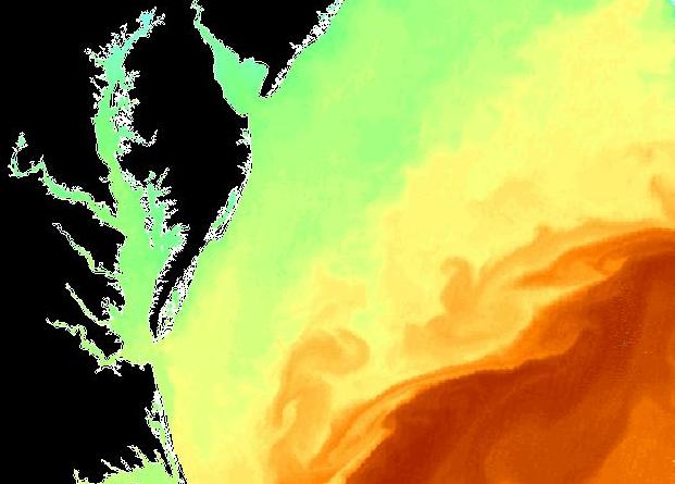
(1.47 km resolution)
Sea Surface Temperature Contour Charts
(14-100km resolution)
Sea Surface Temperature Analyzed Fields
(14-100km resolution)
Nighttime Sea Surface Temperature Imagery
(50 km resolution)
CoastWatch SST of the Chesapeake Bay region SST contour map SST analyzed field map 50 km nighttime SST
Sea Surface Temperature Anomaly Imagery
(get the latest El Nino/La Nina information)
Coral Bleaching HotSpot Charts
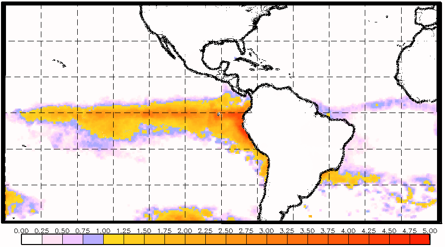
(regions of extremely high ocean temperatures, global perspective)
Degree Heating Week Charts
(accumulations of HotSpots)
Coral Bleaching Virtual Stations
(near-real-time information on thermal stress at selected coral reef sites)
SST anomaly map SST hotspot map

degree heating week map

thumbnail of Coral Bleaching Virtual Stations web page


Regularly Updated Sea Surface Temperature (SST) Imagery:
SST contour charts | SST analyzed fields | high resolution CoastWatch imagery

Regularly Updated Operational Coral Bleaching Monitoring Products:
50 km Nighttime SST | SST Anomalies | HotSpots | Degree Heating Weeks | Coral Bleaching Virtual Stations | Satellite Bleaching Alerts

Regularly Updated Animations of Operational Coral Bleaching Monitoring Products:
50 km Nighttime SST Animations | Anomaly Animations | HotSpot Animations | DHW Animations

Retrospective Coral Bleaching Monitoring Products:
1983-1998 SST monthly means | 1983-1998 SST monthly mean Anomalies | 1998 coral bleaching events and animations | 1998/1999 seasonal DHWs | 1985-1999 SST time series for 24 global coral reef sites

Other Links of Interest:
Ocean Surface Winds | ORA Satellite Oceanography Division | Comprehensive Large Array-data Stewardship System | National Climatic Data Center | Polar Orbiter Data and NOAA KLM User's Guides


Privacy Policy | Disclaimer

Last Modified March 03, 2008 (jw)

Contact Environmental Products team.

Contact OSDPD Webmaster.

Computer Operations Branch Comprehensive Large Array-data Stewardship System Computer Operations Branch CLASS
NOAA/NESDIS/OSDPD; Revised March 03, 2008