

Project News: Summary of 2008 Real-time Spring PAR Experiment
Several severe weather events, including hail-producing storms and tornadic supercells, were captured by the National Weather Radar Testbed Phased Array Radar (NWRT PAR) during the 2008 Real-time Spring PAR Experiment (28 April to 6 June 2008). Each week up to four visiting forecasters evaluate the utility of PAR data in the analysis of severe weather events. During five real-time events, forecasters used the PAR data to evaluate the threats of large hail, high winds, and tornadoes, and provided feedback on the operational utility of this high-temporal resolution data (1-minute volumetric scans; 24-second 0.5 degree updates). A short summary of each weather event evaluated by forecasters follows.
1 May 2008: We had several tornadic supercells in Central Oklahoma today. The first storm developed just west of Norman and moved over the eastern side of the Oklahoma City metro, producing a weak tornado. Two other storms developed farther north, and at least one of these produced a signficant tornado near Ralston. Here is an image of the Oklahoma City supercell at the time it produced an F0 tornado:
7 May 2008: In central Oklahoma several nonmesocyclonic tornadoes formed in association with a squall line, including two in northern Oklahoma City, one just 2 miles south of the National Weather Center, and one near Paoli.
13 May 2008: Storms initiated along the cold front to the NE of the OKC area and the PAR remained focused on those storms during the duration of the evening. These storms moved very slowly - remaining anchored to the front. The Norman NWS issued a number of severe warnings; one storm near Prague had some broad low-level rotation (which tightened up from time-to-time) but never drew a warning.
22 May 2008: There was an HP Supercell event in Western Oklahoma, outside the PAR domain, but we worked it anyway to provide forecasters with a real-time PAR event.
27 May 2008: There was a supercell event in Altus, Oklahoma, outside of the PAR domain, but we worked to provide forecasters with a real-time PAR event.
Important Participant Information
- Operations Plan (.pdf, 1.14 MB)
- PAR Training Materials
Realtime Data Displays
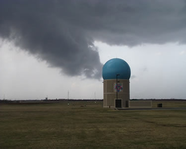
Early detection of rapidly developing hazardous storms requires rapid-scan radar. The National Weather Radar Testbed (NWRT), located in Norman, Oklahoma, collects data from a 9.38-cm, single-faced, phased array radar (PAR) antenna. The PAR supports adaptable scanning strategies and volumetrically scans storms in time scales of seconds instead of several minutes. Such high temporal sampling provides unprecedented opportunity to research rapidly evolving weather phenomena and explore the potential to extend warning lead-time for severe weather.
The Spring 2008 National Weather Radar Testbed (NWRT) Demonstration ran from 14 April through 15 June 2008. To investigate the potential operational benefits of PAR technology, forecasters from National Weather Service forecast offices across the nation evaluated PAR data in real-time. This hands-on evaluation took place 28 April through 6 June 2008. More information about this effort is available in the "Important Participant Information" box.
Another key spring experiment is the multi-function phased array radar (MPAR) demonstration, which tested the PAR's capability to perform simultaneous surveillance of aircraft and weather echoes.
Additional 2008 PAR experiments are described in the 2008 NWRT Demonstration Plan (.pdf, 304 KB).
Recently Published Papers on Weather Surveillance By Phased Array Radar
Presentations illustrating and comparing the rapid-update capability of the PAR antenna to the WSR-88D.
- SLS2006 Presentation: Comparison of Storm Evolution Characteristics: PAR and WSR-88D (.ppt, 17.8 MB)
- SLS2006 Paper: Comparison of Storm Evolution Characteristics: PAR and WSR-88D (.pdf, 943 kB)
- IPPS2007 Presentation: Characteristics of Microburst Events with the National Weather Radar Testbed Phased Array Radar (.ppt, 34.3 MB)
- IPPS2007 Paper: Characteristics of Microburst Events with the National Weather Radar Testbed Phased Array Radar (.pdf, 1.56 MB)
- Microburst time series comparison of PAR and TDWR data (.ppt, 11.9 MB)
This page is maintained by Dr. Pam Heinselman. ![]()
Contact Information:
Dr. Pam Heinselman, Research Meteorologist
National Weather Center, David L. Boren Blvd.
Radar Research and Development Division
Norman, OK 73072
(405) 325-6595; Pam.Heinselman@noaa.gov