
- HOME
- EXPLORE
- Oceans
- Coasts
- Coastal Decision-making Tools
- Coastal Ecosystem Science
- Coastal Zone Management
- Coastal Monitoring and Observations
- Contaminants in the Environment
- Ecological Forecasting
- Harmful Algal Blooms
- National Estuarine Research Reserves
- Natural Hazards Assessment
- Natural Resource Restoration
- Training and Capacity- Building
- Charting and Navigation
- EDUCATION
- DATA EXPLORER
- NEWS
- OFFICES
- Center for Operational Oceanographic Products and Services
- International Program Office
- Management and Budget Office
- National Centers for Coastal Ocean Science
- National Geodetic Survey
- Office of National Marine Sanctuaries
- NOAA Coastal Services Center
- Office of Coast Survey
- Office of Ocean and Coastal Resources Management
- Office of Response and Restoration
- OUTREACH
- PUBLICATIONS
- WEB SITES
- ABOUT

|
|
|
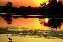
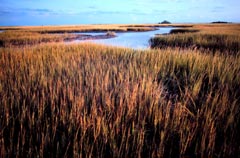
The National Estuarine Research Reserve System (NERRS) is a network of 27 estuarine areas — places where freshwater from land mixes with saltwater from the sea — established across the nation for long-term stewardship, research, and education. Bays, sounds, marshes, inlets, lagoons, and sloughs are all examples of estuaries. Estuaries are crucial spawning areas for many commercial and recreational fish and shellfish and buffer upland areas from flooding and shoreline erosion. The sites within the estuarine reserve system protect more than 1.3 million acres of land and water in 23 states and Puerto Rico. Reserves range in size from 365,000-acre Kachemak Bay, Alaska, to 571-acre Old Woman Creek in Erie County, Ohio. NOAA’s National Ocean Service (NOS) implements NERRS, which was authorized by Section 315 of the Coastal Zone Management (CZM) Act of 1972. This section of the act called for establishing a network of estuaries that represent different biogeographical regions of the United States. Within this network, reserve scientists and other researchers conduct ecological research. Their findings are communicated to coastal managers and other decision makers.
NOS’s Office of Ocean and Coastal Resource Management (OCRM) is responsible for administrating the reserve system. Reserve field staff work with local communities and regional groups on natural resource management issues, such as non-point source pollution, habitat restoration, and invasive species. The Cooperative Institute for Coastal and Estuarine Environmental Technology (CICEET), a partnership between NOAA and the University of New Hampshire, supports many academic researchers throughout the reserve system. CICEET brings its university resources together with those of other public and private research institutions and NERRS sites to develop and apply new environmental technologies and techniques. Three programs, summarized below, provide a national, system-wide framework for the extensive teacher training, education, research, and monitoring carried out at the reserves.
The System-wide Monitoring Program collects data on the health of the nation’s estuaries. It tracks short-term variability and long-term changes in estuarine waters to understand how human activities and natural events can change ecosystems. And it provides valuable long-term data on water quality and weather at frequent time intervals. Some of the data collected by the reserves for this program include levels of dissolved oxygen, water clarity, nutrient concentrations, chlorophyll levels, and extent of submerged aquatic vegetation. Weather and water-quality data are transmitted in near-real-time and provided on the Web through the Centralized Data Management Office.
|
Educational ResourcesNational Estuarine Research Reserves Lesson Plans
|
||||||||||||||||||||||||

- NOS Program Offices
- Center for Operational Oceanographic Products and Services
- National Centers for Coastal Ocean Science
- NOAA Coastal Services Center
- National Geodetic Survey
- Office of Coast Survey
- Office of National Marine Sanctuaries
- Office of Ocean and Coastal Resource Management
- Office of Response and Restoration

Revised September 20, 2007
| Questions, Comments? Contact Us | Report
Error | Disclaimer | About
the Site | User Survey
National Oceanic and Atmospheric
Administration | U.S.
Department of Commerce | USA.gov
http://oceanservice.noaa.gov/topics/coasts/reserves/welcome.html