Tools and Resources
The National Ocean Service (NOS) develops software
tools, applications, and resources to help users
create and use spatial data more efficiently. The tools and resources
listed below are aids to working with spatial data in the NOS Data
Explorer.
GIS
Tools | OGC Data Feeds | Data
Viewers | Metadata
Resources
 |
|
|
A variety of tools and metadata resources are available to help users create and use spatial data. The NOAA Coastal Services Center has several metadata products available for download.
|
 |
|
GIS Tools
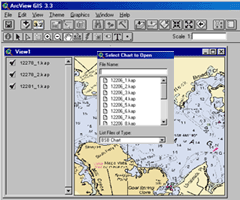
Nautical
Chart Viewer for ArcView® 3.x, ArcGIS® 8+ and Imagine®
8
Allows display of NOAA nautical charts in some ESRI and
ERDAS products. Be aware that this extension is not intended to be
used for navigational purposes.
Electronic
Navigational Chart Data Handler for ArcView®
Simplifies the use of electronic navigational charts.
ArcView®
Habitat Digitizer Extension ArcGIS 9
Allows users to create custom classification schemes and rapidly delineate
and attribute polygons, lines, and points using simple menus.
VDatum
Allows users to convert elevation data among 28 different vertical
datums. Vertical datums can be based on Mean Sea Level (such as NAVD88),
tidally derived surfaces (nautical charts) or three-dimensional space
systems (GPS, for example).
MARPLOT
Allows you to create, view, and modify maps quickly and easily and
to link objects on maps to data in other programs. MARPLOT is a general-purpose
desktop mapping program that was jointly developed by NOAA, the U.S.
Coast Guard, and the Census Bureau.
N-SPECT
Nonpoint Source Pollution and Erosion Comparison Tool (N-SPECT) helps
coastal managers and local officials predict potential water quality
impacts to rivers and streams from nonpoint source pollution and erosion.
(top)
OGC web-mapping data feeds
The NOS Data Explorer downloadable data inventory is available through Open Geospatial Consortium (OGC) connections:
WMS:
Web Map Server (WMS) link - click for the capabilities document:
http://egisws01.nos.noaa.gov/wmsconnector/com.esri.wms.Esrimap/
nosdataexplorer_wms?
WFS:
Web Feature Service (WFS) link - click for the capabilities document:
http://egisws01.nos.noaa.gov/wfsconnector/com.esri.wfs.Esrimap/
nosdataexplorer_wfs?
(top)
Data
Viewers
The NOS data available through this site are
delivered in a variety of file formats. Use the links below to obtain
free software to view these files.
Shapefile format
This format is a common GIS format for spatial data and consists of
several files, each sharing the same root filename. The extensions
commonly are .shp, .dbf and .shx. ArcExplorer a free GIS viewer is
available from the ESRI website.
Image
formats
Scanned images are delivered in either TIFF or GIF formats. These
image file formats can be viewed in most image software packages.
In addition, the Coastal Map downloads are comprised of two files
(.tif and .tfw). The TIFF format can be viewed in an image software
package or the the data can be used in a GIS with the accompanying
.tfw file which contains the spatial reference information. A list
of free Image software programs is available from this web site.
JPEG2000
format
Hurricane photo mosaics are delivered in jpeg2000 format. Jpeg2000
is supported by newer GIS software and graphics packages. XnView a
free image viewer can be used to view these files.
ERDAS™ Imagine format
C-CAP data are delivered in ERDAS™ Imagine format (.img). ERDAS™
Imagine is a common format used for image analysis and is supported
by many GIS software packages. ArcExplorer a free GIS viewer is available
from the ESRI website.
DEM
format
A Digital Elevation Model (DEM) file format is a standard GIS exchange
format for exchanging elevation and bathymetric data sets. A free
DEM viewer can be obtained from the USGS web site.
PDF
format
To use PDF files, you must download and install Adobe Acrobat Reader,
a free application you can use to view or print PDF files. Download
Acrobat
Reader for Macintosh, Linux, Unix, or Windows, or the accessible
Acrobat Reader (Windows-only) from the Adobe web site.
Zip
format
All files downloaded through the NOS Data Explorer are in a compressed
.zip format. This is a common format for compressing the size of data
sets so they can be downloaded faster over a slow internet connection.
A list of free Unzip and compression software is available from this
web site.
(top)
Metadata Resources
metaScribe
This on-line application uses templates to reduce the labor required to produce metadata.
ArcView® Metadata Collector v2.0 Extension
Helps users create metadata that is Federal Geographic Data Committee (FGDC)-compliant.
(top)