Event CategoriesYear 2008 Storm Events
Year 2007 Storm Events
Year 2006 Storm Events
Year 2005 Storm Events
Year 2004 Storm Events
Year 2003 Storm Events
Year 2002 Storm Events
Year 2001 Storm Events
Year 2000 Storm Events
Archival Imagery
2009 Regional Imagery
2008 Regional Imagery
2007 Regional Imagery
2006 Regional Imagery
2005 Regional Imagery
2004 Regional Imagery
2003 Regional Imagery
2002 Regional Imagery
2001 Regional Imagery
2001 Regional Analyses
2000 Regional Imagery
2000 Regional Analyses
1999 Tropical Storm Summary
Home
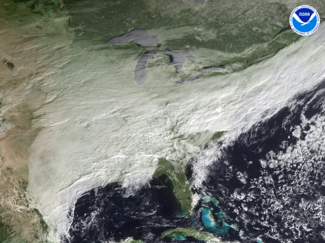
NOAA Satellite and Information Service Home Page NOAA's All Hazards Monitor Where in the World is Tomorrow Now? NOAA National Hurricane Center NOAA Satellite Services Division Geostationary Satellite Server nowCOAST GIS Mapping Portal to Real-Time Environmental Observations and NOAA Forecasts Operational Significant Event Imagery Defense Meteorological Satellite Program NCDC Climate of 2008 FAQ: Hurricanes, Typhoons And Tropical Cyclones Visualization Lab Support | 2008 Regional ImageryCentral United StatesCentral United States regional imagery, 2008.12.16 at 1445Z. Centerpoint Latitude: 39:09:07N Longitude: 83:42:17W.
View our larger 1280 X 960
picture!
Data Elements: A low pressure system moving over parts of the Midwestern, Southern and Eastern United States. This system is producing rain and snow over parts of these regions.
Observation Device: GOES-13 1 km visible imagery.
Visualization Date: December 16, 2008 11:17:30
|