 |
 |
||||||||
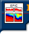
EPIC Graphics and Animation Gallery EPIC data displays include line plots with overlay options, contour plots and animations, using the Plot Plus Graphics Package. All plots are labeled automatically and are of publication quality. It is easy for a user to combine several plots to form composites, such as the EPIC icon at the top of this page. Following are some example graphics for CTD, for time series, and for ADCP data. The GIF is generated by m2gif. Example
EPIC CTD gaphics Example EPIC
Time Series gaphics Example
EPIC Analysis of a combined CTD-ADCP section
(This work used PPLUS and EPIC programs CTDVAR, CTDVEL, CONCTDVEL, TRACKAV, POINTAV and CONADCP. ) Reference: EPIC graphics of Bering Sea Basin Circulation
Two strong current systems are evident. The Alaskan Stream lies just south of the Aleutian Islands and provides inflow to the Bering Sea through the Aleutian passes. It separated from the island arc at 174E forming a large clockwise eddy that reduced the inflow through Near Strait. The Kamchatka Current on the western side is the main outflow from the Bering Sea. Eddies entrain water from it, and weak currents and eddies comprise the basin's interior flow. (click on the image to see a larger version.) This work used PPLUS and EPIC programs TRACKAV and MAPADCP.
|
|||||||||||||||||||||


![]()
home
| on-line
data access | faq
| software
| download
documentation
| epic
contacts | what's
new | site
map
DOC / NOAA / OAR / PMEL
Privacy Policy | Disclaimer