Hays' Tropical Weather Pages: Home Page
Hurricanes, Typhoons, Satellite Imagery and Forecasts (pg 1 of 3)
(Graphics Intensive)-- On slow connections, go to the "Hurricane Links Only" Page.
(Graphics Intensive)-- On slow connections, go to the "Hurricane Links Only" Page.
|
|
Welcome! It is 4:07:54 PM on Tuesday, January 20, 2009. This page has served 394334 hurricane watchers. Last update: Wednesday, December 10, 2008.
The Atlantic Hurricane Season had 26 named storms in 2005. Don't despair, we have 51 Days before the 2008 hurricane season ends!!
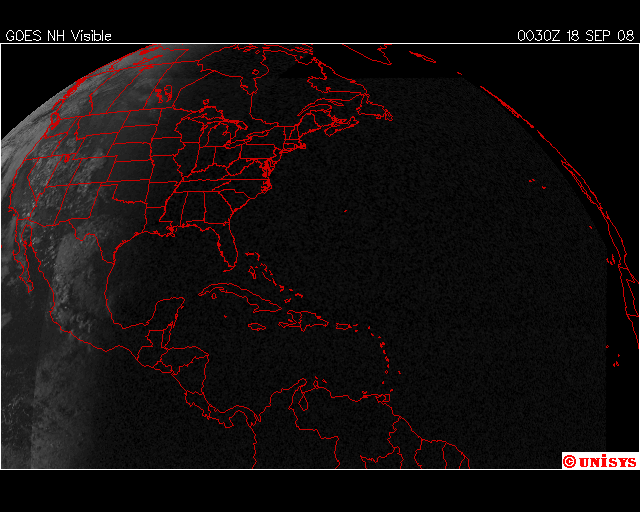
The latest visible imagery of the Atlantic Basin. (From UNISYS )
I separated this site from the main weather site to make the info more accessible for Tropical Weather Lovers and hasten download time. It includes My Favorite Sources of Tropical Information, Reconnaissance Information, Buoy Data, Satellite Movies , Single Frame Satellite Imagery, Spectacular Imagery from Previous Years , Computer Models , Radar , Predictive Forecasting Tools, the Saffir-Simpson Scale of Hurricane Intensity and a Temperature and Pressure Conversion Chart. Thanks to all of the wonderful organizations and resources on the Net!
Main Street Weather (Weather Home Base!!)of the same weather sites. Not as interesting, but download time is much quicker! |
Radar
and Severe Weather
Get the latest predictions on severe weather |
Just
the Maps & Views!
While far from complete, these downloaded views provide for a satisfying overview of North American Weather. Satellite Downloads and Other Maps Real-time satellite movies automatically downloaded. |
| Satellite Links
A complete text listing of satellite images and movies. |

Nature's Show: A GOES 10 Visible image of Hurricane Linda on 9/12/97. The eye was about 12 nm in diameter at the time. The storm intensity was estimated to be an amazing T7.5 to T8.0 on the Dvorak scale and a Category 5 on the Saffir-Simpson scale, with maximum sustained wind speeds of 160 knots/82 ms-1 (gusting to 190 knots/98 ms-1). Minimum central pressure was estimated to be 900 hPa (26.58 inches of mercury). From CIMSS Tropical Cyclone Page .
 Search a DATABASE of Hurricane Sites!

Infrared Image Courtesy of Plymouth State College. (Click on Map for a Larger View)
My Favorite Sources of Tropical Information |
| Hurricanes and Tropical Weather | OSU | NHC | HWN | FSU |
|---|---|---|---|---|
| Tropical Weather Outlook | Latest | Latest | Latest | Archive |
| Tropical Weather Discussion | Latest | Latest | NA | Archive |
| NCEP Tropical Desk | Latest | NA | Latest | Archive |
| Monthly Tropical Summary | Latest | Latest | NA | Archive |
| Public Advisory | Latest | Latest | Latest | Latest |
| Latest Storm Discussion | Latest | Latest | NA | Latest |
| Strike Probabilities | Latest | Latest | NA | Latest |
| Marine Advisory / Forecast | Latest | Latest | NA | Latest |
| RECON~Vortex Messages | Latest | Everything | NA | Atlantic |
| Hurricane MODELS/RECON | Archives | Hunters | NA | NA |
| Aviation Surface Analysis & Forecasts | Aviation 500 mb Analysis & Forecast | Aviation Shear Analysis | Aviation 300 mbAnalysis & Forecast |
| Analysis | Analysis | Analysis | Analysis |
| 24 hr Forecast | 24 hr Forecast | 24 hr Forecast | 24 hr Forecast |
| 48 hr Forecast | 48 hr Forecast | 48 hr Forecast | 48 hr Forecast |
| NOGAPS Surface Analysis & Forecasts | NOGAPS 500 mb Analysis & Forecast | NOGAPS 200 mbAnalysis & Forecast |
| Analysis | Analysis | Analysis |
| 24 hr Forecast | 24 hr Forecast | 24 hr Forecast |
| 48 hr Forecast | 48 hr Forecast | 48 hr Forecast |
| 72 hr Forecast | 72 hr Forecast | 72 hr Forecast |
| UNISYS | Texas A&M | NWS Marine FAX | UNIDATA |
|
|

|
WEST
PACIFIC OCEAN (Recon, outlooks, & discussions--
Ohio State Link )
|
|
INDIAN
OCEAN (Recon, outlooks, & discussions--Ohio State Link)
|