USDA Forest Service Celebrating Wildflowers
|
|
|
Southern Region Viewing AreaLOCATION and PHOTOS
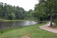
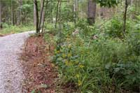
Choctaw Lake Recreation Area Trails: Lakeside, Chata, Cabin Lake, and Noxubee Hills/Beaverlodge TrailsForest: National Forests in Mississippi District: Tombigbee National Forest Description: A variety of wildflower viewing opportunities exist along four trail segments which are located in and near the Choctaw Lake Recreation Area on the Ackerman Unit of the Tombigbee National Forest. These trails traverse the remote and hilly terrain of Choctaw County in central Mississippi and are utilized as walking, hiking, birding and/or biking trails. The 2.5 mile Lakeside Trail circles Choctaw Lake in close proximity to its shore. Approximately 1.2 mile of the trail along the eastern shore of the lake (map) allows views of lakeshore vegetation as well as flowering plants in both mature pine and pine hardwood understories in spring and summer. Wooden footbridges traverse the upper end of the Lake allowing close-up views of aquatic plants ranging from alders and buttonbush to lizard tails, rushes and water-lilies as well as turtles, frogs, snakes and songbirds. The visitor may leave Lakeside Trail near the comfort station in the northwest corner of Choctaw Lake (map) and enter Chata Trail. It is approximately 1.5 miles in length ascending, descending and running atop low ridges through upland pine and hardwood forests and connecting with the Cabin Lake Trail around Cabin Lake. Noxubee Hills/Beaver lodge Trail (1.6 miles) runs south and east from Choctaw Lake levee/parking area (map) through forests of pine, bottomland hardwoods and mixed pine hardwoods. Most of this trail is fairly flat and pleasant walking with the last 0.1 mile ascending a small ridge affording a view of the Noxubee River. A few small creeks are crossed and the trail borders a large beaver pond near its end affording views of diversified wetland vegetation and wildlife. This last trail was designed for mountain bikes so be aware of their possible presence. Viewing Information: The trails offer a variety of plant viewing opportunities and, depending on the season of the year, visitors may see flowering Indian-pink, butterfly weed, passion flower, lizard-tail, cat-tail, wild azalea, wood sorrels, black-eyed susan, phlox, blue mountain mint, false Solomon’s seal, Virginia willow, heal-all, Samson snake-root, spiderworts, button-bush and Joe-pye weed, to name a few. Directions: Choctaw Lake Recreation Area is located about three miles south of Ackerman, MS, 11 miles northeast of Louisville, MS, and 30 miles southwest of Starkville, MS. From Ackerman, drive 3 miles South on MS 15 to the Choctaw Lake Recreational Area entrance sign, turn east and follow paved Choctaw Lake Road for 1.9 miles to the boat ramp, parking area, fee area and comfort station near the levee at the southern end of Choctaw Lake. Park here and go south on the Noxubee Hills/Beaverlodge Trail or north on the Lakeside Trail to the Chata Trail (map). The most direct route to the Chata and Cabin lake trailheads is to follow Choctaw Lake Road east from Hwy 15 for 1.2 miles, turn left at the Fee Area, and drive north 0.3 miles to the Chata Trail sign and a few hundred feet farther to Cabin Lake. If parking at Chata or Cabin trails is not available try the swimming area parking lot across the road and up the hill. Ownership and Management: U.S. Forest Service, National Forests in Mississippi, Tombigbee National Forest. Closest Town: Ackerman, Mississippi. |
|
| NOTE: PDF format links require the Adobe Acrobat Reader to view. | |
| top | Disclaimers | FOIA | Privacy Policy | Quality of Information | Photo Credits & Use |
Location: http://www.fs.fed.us/wildflowers/regions/southern/ChoctawLake/index.shtml
Last modified: Tuesday, 24-Jun-2008 21:57:20 EDT


