USDA Forest Service Celebrating Wildflowers
|
|
|
Southwestern Region Viewing AreaLOCATION and PHOTOS
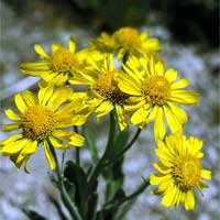
Springerville-Big Lake Sub-alpine GrasslandsForest: Apache-Sitgreaves National Forest District: Springerville Ranger District Description: From Springerville, Arizona, State Highway 261 climbs quickly to an elevation of about 9,000 feet and then levels out traveling through rolling grasslands for nearly 20 miles on the way to Big Lake. Forests of aspen, ponderosa pine, spruce, and fir can be seen in the distance; the colors in fall are beautiful, but fall is not the best season for wildflower viewing. In fact, the best wildflower season is July and August when usually brief, but sometimes torrential, afternoon rains green-up the landscape. Stop anywhere wildflowers catch your eye. There are plenty of places to park along the highway roadside. You might see cinquefoil (Potentilla sp.), paintbrush (Castilleja sp.), harebells (Campanula sp.), yarrow (Achillea millifolium), owl’s-claws (Hymenoxys hoopsei), fleabane daisy (Erigeron sp.), and many other species. Make some stops along small streams, boggy-looking places, or lake margins where you might find iris (Iris missouriensis), shooting star (Dodecatheon sp.), checkermallow (Sidalcea sp.), self heal (Prunella vulgaris), or buttercups (Ranunculus sp.). The fun is in the looking and in enjoying the beautiful scenery around you. Your destination is Big Lake where the Big Lake Recreation Area offers four campgrounds, toilets, showers, drinking water, and a store. Camp here for the night or return to Springerville. Safety First: Summer storms can cause drastic temperature drops and hypothermia is possible even during the warmest summer months so always carry protective clothing. If you venture away from your car you should take a small pack with protective clothing, compass, flashlight, first aid kit, water, and snack foods. Directions: Follow State Highway 260 west from Springerville toward Pinetop-Lakeside. In only a mile or two outside of Springerville, State Highway 261 goes south. Take this paved highway to Big Lake. The pavement ends shortly before Big Lake and turns into well-maintained gravel that is still suitable for any type of vehicle. Contact: Apache-Sitgreaves National Forests, Springerville Ranger District, 165 South Mountain Avenue, Springerville, Arizona. Phone: (928) 333-4372. Closest Town: Springerville, Arizona. |
|
| NOTE: PDF format links require the Adobe Acrobat Reader to view. | |
| top | Disclaimers | FOIA | Privacy Policy | Quality of Information | Photo Credits & Use |
Location: http://www.fs.fed.us/wildflowers/regions/southwestern/SpringervilleBigLake/index.shtml
Last modified: Tuesday, 24-Jun-2008 21:57:47 EDT


