Observations
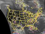
Infrared Satellite Image
- Satellite image loops in Lambert Conformal projection
- GOES satellite loops in the native satellite view.
All 5 channels are available for each of these selections.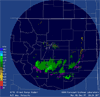
0.5° Reflectivity
- Northeast Colorado Reflectivity (from NWS)
- National Reflectivity (from WSI)
- Front Range Radar image loops
- Colorado current conditions from the Boulder NWS Forecast Office
- Profiler network real-time data display
- Rawinsonde soundings
- GPS integrated precipitable water (IPW) observations
- Surface reports from various Mesonets and METAR stations (Java applet). Or, use our older METAR page (also a Java applet).
- Precipitation data for the past 30 days (Java applet)
- Weather data from scheduled commercial aircraft for the past 30 days. (Demonstration data available to all; current data restricted to certain users.)