| Northern Region Home | |
| About Us | |
| Contact Us | |
| Current Conditions | |
| Employment | |
| FAQ'S | |
| Fire | |
| Maps & Brochures | |
| Newsroom | |
| Passes & Permits | |
| Programs & Plans | |
| Recreational Activities | |
| Volunteering | |
| |
Rental Cabins and Lookouts |
| National Forest Store | |
|
|
Electronic
Freedom of Information Act (EFOIA and FOIA) |
| Forest Service Phone Directory | |
| |
Northern Region Phone Directory |
| Employee Search | |
| |
Evaluate
Our Service We welcome comments on our service and your suggestions for improvement. Please let us hear from you! |
| Northern
Region INFO: |
|
|


About Us

The Northern Region National Forest lands encompass 25 million acres and is spread over 5 states. Included are 12 national forests located within the perimeter of northeastern Washington, northern Idaho, and Montana; and a national grassland in North Dakota and northwestern South Dakota.
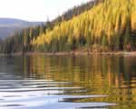
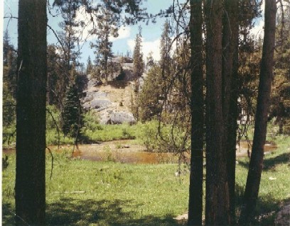
The Region's diversity and expanse of landscape features a vast array of native species in native ecosystems found nowhere else in the world. The boundaries extend from the tall grass prairies of the Dakotas, through high elevation lodgepole pine forests and sagebrush communities of Montana, to old-growth Douglas-fir and hemlock forests of northern Idaho.
ORGANIZATIONAL OVERVIEW
As a part of the United States
Department of Agriculture, we show you more about our Forest Service structure
and organization. ![]()
HISTORY
Explore the early beginnings of the Northern Region of the US Forest Service below.
|
|
|
| The creation of the Northern Region goes back to the earliest days of the Forest Service. Born almost 100 years ago in the midst of massive destruction of our Nation's natural resources, the Forest Service represents a grand experiment to assure that the country's forests and watersheds would always be protected. |
 |
 |
Congress took the first step towards that goal in 1891 when it passed the Forest Reserve Act. It authorized the creation of over a dozen new forest reserves to be carved out of public lands bearing forests. |
In 1897, President Grover Cleveland proclaimed 13 additional forest reserves, 3 in what in now the Northern Region. They were: the Bitterroot Forest Reserve in Montana and Idaho, the Flathead in Montana, and the Lewis and Clark in Montana. Today the region consists of 12 forests and 1 grassland spread over 4 states: Montana, northern Idaho, western North Dakota and a small area in eastern Washington. |
 Photograph by Dale Dufour. |
|
In 1905, the Forest Service was created and the forest reserves placed under its management. Region One, also known as the Northern Region, in Missoula, Montana, was among the original six regions.
In those days, field employees had to know woodcraft and horsemanship. Its field officers were called "forest rangers." For the Ranger exam, men had to shoot, ride, use an ax, throw a diamond hitch, lash freight on a mule or horse, and take a written test. Rangers cleared forest trails, strung telephone wire, and built lookout towers as well as their own residence. Additionally, one of the duties of early forest rangers was to assure that the multiple use idea did not compromise forest, stream or range health. |
In August 1910, 3 million acres in the Northern Rockies were engulfed in flames. The Forest Service quickly assembled all available manpower, but is was not enough. A total of 87 people lost their lives battling the horrific blazes. As a result, an aggressive fire suppression policy was put in place. Hundreds of fire towers were built in the 1920's, '30s and '40s. In the 1940s, smokejumper crews were formed. |
 |
During the 1940's, the Northern Region saw the development of a cadre of firefighters who parachuted into fire zones. This method of firefighting was called smokejumping. The program came to be concentrated in the Northern Region because of its vast roadless areas that were more inaccessible to firefighters. One of the first bases was established near the Ninemile Ranger District on the Lolo National Forest. Later the program expanded to other locations outside Region One. |
|
|
Photo used by permission of the National Smokejumpers Association; from the video "Smokejumpers: Firefighters From the Sky" |
Photo used by permission of the National Smokejumpers Association; from the video "Smokejumpers: Firefighters From the Sky" |
| Historically, National Forest System lands always, by law, have been managed for multiple use. After World War II, with the return of veterans, a bay boom took place, instigating new home construction. Timber harvesting in the 1950s increased dramatically from previous year. In the 1960s, some timber harvesting practices, particularly clearcutting, precipitated national debate. Out of that debate came new regulations and a heightened awareness to assure that Forest Service lands and resources were not abused by overuse. For over 100 years, regional employees have managed vast stretches of public lands on behalf of the American people. Today that area totals 25 million acres. Of that total, 40 percent (or 10 million acres) is unroaded backcountry, of which half, or 5 million acres is within congressionally designated Wilderness areas. |
|
|
 |
|
![[old photograph] Man standing besides large tree](https://webarchive.library.unt.edu/eot2008/20090115112622im_/http://www.fs.fed.us/r1/local-resources/images/historical/smman_bigtree_bw.jpg)


USDA Forest Service - Northern Region
Last Modified: Thursday, 10 April 2008 at 12:21:46 EDT