|
|
| |
|
|
| |
|
|
| |
|
|
| |

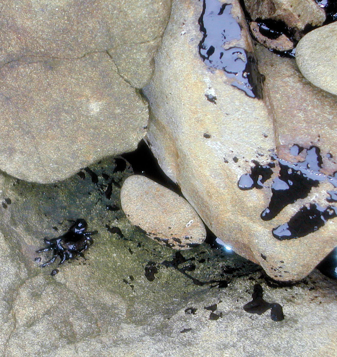
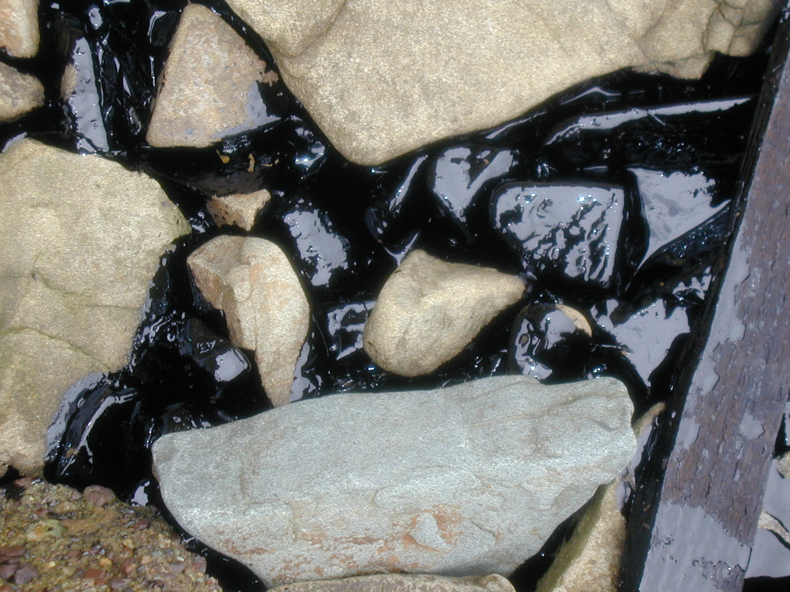
Oil in Crevices, Alcatraz Island
Layers of oil have begun to seep into the rock crevices along the Alcatraz shores. Credit: NPS |

Ribbons of Oil, Port of Oakland
November 09, 2007
Aerial Photo - Ribbons of oil can be seen in and around the Port of Oakland.
Credit: NOAA
|

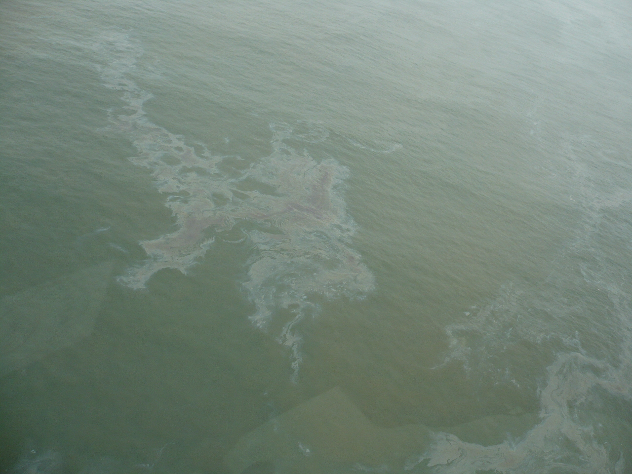
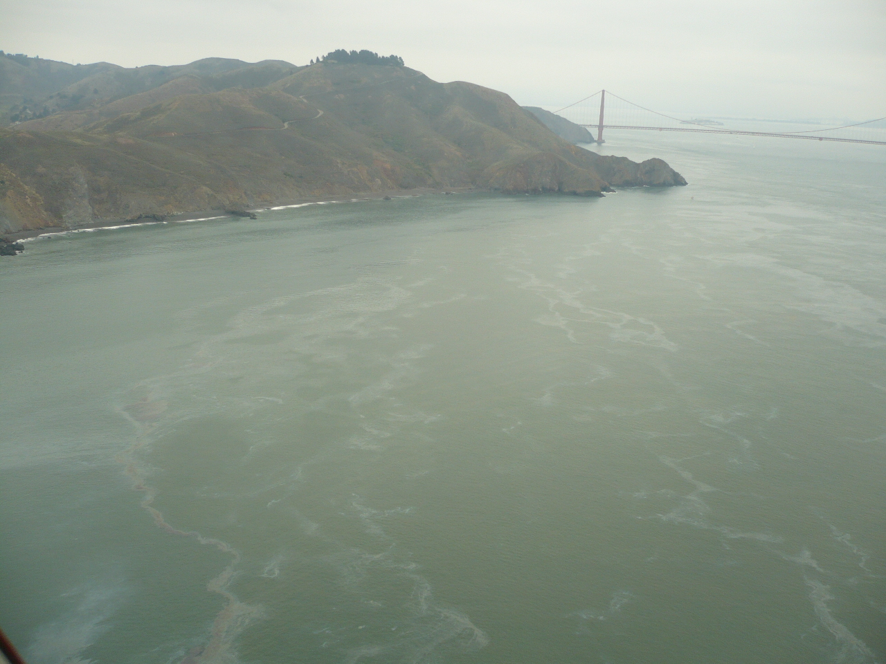
Ribbons of Oil Outside the Bay
November 08, 2007
Aerial Photo - Ribbons of oil spread all across the water west of the Golden Gate Bridge.
Credit: NOAA |

Ribbons of Oil, Point Bonita Lighthouse
November 09, 2007
Aerial Photo - Ribbons of oil can be seen from above, running along the shores of Point Bonita, Rodeo Lagoon, and Rodeo Beach.
Credit: NOAA
|

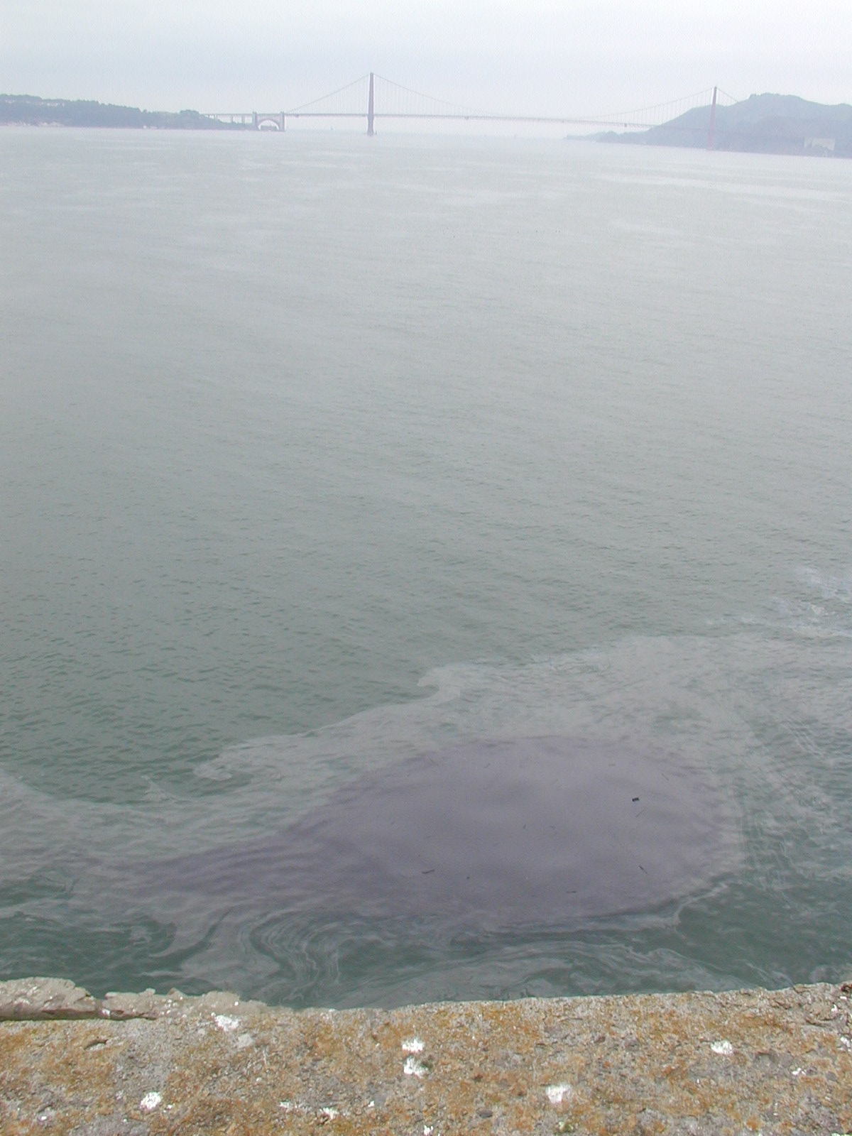
Pools of Black towards Golden Gate
November 08, 2007
A dark black oil spot floats along the western shores of Alcatraz. In the distance, Golden Gate Bridge can been seen.
Credit: NPS |
|
|
|
|
|
Return to Oil Spill Home Page |
Next > |
|


