- Identification_Information:
-
- Citation:
-
- Citation_Information:
-
- Originator: U.S. Geological Survey (USGS), Coastal and Marine Geology (CMG)
- Publication_Date: 20081216
- Title:
-
Geophysical data of field activity K-1-83-NP in Washington
Coast, North Pacific from 09/16/1983 to 10/07/1983
- Publication_Information:
-
- Publisher: U.S. Geological Survey (USGS), Coastal and Marine Geology (CMG)
- Online_Linkage: <http://walrus.wr.usgs.gov/infobank/gos/k-1-83-np.fmeta.xml>
- Online_Linkage:
-
<http://walrus.wr.usgs.gov/infobank/k/k183np/html/k-1-83-np.meta.html>
- Description:
-
- Abstract:
-
United States Geological Survey, Menlo Park,
California,Hawaii Institute of Geophysics. Chief Scientists:
Jim Gardner, Mark Holmes. Geophysical data (200khz, 3dot5khz,
gravity, magnetics, sidescansonar, airgun, LoranC,
transitsatellite) of field activity K-1-83-NP in Washington
Coast, North Pacific from 09/16/1983 to 10/07/1983,
<http://walrus.wr.usgs.gov/infobank/k/k183np/html/k-1-83-np.meta.html>.
- Purpose:
-
These data and information are intended for science
researchers, students from elementary through
college, policy makers, and general public.
- Supplemental_Information:
-
Equipment Used -
200khz bathymetry
3dot5khz bathymetry
gravity Lacoste Romberg S-33
magnetics Geometrics G 801-3
sidescansonar
airgun 40 and 120 cu. in.
LoranC
transitsatellite Omega navigation system
Publications -
Edwards, B.D., Carlson, P.R., Gardner, J.V., Holmes, M.L., and Karl, Herman A., 1984,
Surface morphology of the Gorda Ridge as seen by the SeaMARC II seafloor mapping system,
in Society of Economic Paleontologists and Mineralogists first annual midyear meeting:
Society For Sedimentary Geology Midyear Meeting Abstracts , v. 1, p. 29-30.<BR>
<HR>
Holmes, M.L., Gardner, J.V., Johnson, H.P., Campbell, J.F., Carlson, P., Edwards, B., and
Karl, H.A., 1984, SeaMARC II studies of the Juan de Fuca and Gorda ridges: American Geophysical
Union Eos, Transactions, v. 65, no. 16, p. 279.<BR>
<HR>
Carlson and C. Hans Nelson, 1987, Marine geology and resource potential of Cascadia Basin, in D. Scholl, A. Grantz, and J. Vedder, editors, Geology
and resource potential of the continental margin of W. No. America and adjacent ocean basins: Houston, TX, Circum-Pacific Council for Energy and Mineral
Resource Earth Science Series, v. 6, p. 523-535.
Similar information is available for thousands
of other USGS/CMG-related Activities.
If known, available are Activity-specific
navigation, gravity, magnetics, bathymetry,
seismic, and sampling data; track maps; and
equipment information; as well as summary
overviews, crew lists, and information
about analog materials.
If available, access to physical samples is
described in the "WR CMG Sample Distribution
Policy" at:
<http://walrus.wr.usgs.gov/infobank/programs/html/main/sample-dist-policy.html>
Primary access to the USGS/CMG Information
Bank's digital data, analog data, and
metadata is provided through...
<http://walrus.wr.usgs.gov/infobank/>
This page accomodates a variety of search
approaches (e.g., by platform, by region,
by scientist, by equipment type, etc.).
- Time_Period_of_Content:
-
- Time_Period_Information:
-
- Range_of_Dates/Times:
-
- Beginning_Date: 19830916
- Ending_Date: 19831007
- Currentness_Reference: ground condition
- Status:
-
- Progress: Complete
- Maintenance_and_Update_Frequency: As needed
- Spatial_Domain:
-
- Bounding_Coordinates:
-
- West_Bounding_Coordinate: -130.59982
- East_Bounding_Coordinate: -122.37392
- North_Bounding_Coordinate: 48.51571
- South_Bounding_Coordinate: 40.86298
- Keywords:
-
- Theme:
-
- Theme_Keyword_Thesaurus: ISO 19115 Topic Category
- Theme_Keyword: geoscientificinformation
- Theme_Keyword: oceans
- Theme:
-
- Theme_Keyword_Thesaurus: USGS CMG InfoBank
- Theme_Keyword: Marine Geology
- Theme_Keyword: Marine Geophysics
- Theme_Keyword: Marine Gravity Field
- Theme_Keyword: Marine Magnetic Field
- Theme_Keyword: Magnetic Anomalies
- Theme_Keyword: Bathymetry
- Theme_Keyword: Water Depth
- Theme_Keyword: Seafloor Topography
- Theme_Keyword: Marine Seismic
- Place:
-
- Place_Keyword_Thesaurus: USGS CMG InfoBank
- Place_Keyword: North Pacific Ocean
- Place_Keyword: Northern Pacific Ocean
- Place_Keyword: Pacific Northwest EEZ
- Place_Keyword: Washington Coast, North Pacific
- Access_Constraints:
-
Physical materials are under controlled on-site access.
If available, access to physical samples is described
in the "WR CMG Sample Distribution Policy" at:
<http://walrus.wr.usgs.gov/infobank/programs/html/main/sample-dist-policy.html>
- Use_Constraints:
-
Please recognize the U.S. Geological Survey (USGS) as
the source of this information.
Physical materials are under controlled on-site access.
Some USGS information accessed through this means
may be preliminary in nature and presented without
the approval of the Director of the USGS. This
information is provided with the understanding
that it is not guaranteed to be correct or complete
and conclusions drawn from such information are
the responsibility of the user.
This information is not intended for navigational
purposes.
Any use of trade, firm, or product names is for
descriptive purposes only and does not imply
endorsement by the U.S. Government.
- Point_of_Contact:
-
- Contact_Information:
-
- Contact_Organization_Primary:
-
- Contact_Organization: U.S. Geological Survey (USGS), Coastal and Marine Geology (CMG)
- Contact_Person: Clint Steele
- Contact_Position: Data Acquisition, Processing, and Storage (DAPS) Group Leader
- Contact_Address:
-
- Address_Type: mailing and physical address
- Address: USGS, MailStop 999, 345 Middlefield Road
- City: Menlo Park
- State_or_Province: CA
- Postal_Code: 94025-3561
- Country: USA
- Contact_Voice_Telephone: (650) 329-5055
- Contact_Facsimile_Telephone: (650) 329-5190
- Contact_Electronic_Mail_Address: csteele@usgs.gov
- Browse_Graphic:
-
- Browse_Graphic_File_Name:
-
<http://walrus.wr.usgs.gov/infobank/k/k183np/html/k-1-83-np.nav.gif>
- Browse_Graphic_File_Description: Trackline map of K-1-83-NP
- Browse_Graphic_File_Type: GIF
- Browse_Graphic:
-
- Browse_Graphic_File_Name:
-
<http://walrus.wr.usgs.gov/infobank/k/k183np/html/k-1-83-np.grav.gif>
- Browse_Graphic_File_Description: Gravity data trackline map of K-1-83-NP
- Browse_Graphic_File_Type: GIF
- Browse_Graphic:
-
- Browse_Graphic_File_Name:
-
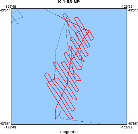
<http://walrus.wr.usgs.gov/infobank/k/k183np/html/k-1-83-np.mag.gif>
- Browse_Graphic_File_Description: Magnetics data trackline map of K-1-83-NP
- Browse_Graphic_File_Type: GIF
- Browse_Graphic:
-
- Browse_Graphic_File_Name:
-
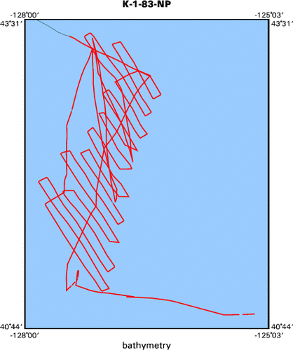
<http://walrus.wr.usgs.gov/infobank/k/k183np/html/k-1-83-np.bath.gif>
- Browse_Graphic_File_Description: Bathymetry data trackline map of K-1-83-NP
- Browse_Graphic_File_Type: GIF
- Data_Set_Credit:
-
Brian Edwards (Geologist, USGS Western Region);
Friz Campbell (Geologist, U of HI);
Herman Karl (Geologist, USGS Western Region);
Jim Gardner (Chief Scientist, USGS Western Region);
Mark Holmes (Chief Scientist, USGS Western Region);
Paul Carlson (Geologist, USGS Western Region);
Paul Johnson (Geologist, U of Wash)
- Native_Data_Set_Environment: Digital, ASCII
- Cross_Reference:
-
- Citation_Information:
-
- Originator: U.S. Geological Survey (USGS), Coastal and Marine Geology (CMG)
- Publication_Date: Unknown
- Title: USGS/CMG Information Bank
- Publication_Information:
-
- Publisher: U.S. Geological Survey (USGS), Coastal and Marine Geology (CMG)
- Other_Citation_Details: Updated daily
- Online_Linkage: <http://walrus.wr.usgs.gov/infobank/>
- Other_Citation_Details:
-
Edwards, B.D., Carlson, P.R., Gardner, J.V., Holmes, M.L., and Karl, Herman A., 1984,
Surface morphology of the Gorda Ridge as seen by the SeaMARC II seafloor mapping system,
in Society of Economic Paleontologists and Mineralogists first annual midyear meeting:
Society For Sedimentary Geology Midyear Meeting Abstracts , v. 1, p. 29-30.
- Other_Citation_Details:
-
Holmes, M.L., Gardner, J.V., Johnson, H.P., Campbell, J.F., Carlson, P., Edwards, B., and
Karl, H.A., 1984, SeaMARC II studies of the Juan de Fuca and Gorda ridges: American Geophysical
Union Eos, Transactions, v. 65, no. 16, p. 279.
- Other_Citation_Details:
-
Carlson and C. Hans Nelson, 1987, Marine geology and resource potential of Cascadia Basin, in D. Scholl, A. Grantz, and J. Vedder, editors, Geology
and resource potential of the continental margin of W. No. America and adjacent ocean basins: Houston, TX, Circum-Pacific Council for Energy and Mineral
Resource Earth Science Series, v. 6, p. 523-535.
- Data_Quality_Information:
-
- Attribute_Accuracy:
-
- Attribute_Accuracy_Report: Identified as best available version.
- Logical_Consistency_Report: Unspecified
- Completeness_Report:
-
Start and end date/times of data
Navigation Data (k-1-83-np.051 [SINS])
YYYYMMDDHHMMSST    YYYYMMDDHHMMSST
198309161613400    198310070850000
YYYYMMDDHHMMSST    YYYYMMDDHHMMSST
Gravity Data (k-1-83-np.161_051)
YYYYMMDDHHMMSST    YYYYMMDDHHMMSST
198309161614000    198309200644000
198309201155000    198309221055000
198309221108000    198309271056000
198309271102000    198310021701000
198310021713000    198310070850000
YYYYMMDDHHMMSST    YYYYMMDDHHMMSST
Magnetics Data (k-1-83-np.222_051)
YYYYMMDDHHMMSST    YYYYMMDDHHMMSST
198309180013000    198309181455000
198309181507000    198309221057000
198309221111000    198309231452000
198309232017000    198309240613000
198309240922000    198309241841000
198309250257000    198309251044000
198309251226000    198309271006000
198310010255000    198310021704000
198310021716000    198310061851000
YYYYMMDDHHMMSST    YYYYMMDDHHMMSST
Bathymetry Data (k-1-83-np.321_051)
YYYYMMDDHHMMSST    YYYYMMDDHHMMSST
198309162128199    198309171219199
198309171240400    198309171735199
198309180151400    198309181931400
198309181944000    198309190721570
198309190735000    198309192239199
198309192250000    198309210511400
198309210524199    198309211412400
198309211423199    198309221445400
198309221458199    198309230805000
198309230815400    198309231153349
198309231205000    198309231932199
198309231949400    198309240722199
198309240733400    198309240733400
198309240744400    198309240744400
198309240756400    198309241233000
198309241245000    198309242130400
198309242144199    198309260713529
198309260728199    198309270423000
198309270434400    198309271201000
198309271214000    198309271801400
198309272120199    198309280007000
198309280020000    198309300400400
198309300411400    198309301726010
198309301739400    198310031618079
198310031630199    198310061605400
198310061617199    198310061805199
198310061818000    198310070754400
198310070806400    198310070848400
YYYYMMDDHHMMSST    YYYYMMDDHHMMSST
- Positional_Accuracy:
-
- Horizontal_Positional_Accuracy:
-
- Horizontal_Positional_Accuracy_Report: Unspecified
- Vertical_Positional_Accuracy:
-
- Vertical_Positional_Accuracy_Report: Unspecified
- Lineage:
-
- Process_Step:
-
- Process_Description:
-
Navigation Data
03/25/2004 mosier moved here from k-2-83-cn nav
01/30/1998 clint k-2-83-cn.050
/bear/programs/ngdc/unrefngdc/unrefngdc
Integrated navigation (SINS) data
- Process_Date: 20040325
- Process_Contact:
-
- Contact_Information:
-
- Contact_Organization_Primary:
-
- Contact_Organization: U.S. Geological Survey (USGS), Coastal and Marine Geology (CMG)
- Contact_Person: Clint Steele
- Contact_Position: Data Acquisition, Processing, and Storage (DAPS) Group Leader
- Contact_Address:
-
- Address_Type: mailing and physical address
- Address: USGS, MailStop 999, 345 Middlefield Road
- City: Menlo Park
- State_or_Province: CA
- Postal_Code: 94025-3561
- Country: USA
- Contact_Voice_Telephone: (650) 329-5055
- Contact_Facsimile_Telephone: (650) 329-5190
- Contact_Electronic_Mail_Address: csteele@usgs.gov
- Process_Step:
-
- Process_Description:
-
Gravity Data
03/25/2004 mosier moved here from k283cn grav
10/31/1998  /tiger/k/k283cn/grav/k-2-83-cn.160_050
/bear/programs/edit/automerge/automerge

Input was...
01/30/1998 clint k-2-83-cn.160
/bear/programs/ngdc/unrefngdc/unrefngdc
Free Air Anomaly data

Input was...
01/30/1998 clint k-2-83-cn.050
/bear/programs/ngdc/unrefngdc/unrefngdc
Integrated navigation (SINS) data

time, lat, long, time(sec) to nearest nav fix, data values
- Process_Date: 20040325
- Process_Contact:
-
- Contact_Information:
-
- Contact_Organization_Primary:
-
- Contact_Organization: U.S. Geological Survey (USGS), Coastal and Marine Geology (CMG)
- Contact_Person: Clint Steele
- Contact_Position: Data Acquisition, Processing, and Storage (DAPS) Group Leader
- Contact_Address:
-
- Address_Type: mailing and physical address
- Address: USGS, MailStop 999, 345 Middlefield Road
- City: Menlo Park
- State_or_Province: CA
- Postal_Code: 94025-3561
- Country: USA
- Contact_Voice_Telephone: (650) 329-5055
- Contact_Facsimile_Telephone: (650) 329-5190
- Contact_Electronic_Mail_Address: csteele@usgs.gov
- Process_Step:
-
- Process_Description:
-
Magnetics Data
03/25/2004 mosier moved here from k283cn mag
10/31/1998  /tiger/k/k283cn/mag/k-2-83-cn.220_050
/bear/programs/edit/automerge/automerge

Input was...
01/30/1998 clint k-2-83-cn.220
/bear/programs/ngdc/unrefngdc/unrefngdc
Edited magnetics data

Input was...
01/30/1998 clint k-2-83-cn.050
/bear/programs/ngdc/unrefngdc/unrefngdc
Integrated navigation (SINS) data

time, lat, long, time(sec) to nearest nav fix, data values
- Process_Date: 20040325
- Process_Contact:
-
- Contact_Information:
-
- Contact_Organization_Primary:
-
- Contact_Organization: U.S. Geological Survey (USGS), Coastal and Marine Geology (CMG)
- Contact_Person: Clint Steele
- Contact_Position: Data Acquisition, Processing, and Storage (DAPS) Group Leader
- Contact_Address:
-
- Address_Type: mailing and physical address
- Address: USGS, MailStop 999, 345 Middlefield Road
- City: Menlo Park
- State_or_Province: CA
- Postal_Code: 94025-3561
- Country: USA
- Contact_Voice_Telephone: (650) 329-5055
- Contact_Facsimile_Telephone: (650) 329-5190
- Contact_Electronic_Mail_Address: csteele@usgs.gov
- Process_Step:
-
- Process_Description:
-
Bathymetry Data
03/25/2004 mosier moved here from k283cn bath
10/31/1998  /tiger/k/k283cn/bath/k-2-83-cn.320_050
/bear/programs/edit/automerge/automerge

Input was...
01/30/1998 clint k-2-83-cn.320
/bear/programs/ngdc/unrefngdc/unrefngdc
Edited bathymetry data with corrected depths

Input was...
01/30/1998 clint k-2-83-cn.050
/bear/programs/ngdc/unrefngdc/unrefngdc
Integrated navigation (SINS) data

time, lat, long, time(sec) to nearest nav fix, data values
- Process_Date: 20040325
- Process_Contact:
-
- Contact_Information:
-
- Contact_Organization_Primary:
-
- Contact_Organization: U.S. Geological Survey (USGS), Coastal and Marine Geology (CMG)
- Contact_Person: Clint Steele
- Contact_Position: Data Acquisition, Processing, and Storage (DAPS) Group Leader
- Contact_Address:
-
- Address_Type: mailing and physical address
- Address: USGS, MailStop 999, 345 Middlefield Road
- City: Menlo Park
- State_or_Province: CA
- Postal_Code: 94025-3561
- Country: USA
- Contact_Voice_Telephone: (650) 329-5055
- Contact_Facsimile_Telephone: (650) 329-5190
- Contact_Electronic_Mail_Address: csteele@usgs.gov
- Spatial_Data_Organization_Information:
-
- Indirect_Spatial_Reference: Washington Coast, North Pacific
- Direct_Spatial_Reference_Method: Point
- Point_and_Vector_Object_Information:
-
- SDTS_Terms_Description:
-
- SDTS_Point_and_Vector_Object_Type: Point
- Spatial_Reference_Information:
-
- Horizontal_Coordinate_System_Definition:
-
- Geographic:
-
- Latitude_Resolution: 0.00001
- Longitude_Resolution: 0.00001
- Geographic_Coordinate_Units: Decimal degrees
- Geodetic_Model:
-
- Horizontal_Datum_Name: North American Datum of 1927
- Ellipsoid_Name: Clarke 1866
- Semi-major_Axis: 6378206.4
- Denominator_of_Flattening_Ratio: 294.98
- Vertical_Coordinate_System_Definition:
-
- Depth_System_Definition:
-
- Depth_Datum_Name: Local surface
- Depth_Resolution: 0.1
- Depth_Distance_Units: meters
- Depth_Encoding_Method: Attribute values
- Entity_and_Attribute_Information:
-
- Overview_Description:
-
- Entity_and_Attribute_Overview: Bathymetry with Time Stamp
- Entity_and_Attribute_Detail_Citation:
-
Edited bathymetry data with corrected depths
Mnemonic:       (Year, Day, Hour, Min, Sec, Tenths, 2WayTravelTime, UncorrDepth, CorrDepth)
FORTRAN format: (i4.4, i3.3, 3i2.2, i1.1, t16, f7.4, t23, f7.1, t31, f7.1)
C format:       (%4.4i%3.3i3%2.2i%1.1i %7.1f %7.1f %7.1f\\n)
Naming:         .320
- Overview_Description:
-
- Entity_and_Attribute_Overview: Gravity with Time Stamp
- Entity_and_Attribute_Detail_Citation:
-
Free Air Anomaly data
Mnemonic:       (Year, Day, Hour, Min, Sec, Tenths, Eotvos, ObsGrv, TheoGrv, FAA)
FORTRAN format: (i4.4, i3.3, 3i2.2, i1.1, t16, f6.1, t23, f9.1, t33, f9.1, t43, f8.1)
C format:       (%4.4i%3.3i3%2.2i%1.1i %6.1f %9.1f %9.1f %8.1f\\n)
Naming:         .160
- Overview_Description:
-
- Entity_and_Attribute_Overview: Magnetics with Time Stamp
- Entity_and_Attribute_Detail_Citation:
-
Edited magnetics data
Mnemonic:       (Year, Day, Hour, Min, Sec, Tenths, MstObs, MstReg, MstRes)
FORTRAN format: (i4.4, i3.3, 3i2.2, i1.1, t16, f7.1, t24, f7.1, t32, f7.1)
C format:       (%4.4i%3.3i3%2.2i%1.1i %7.1f %7.1f %7.1f\\n)
Naming:         .220
- Overview_Description:
-
- Entity_and_Attribute_Overview: Navigation with Time Stamp
- Entity_and_Attribute_Detail_Citation:
-
Integrated navigation (SINS) data
Mnemonic:       (Year, Day, Hour, Min, Sec, Tenths, Latitude, Longitude)
FORTRAN format: (i4.4, i3.3, 3i2.2, i1.1, t16, f9.5, t26, f10.5)
C format:       (%4.4i%3.3i3%2.2i%1.1i %9.5f %10.5f\\n)
Naming:         .050
- Distribution_Information:
-
- Distributor:
-
- Contact_Information:
-
- Contact_Organization_Primary:
-
- Contact_Organization: U.S. Geological Survey (USGS), Coastal and Marine Geology (CMG)
- Contact_Person: Clint Steele
- Contact_Position: Data Acquisition, Processing, and Storage (DAPS) Group Leader
- Contact_Address:
-
- Address_Type: mailing and physical address
- Address: USGS, MailStop 999, 345 Middlefield Road
- City: Menlo Park
- State_or_Province: CA
- Postal_Code: 94025-3561
- Country: USA
- Contact_Voice_Telephone: (650) 329-5055
- Contact_Facsimile_Telephone: (650) 329-5190
- Contact_Electronic_Mail_Address: csteele@usgs.gov
- Resource_Description: Downloadable Data K-1-83-NP data set
- Distribution_Liability:
-
Please recognize the U.S. Geological Survey (USGS) as
the source of this information.
Physical materials are under controlled on-site access.
Some USGS information accessed through this means
may be preliminary in nature and presented without
the approval of the Director of the USGS. This
information is provided with the understanding
that it is not guaranteed to be correct or complete
and conclusions drawn from such information are
the responsibility of the user.
This information is not intended for navigational
purposes.
Any use of trade, firm, or product names is for
descriptive purposes only and does not imply
endorsement by the U.S. Government.
- Standard_Order_Process:
-
- Digital_Form:
-
- Digital_Transfer_Information:
-
- Format_Name: ASCII
- File_Decompression_Technique: No compression applied
- Transfer_Size: 3.2
- Digital_Transfer_Option:
-
- Online_Option:
-
- Computer_Contact_Information:
-
- Network_Address:
-
- Network_Resource_Name:
-
<http://walrus.wr.usgs.gov/infobank/k/k183np/html/k-1-83-np.nav.html>
- Digital_Form:
-
- Digital_Transfer_Information:
-
- Format_Name: ASCII
- File_Decompression_Technique: No compression applied
- Transfer_Size: 2.5
- Digital_Transfer_Option:
-
- Online_Option:
-
- Computer_Contact_Information:
-
- Network_Address:
-
- Network_Resource_Name:
-
<http://walrus.wr.usgs.gov/infobank/k/k183np/html/k-1-83-np.grav.html>
- Digital_Form:
-
- Digital_Transfer_Information:
-
- Format_Name: ASCII
- File_Decompression_Technique: No compression applied
- Transfer_Size: 1.5
- Digital_Transfer_Option:
-
- Online_Option:
-
- Computer_Contact_Information:
-
- Network_Address:
-
- Network_Resource_Name:
-
<http://walrus.wr.usgs.gov/infobank/k/k183np/html/k-1-83-np.mag.html>
- Digital_Form:
-
- Digital_Transfer_Information:
-
- Format_Name: ASCII
- File_Decompression_Technique: No compression applied
- Transfer_Size: 1.0
- Digital_Transfer_Option:
-
- Online_Option:
-
- Computer_Contact_Information:
-
- Network_Address:
-
- Network_Resource_Name:
-
<http://walrus.wr.usgs.gov/infobank/k/k183np/html/k-1-83-np.bath.html>
- Fees: None
- Metadata_Reference_Information:
-
- Metadata_Date: 20081216
- Metadata_Contact:
-
- Contact_Information:
-
- Contact_Organization_Primary:
-
- Contact_Organization: U.S. Geological Survey (USGS), Coastal and Marine Geology (CMG)
- Contact_Person: Clint Steele
- Contact_Position: Data Acquisition, Processing, and Storage (DAPS) Group Leader
- Contact_Address:
-
- Address_Type: mailing and physical address
- Address: USGS, MailStop 999, 345 Middlefield Road
- City: Menlo Park
- State_or_Province: CA
- Postal_Code: 94025-3561
- Country: USA
- Contact_Voice_Telephone: (650) 329-5055
- Contact_Facsimile_Telephone: (650) 329-5190
- Contact_Electronic_Mail_Address: csteele@usgs.gov
- Metadata_Standard_Name: FGDC Content Standards for Digital Geospatial Metadata
- Metadata_Standard_Version: FGDC-STD-001-1998
- Metadata_Time_Convention: universal time
- Metadata_Access_Constraints: none
- Metadata_Use_Constraints: none
|


