What's New
NOAA Presence at NASA Dryden Global Hawk Event >> read more
NOAA's Science On a Sphere® Increases Museum Admissions >> read more
NOAA Research Tests On-Demand High Performance Computing and High-Resolution Hurricane Models During 2008 Season >> read more
OAR/NWS Letter of Agreement Signed >> read more
ESRL Forecast Technology Goes Live in Australia >> read more
Science On a Sphere® Touring in France >> read more
 

Forecasts and Analyses


RUC Image
RUC

Rapid Refresh Image
RR

FIM Image
FIM

From the Assimilation and Modeling Branch

Rapid Update Cycle (RUC)
An integrated high-frequency model/assimilation system developed in coordination with NOAA/NCEP to support NWS, other components in NOAA, and the aviation community including FAA with accurate short-range forecasts based on latest hourly observations.
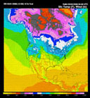
Rapid Refresh (RR)
Next-generation replacement for the (RUC), the Rapid Refresh (RR).
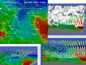
WRF-Chem
A next- generation coupled weather/air quality numerical prediction system based upon the Weather Research & Forecast (WRF) model. WRF-Chem has a large international user base and, in addition to studying global change processes, is used to predict weather, dispersion, and air quality.

Weather Research & Forecast Model (WRF) (external Web site)
A collaborative partnership to develop an advanced mesoscale forecast and assimilation system, and accelerate research advances into operational forecasting.

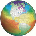
Flow-following Finite-volume Icosahedral Model (FIM)
An initial version of a new global model including use of the adaptive isentropic-sigma hybrid vertical coordinate successful with the RUC model, accurate finite-volume horizontal advection, and use of an icosahedral horizontal grid.


LAPS image
LAPS

Colorado Region Analysis image
Colorado region analysis

From the Forecast Applications Branch (FAB)

Local Analysis and Prediction System (LAPS)
LAPS integrates data from virtually every meteorological observation system into a very high-resolution gridded framework centered on a forecast office's domain of responsibility.


image
60-km sea-level pressure

From the MAPS/RUC Surface Assimilation Systems (MSAS/RSAS)

The Mesoscale Analysis and Prediction System (MAPS) and the Rapid Update Cycle (RUC) Surface Assimilation Systems (MSAS/RSAS) exploit the resolution of surface data by providing timely and detailed surface analyses.

Forecasts from other sources: