Hurricane Ivan Inundation Maps
Hurricane Ivan Surge Inundation Maps
To aid in ongoing recovery and rebuilding efforts, the Federal Emergency Management Agency (FEMA) initiated a short-term project to produce coastal flood recovery maps for the areas that were most severely affected by Hurricane Ivan. These Ivan maps show High Water Mark (HWM) flood elevations, flood inundation limits, the inland limit of waterborne debris (trash lines), and storm surge elevation contours. The maps also show existing FEMA Flood Insurance Rate Map (FIRM) flood elevations for comparison to the Hurricane Ivan data.
Hurricane Ivan Maps are for advisory purposes only; they do not supersede effective Flood Insurance Rate Maps (FIRMs). The Ivan data presented are preliminary and subject to update as additional data become available.
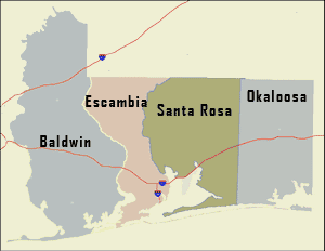
To access the Ivan maps for each county, click on the links below or on the map above.
Please note: Hurricane Ivan surge elevations cannot be compared directly to Base Flood Elevations (BFEs) from the FEMA flood maps, since BFEs in coastal areas include both wave effects and storm surge. To estimate flood levels that include wave effects see the example calculations provided at the bottom of this page.
FEMA also developed an overview map for the four-county study area. The overview map shows the locations of the Ivan map panels, as well as data concerning Hurricane Ivan, such as the surge flooding limits, estimated surge elevation contours, HWM locations, and storm path. Two versions of this overview map are provided:
- Hurricane Ivan Surge Inundation Overview (PDF - 1.6 MB)
- Hurricane Ivan Surge Inundation Overview Including FEMA FIRM Paneling (PDF - 2.3 MB)
Using Hurricane Ivan Surge Levels to Estimate Coastal Flood Elevations (with Waves)
Hurricane Ivan surge elevations cannot be compared directly to BFEs from the FEMA flood maps, since BFEs in coastal areas include both wave effects and storm surge. Flood elevations including wave heights can be estimated in areas where there are no major obstructions (such as seawalls or dense zones of vegetation) located directly between the site of interest and the coastal flooding source.
To estimate a wave crest elevation from a HWM or estimated surge elevation contour, take the water depth at the site and multiply times 1.55. See example calculations below.
Example 1: At a HWM survey site, located at the shoreline
Ground elevation: 0.0 feet (NAVD88)
HWM elevation: 11.3 feet (NAVD88)
Water depth: 11.3 feet – 0.0 feet = 11.3 feet
Estimated wave crest elevation: 11.3 feet x 1.55 = 17.5 feet (NAVD88)
Example 2: An inland site where the ground elevation is known
Ground elevation: 6.5 feet (NAVD88)
Surge elevation (read from contours on Ivan map): 9.0 feet (NAVD88)
Water depth: 9.0 feet – 6.5 feet = 2.5 feet
Estimated wave crest height: 2.5 feet x 1.55 = 3.9 feet (above the ground)
Estimated wave crest elevation: (2.5 feet x 1.55) + 6.5 feet = 10.4 feet (NAVD88)
Download Plug-in
Some of the links on this page require a plug-in to view them. Links to the plug-ins are available below.
Last Modified: Sunday, 26-Mar-2006 18:37:46 EST