Hurricane Rita Flood Recovery Maps
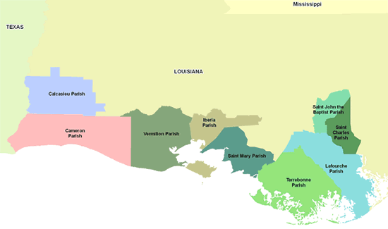
Maps showing the extent and magnitude of Hurricane Rita’s surge, as well as information on advisory flood data, were created for areas in southern Louisiana parishes that were most severely impacted by coastal flooding. These maps, referred to as “Rita Recovery Maps,” show high water marks surveyed after the storm, an inundation limit developed from these surveyed points, and FEMA’s Advisory Base Flood Elevations (ABFEs). To access the Rita Recovery Maps for each Louisiana parish included in this project, click on the links or map below.
- Calcasieu Parish
- Cameron Parish
- Iberia Parish
- Lafourche Parish
- St. Charles Parish*
- St. John the Baptist Parish*
- St. Mary Parish
- Terrebonne Parish
- Vermilion Parish
*Note: FEMA has produced Katrina Recovery Maps for Louisiana parishes where Hurricane Katrina’s storm surge was greater than the coastal flooding caused by Hurricane Rita.
Rita Recovery Maps are for advisory purposes only; they do not supersede effective Flood Insurance Rate Maps (FIRMs) for insurance rating purposes. The Hurricane Rita-related data presented are preliminary and subject to update as additional data become available.
In addition, FEMA has produced index maps for each parish; these can be found on the respective parish mapping home pages, which can be accessed through the links listed above. Each index map shows the detailed Rita Recovery Map paneling scheme, the Hurricane Rita preliminary High Water Mark (HWM) locations, the Rita surge inundation limit, and other basic map information (e.g., roads, corporate limits) to help map users locate recovery maps for particular areas of interest.
In addition, the index maps show one or more purple lines that represent estimated Rita storm surge elevation contours. Please note that local wave effects (i.e., wave heights and wave runup) are not included in these contour elevations. The storm surge contours are based on an assessment of the general surge trends interpreted from the surveyed HWMs, engineering judgment concerning general surge behavior in coastal areas, and a comparison against numerical surge forecasts (e.g., SLOSH model runs) prepared by the National Oceanic and Atmospheric Administration’s Tropical Prediction Center.
Both the parish-specific index maps as well as two regional overview maps that FEMA has developed Rita East Overview (PDF 1.0 MB) and Rita West Overview (PDF 0.7 MB) show numerous purple lines, which are Hurricane Rita storm surge elevation contours. These contours represent estimated surge heights reached by Hurricane Rita in Louisiana as the storm made landfall and moved inland. The storm surge contours are based on an assessment of the general surge trends interpreted from the surveyed, surge-only HWMs, engineering judgment concerning general surge behavior in coastal areas, and a comparison against numerical surge forecasts prepared by the National Oceanic and Atmospheric Administration’s Tropical Prediction Center. Please note that local wave effects (i.e., wave heights and wave runup) are not included in these contour elevations.
Download Plug-in
Some of the links on this page require a plug-in to view them. Links to the plug-ins are available below.
Last Modified: Thursday, 20-Apr-2006 15:54:19 EDT