Ivan Flood Recovery Maps
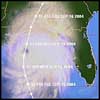
When Hurricane Ivan made landfall on September 16, 2004, it was a major hurricane that produced sustained winds of 130 mph, torrential rains, coastal storm surge flooding of 10-16 feet above normal high tide, and large and battering waves along the western Florida Panhandle and Alabama coastline. More - Hurricane Ivan Recovery Maps
About the Ivan Recovery Maps

To aid in storm recovery and redevelopment efforts, this website was created to provide local, regional, and state officials, as well as homeowners, with coastal flood hazard information concerning Hurricane Ivan.
More - About the Ivan Recovery Maps
- Background
- Mapping Methods and Data Sources
- Flood Insurance
- Additional Resources
- Contact Information
- Frequently Asked Questions (FAQs)
Hurricane Ivan Maps

Coastal flood inundation maps were created for the areas of Baldwin, Escambia, Santa Rosa, and Okaloosa counties that were most severely impacted by Hurricane Ivan's storm surge. These maps also show high water marks surveyed after the storm, the limits of debris carried by the surge, and current FEMA flood map zones and elevations.
More - Hurricane Ivan maps
- Baldwin County, Alabama
- Escambia County, Florida
- Okaloosa County, Florida
- Santa Rosa County, Florida
Hurricane Ivan Maps are for advisory purposes only; they do not supersede effective Flood Insurance Rate Maps (FIRMs). The Ivan data presented are preliminary and subject to update as additional data become available.
Geographic Information System (GIS) Data
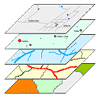
GIS is used to display and analyze spatial data that are tied to databases. The Hurricane Ivan surge inundation maps were developed using GIS. GIS-compatible files of the Ivan-related data layers are provided for download by interested users. Download the GIS data, or select one of the links below.
Last Modified: Monday, 27-Mar-2006 07:53:49 EST