 |
|
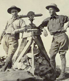
Members
of a 1922 geodetic survey expedition.
Click on the image for
larger view. |
 |
|
Geodesy is the science which makes global positioning possible. Geodesy is literally the science of measuring and monitoring the size and shape of the Earth and the location of points on its surface. NOAA's National Geodetic Survey (NGS) is responsible for the development and maintenance of a national geodetic data system that is used for navigation, communication systems, and mapping and charting.
The Global Positioning Tutorial is an overview of the history, essential elements, and modern methods of geodesy.
The Roadmap to Resources complements the information in the tutorial, leading you to additional information and data resources from NOAA and other reliable resources.

The National Science
Teachers Association (NSTA) has included
this online resource in its SciLinks database.
SciLinks provide students and teachers access to Web-based,
educationally appropriate science content that has been formally evaluated
by master teachers.
For more information about the SciLinks evaluation criteria, click here: http://www.scilinks.org/certificate.asp.
To go directly to the SciLinks log-on page, click here: http://www.scilinks.org/.
(top)


 Global Positioning