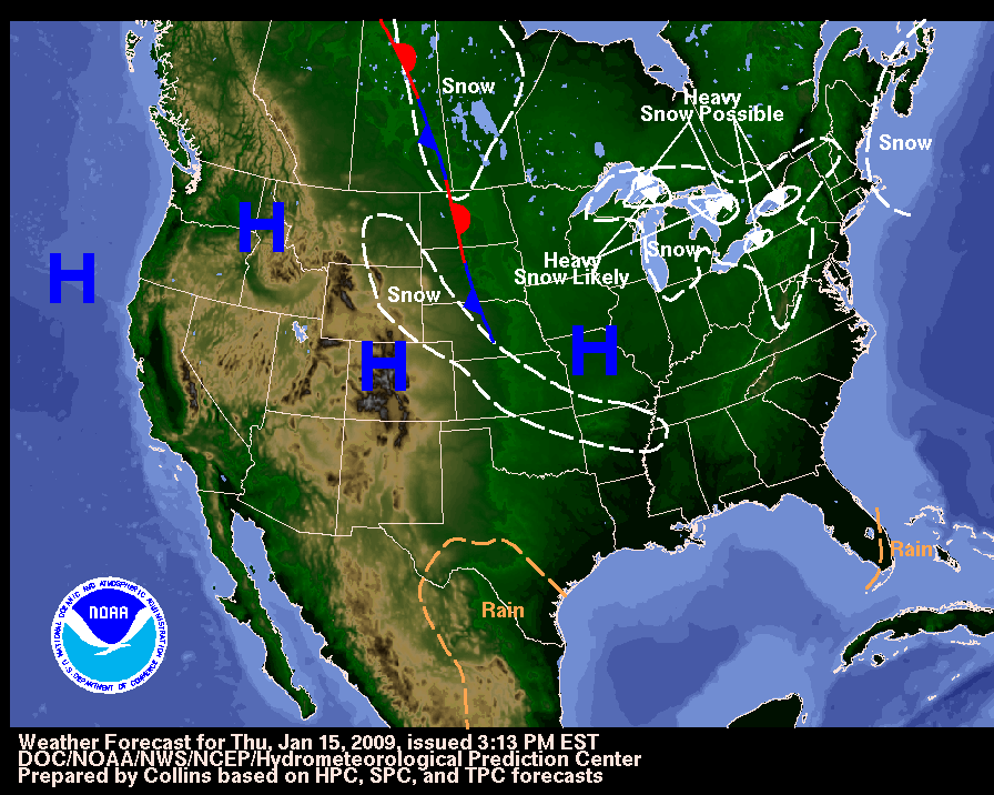
Fri, 16 Jan 2009 06:56:35 EST Frigid temperatures continue across the Midwest and Eastern United States. Temperatures are expected to be 20-30 degrees below the normals for this time of year. Wind Chill Warnings and Advisories are in effect for parts of the Upper Midwest eastward to the Southeast and Northeast. Elsewhere, warm temperatures are expected across parts of the West with the possibility of record or near record high temperatures anticipated along the West Coast. Latest local weather forecasts, warnings, watches, and advisories...
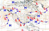
Fri, 16 Jan 2009 07:28:26 EST A bitter mass of cold air continued to extend its grip across much of the United States. The Upper Midwest, Ohio Valley, New England and even the Southeast suffered under dangerous temperatures and brisk winds. Lake effect snow is expected in the lee of the Great Lakes. The greatest snow is expected just east of kakes Ontario and Erie through the weekend. Arctic air across the upper Midwest has caused some rivers to freeze with a few locations in Illinois and Michigan to experience ice jam flooding. This can cause rapid fluctuations of river levels as the jams form and break up. Winter storm warnings are in effect in eastern New York state and across portions of the southern New England states. Details...
Fri, 16 Jan 2009 06:40:47 EST High fire danger exists for portions of southern California due to strong and gusty winds and low relative humidity. High fire danger also exists for parts of northern and central Florida, southern Alabama, and Georgia due to low relative humidity, gusty winds, and moderate drought. Red Flag Warnings are in effect for parts of southern California, Florida, and Georgia. Details...
Fri, 16 Jan 2009 09:22:22 EST Strong southerly winds in the upper atmosphere continue to steer storms north into Alaska. The winds, aided by downslope warming over the mountains, were producing record warmth in some areas. Early Thursday morning, then temperature hit 50 degrees at Eielson Air Force Base, southeast of Fairbanks. This was the warmest temperature ever recorded during January in more than 60 years of weather observations at Eielson. High temperatures Thursday in both Fairbanks and Anchorage reached 45 degrees. For Fairbanks, that was 46 degrees above the normal high for the date of 1 below zero. Peak winds for the event have included 98 mph at the Cordova small boat harbor (along the south coast east of Valdez) and 105 MPH at Glen Alps (on the Anchorage hillside). Minor wind damage was reported around Anchorage. Strong winds to 70 MPH are forecast to return Friday and Friday night over the south central region of the state with the next storm system. Details...
Fri, 16 Jan 2009 09:18:14 EST A cold front approaching the Hawaiian Islands will continue to impact the state through Friday with the potential of strong and damaging southwest winds. Sustained winds of 15 to 30 mph are expected across the state, with gusts as high as 60 mph across portions of Kauai, Oahu, and Molokai. Surf from 15 to 30 feet is forecast (highest mainly along north facing shores) for Kauai, Oahu, Molokai and Maui. The very large and dangerous waves will batter the shoreline resulting in dangerous conditions and deadly rip currents. Dangerous conditions in harbors and harbor entrances exposed to northwest swells. Potential road closures are possible along the north shore due to wave run up. Details...